 |
|
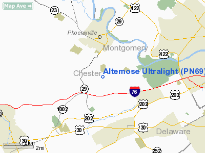
Altemose Ultralight Airport |
Location & QuickFacts
| FAA Information Effective: | 2008-09-25 |
| Airport Identifier: | PN69 |
| Airport Status: | Operational |
| Longitude/Latitude: | 075-30-57.0000W/40-05-33.0000N
-75.515833/40.092500 (Estimated) |
| Elevation: | 345 ft / 105.16 m () |
| Land: | 2 acres |
| From nearest city: | 3 nautical miles N of Malvern, PA |
| Location: | Chester County, PA |
| Magnetic Variation: | () |
Owner & Manager
| Ownership: | Privately owned |
| Owner: | Whitehorse Assoc. |
| Address: | 4326 Whitehorse Rd
Malvern, PA 19355 |
| Phone number: | 610-935-1217 |
| Manager: | Lance Altemose |
| Address: | 4326 Whitehorse Rd
Malvern, PA 19355 |
| Phone number: | 610-935-1217 |
Airport Operations and Facilities
| Airport Use: | Private |
| Wind indicator: | Yes |
| Segmented Circle: | No |
| Control Tower: | No |
| Sectional chart: | New York |
| Region: | AEA - Eastern |
| Boundary ARTCC: | ZNY - New York |
| Tie-in FSS: | IPT - Williamsport |
| FSS Toll Free: | 1-800-WX-BRIEF |
Runway Information
Runway 16/34
| Dimension: | 500 x 100 ft / 152.4 x 30.5 m |
| Surface: | TURF, |
| |
Runway 16 |
Runway 34 |
| Traffic Pattern: | Left | Left |
|
Radio Navigation Aids
| ID |
Type |
Name |
Ch |
Freq |
Var |
Dist |
| ING | NDB | Ambler | | 275.00 | 11W | 10.8 nm |
| NXX | NDB | Willow Grove | | 388.00 | 12W | 18.0 nm |
| UKT | NDB | Quakertown | | 208.00 | 12W | 22.3 nm |
| DYL | NDB | Doylestown | | 237.00 | 10W | 23.2 nm |
| APG | NDB | Aberdeen | | 349.00 | 11W | 43.2 nm |
| RNB | NDB | Rainbow | | 363.00 | 11W | 44.2 nm |
| LQX | NDB | Carbon | | 339.00 | 12W | 44.7 nm |
| NXX | TACAN | Willow Grove | 061X | | 10W | 18.1 nm |
| PNE | VOR | North Philadelphia | | 112.00 | 10W | 23.3 nm |
| CKZ | VOR/DME | Pennridge | 025Y | 108.85 | 12W | 20.7 nm |
| ARD | VOR/DME | Yardley | 019X | 108.20 | 10W | 29.6 nm |
| ETX | VOR/DME | East Texas | 039X | 110.20 | 09W | 30.4 nm |
| SBJ | VOR/DME | Solberg | 076X | 112.90 | 10W | 46.1 nm |
| PPM | VOR/DME | Phillips | 021X | 108.40 | 09W | 48.3 nm |
| PTW | VORTAC | Pottstown | 112X | 116.50 | 09W | 8.1 nm |
| MXE | VORTAC | Modena | 079X | 113.20 | 09W | 12.7 nm |
| DQO | VORTAC | Dupont | 087X | 114.00 | 10W | 25.3 nm |
| OOD | VORTAC | Woodstown | 075X | 112.80 | 10W | 29.1 nm |
| LRP | VORTAC | Lancaster | 120X | 117.30 | 09W | 35.7 nm |
| FJC | VORTAC | Allentown | 122X | 117.50 | 10W | 38.2 nm |
| VCN | VORTAC | Cedar Lake | 099X | 115.20 | 10W | 41.9 nm |
| GXU | VORTAC | Mc Guire | 043X | 110.60 | 11W | 42.6 nm |
| RBV | VORTAC | Robbinsville | 085X | 113.80 | 10W | 47.4 nm |
| PHL | VOT | Philadelphia Intl | | 109.80 | | 18.3 nm |
Remarks
- PRVDD VFR ONLY & CLEAR 20:1 APCH SLOPE.
Images and information placed above are from
http://www.airport-data.com/airport/PN69/
We thank them for the data!
|
|


