|
|
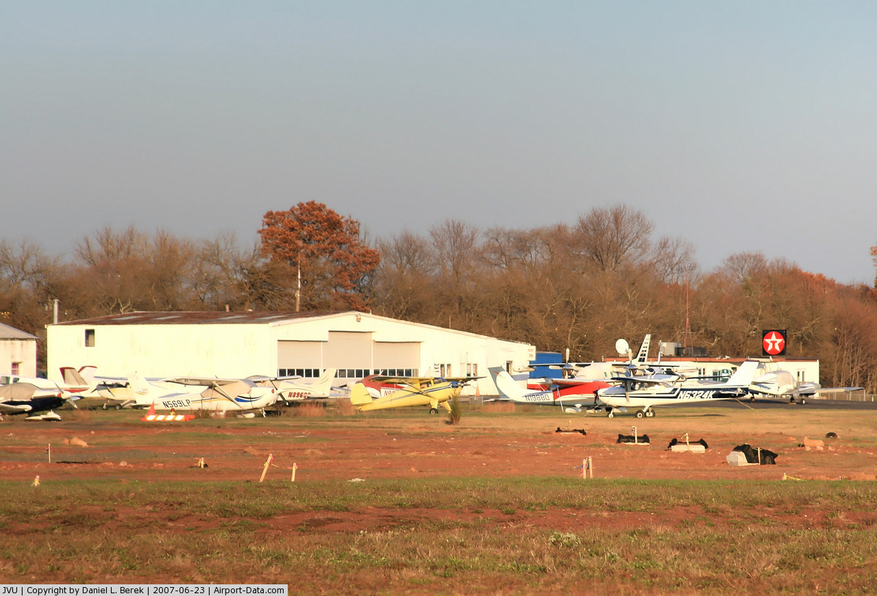
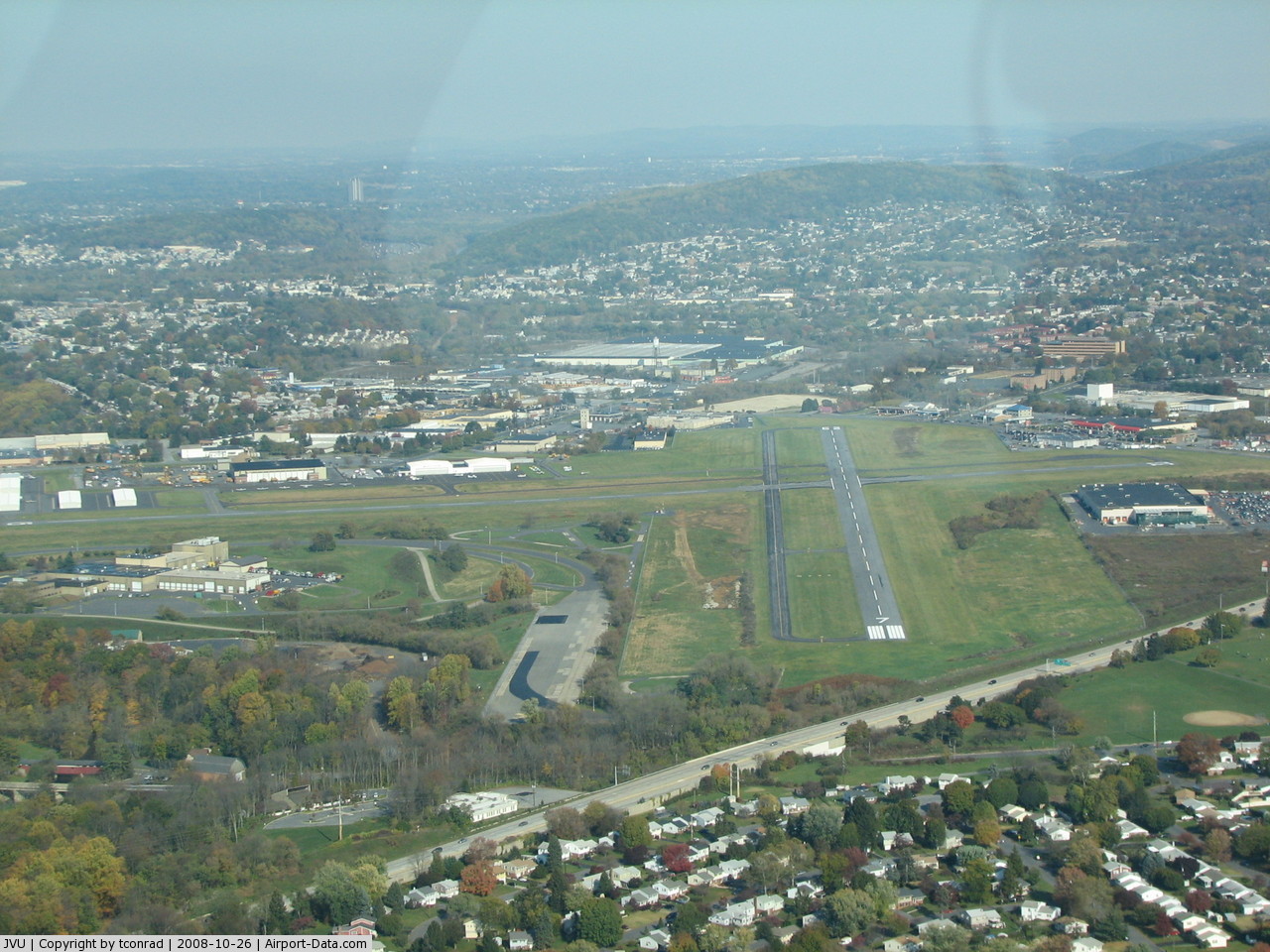
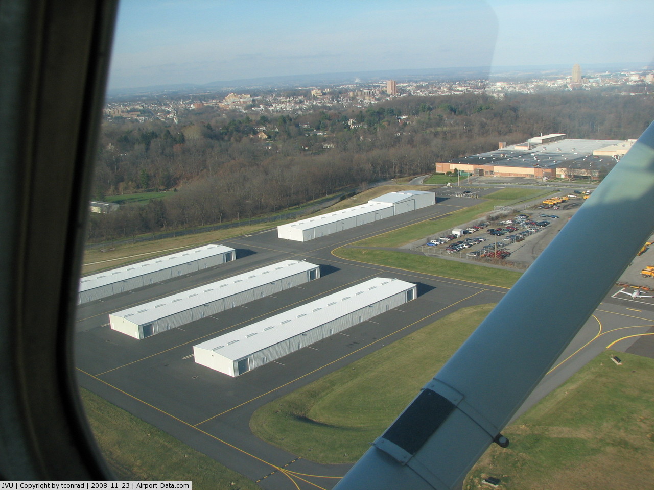
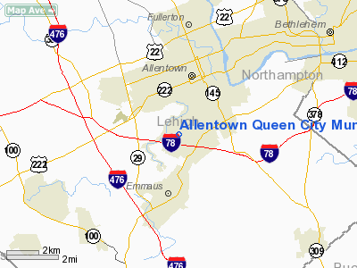
Allentown Queen City Muni Airport |
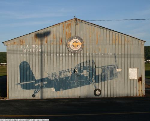 |
(Click on the photo to enlarge) |
 |
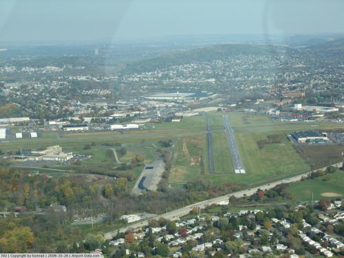
(Click on the photo to enlarge) |
 |
(Click on the photo to enlarge) |
 |
(Click on the photo to enlarge) |
Location & QuickFacts
| FAA Information Effective: | 2008-09-25 |
| Airport Identifier: | JVU |
| Airport Status: | Operational |
| Longitude/Latitude: | 075-29-17.9000W/40-34-13.0000N
-75.488306/40.570278 (Estimated) |
| Elevation: | 399 ft / 121.62 m (Estimated) |
| Land: | 201 acres |
| From nearest city: | 2 nautical miles SW of Allentown, PA |
| Location: | Lehigh County, PA |
| Magnetic Variation: | 12W (2005) |
Owner & Manager
| Ownership: | Publicly owned |
| Owner: | Lehigh Northam Arpt Auth |
| Address: | 3311 Airport Rd
Allentown, PA 18109 |
| Phone number: | 610-266-6001 |
| Manager: | George Doughty |
| Address: | 1730 Vultee Street
Allentown, PA 18103 |
| Phone number: | 610-791-5193 |
Airport Operations and Facilities
| Airport Use: | Open to public |
| Wind indicator: | Yes |
| Segmented Circle: | No |
| Control Tower: | No |
| Lighting Schedule: | DUSK-DAWN
ACTVT MIRL RY 07/25 & 15/33 - CTAF. |
| Beacon Color: | Clear-Green (lighted land airport) |
| Landing fee charge: | Yes |
| Sectional chart: | New York |
| Region: | AEA - Eastern |
| Traffic Pattern Alt: | 1200 ft |
| Boundary ARTCC: | ZNY - New York |
| Tie-in FSS: | IPT - Williamsport |
| FSS on Airport: | No |
| FSS Toll Free: | 1-800-WX-BRIEF |
| NOTAMs Facility: | IPT (NOTAM-d service avaliable) |
| Federal Agreements: | NGRY |
Airport Communications
| CTAF: | 122.700 |
| Unicom: | 122.700 |
Airport Services
| Fuel available: | 100LLA |
| Airframe Repair: | MINOR |
| Power Plant Repair: | MINOR |
| Bulk Oxygen: | NONE |
Runway Information
Runway 07/25
| Dimension: | 3950 x 75 ft / 1204.0 x 22.9 m |
| Surface: | ASPH, Fair Condition |
| Weight Limit: | Single wheel: 12000 lbs. |
| Edge Lights: | Medium |
| |
Runway 07 |
Runway 25 |
| Longitude: | 075-29-39.4131W | 075-28-55.8896W |
| Latitude: | 40-33-59.6602N | 40-34-20.1911N |
| Elevation: | 386.00 ft | 387.00 ft |
| Alignment: | 58 | 127 |
| Traffic Pattern: | Left | Left |
| Markings: | Non-precision instrument, Good Condition | Basic, Good Condition |
| VASI: | 4-light PAPI on left side | 4-light PAPI on left side |
| Visual Glide Angle: | 3.00° | 3.50° |
| Runway End Identifier: | Yes | Yes |
| Obstruction: | 29 ft trees, 378.0 ft from runway, 209 ft right of centerline, 6:1 slope to clear
RY 07 HAS +7 FT BRUSH, 147 FT FM RY END, 175 FT RIGHT. | 27 ft trees, 505.0 ft from runway, 70 ft left of centerline, 11:1 slope to clear |
|
Runway 15/33
| Dimension: | 3159 x 75 ft / 962.9 x 22.9 m |
| Surface: | ASPH, Good Condition |
| Weight Limit: | Single wheel: 12000 lbs. |
| Edge Lights: | Medium |
| |
Runway 15 |
Runway 33 |
| Longitude: | 075-29-32.6790W | 075-29-03.7463W |
| Latitude: | 40-34-27.9585N | 40-34-05.8717N |
| Elevation: | 386.00 ft | 399.00 ft |
| Alignment: | 127 | 127 |
| Traffic Pattern: | Left | Left |
| Markings: | Basic, Good Condition | Basic, Good Condition |
| Obstruction: | 36 ft tree, 596.0 ft from runway, 63 ft left of centerline, 11:1 slope to clear | , 50:1 slope to clear |
|
Radio Navigation Aids
| ID |
Type |
Name |
Ch |
Freq |
Var |
Dist |
| UKT | NDB | Quakertown | | 208.00 | 12W | 12.4 nm |
| LQX | NDB | Carbon | | 339.00 | 12W | 19.1 nm |
| DYL | NDB | Doylestown | | 237.00 | 10W | 21.9 nm |
| NXX | NDB | Willow Grove | | 388.00 | 12W | 27.8 nm |
| ING | NDB | Ambler | | 275.00 | 11W | 28.3 nm |
| HXM | NDB | Humbolt | | 366.00 | 10W | 34.2 nm |
| CYE | NDB | Crystal Lake | | 410.00 | 11W | 41.5 nm |
| BZJ | NDB | Bellgrove | | 328.00 | 10W | 49.3 nm |
| CAT | NDB | Chatham | | 254.00 | 11W | 49.3 nm |
| NXX | TACAN | Willow Grove | 061X | | 10W | 27.5 nm |
| PNE | VOR | North Philadelphia | | 112.00 | 10W | 36.6 nm |
| HZL | VOR | Hazleton | | 109.40 | 09W | 37.9 nm |
| ETX | VOR/DME | East Texas | 039X | 110.20 | 09W | 9.0 nm |
| CKZ | VOR/DME | Pennridge | 025Y | 108.85 | 12W | 14.1 nm |
| ARD | VOR/DME | Yardley | 019X | 108.20 | 10W | 32.7 nm |
| BWZ | VOR/DME | Broadway | 089X | 114.20 | 11W | 33.3 nm |
| SBJ | VOR/DME | Solberg | 076X | 112.90 | 10W | 34.1 nm |
| STW | VOR/DME | Stillwater | 033X | 109.60 | 11W | 38.1 nm |
| FJC | VORTAC | Allentown | 122X | 117.50 | 10W | 9.5 nm |
| PTW | VORTAC | Pottstown | 112X | 116.50 | 09W | 21.2 nm |
| MXE | VORTAC | Modena | 079X | 113.20 | 09W | 40.1 nm |
| LVZ | VORTAC | Wilkes-barre | 053X | 111.60 | 10W | 43.2 nm |
| LRP | VORTAC | Lancaster | 120X | 117.30 | 09W | 45.7 nm |
| PHL | VOT | Philadelphia Intl | | 109.80 | | 43.5 nm |
Remarks
- DEER; GROUNDHOGS; BIRDS ON & INVOF ARPT.
- NOISE ABATEMENT PROCEDURES IN EFFECT, FOR DETAILS CTC ARPT MANAGEMENT AT 610-791-5193.
- FOR SVC AFT HRS CTC 610-266-6000.
- EXISTED PRIOR TO 1959.
Images and information placed above are from
http://www.airport-data.com/airport/JVU/
We thank them for the data!
|
|