|
|
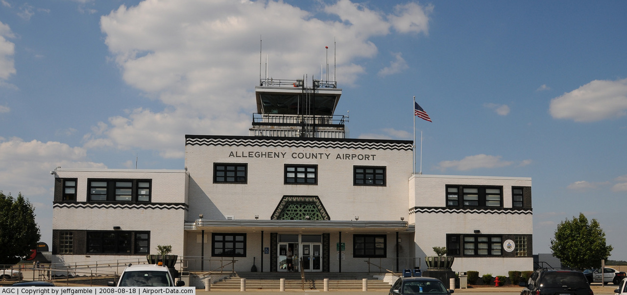
| Allegheny County Airport |
| IATA: AGC – ICAO: KAGC |
| Summary |
| Airport type |
Public |
| Owner |
Allegheny County Airport Authority |
| Location |
Pittsburgh, Pennsylvania |
| Elevation AMSL |
1,252 ft / 381.6 m |
| Coordinates |
40°21′15.84″N 79°55′48.6″W / 40.3544°N 79.930167°W / 40.3544; -79.930167 |
| Runways |
| Direction |
Length |
Surface |
| ft |
m |
| 10/28 |
6,501 |
1,982 |
Concrete |
| 13/31 |
3,825 |
1,166 |
Concrete |
| Helipads |
| Number |
Length |
Surface |
| ft |
m |
| H1 |
47 |
14 |
Concrete |
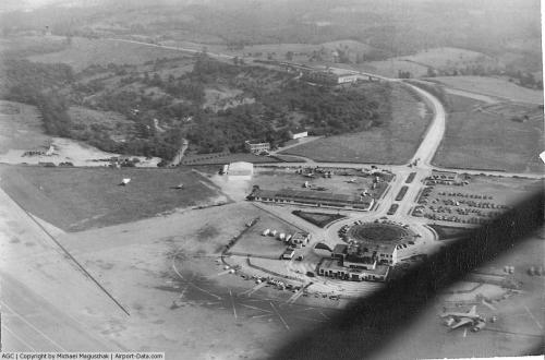
Allegheny County Airport (IATA: AGC, ICAO: KAGC) is located in West Mifflin, Pennsylvania, four miles (6 km) southeast of the city of Pittsburgh. It is the fifth busiest airport in Pennsylvania following Philadelphia, Pittsburgh, Allentown, and Harrisburg. The airport is owned by the Allegheny County Airport Authority and serves as the primary FAA designated reliever airport for Pittsburgh International Airport. It was historically the main entrance to metro Pittsburgh via air from its inception up until the early 1950s when Pittsburgh International opened. Like many other historic "municipal" fields throughout the country, Allegheny serves small and mid-sized private, corporate and commercial traffic well, but was not built to handle the constant traffic of international jet service that arrived in the 1950s and 1960s at the newer, more modern Pittsburgh International Airport.
The airport is popular among business travelers because of its very close proximity to downtown as opposed to Pittsburgh International Airport. It is also much closer to the South Hills and Monroeville than Pittsburgh International.
The airport also enjoys a Hollywood big screen moment in 2004's The Mothman Prophecies, serving as the small "Pt. Pleasant" airport where the governor and Richard Gere debate how serious the impending crisis is in the river town. Also the Airport and Terminal were used in the 1986 movie "Gung Ho" starring Michael Keaton Facilities
Allegheny County Airport covers 432 acres (1.75 km) and has two active runways and one helipad:
- Runway 10/28: 6,501 x 150 ft (1,982 x 46 m), Surface: Concrete
- Runway 13/31: 3,825 x 100 ft (1,166 x 30 m), Surface: Concrete
- Helipad H1: 47 x 45 ft (14 x 14 m), Surface: Concrete
Future Improvements
The Allegheny County Airport Authority has received $2 million from the federal stimulus bill for construction at the Allegheny County airport. The money will be used to renovate four taxiways. It will also be used to reconfigure aircraft apron areas. This will allow for future construction on aircraft maintenance hangers and ramp space associated for the maintenance areas. Construction was scheduled to begin July 20, 2009. The airport expected 40 new jobs to be created with the project but says it is the gateway for more jobs when the aircraft maintenance facility construction starts. The construction will help improve the layout of the airfield.
FBO Airlines
- Corporate Air LLC.
- Voyager Jet Center
Aviation Schools
- Pittsburgh Flight Training Center
- Pittsburgh Institute of Aeronautics
Rental Car
- Hertz Rental Cars
- Avis Rent-A-Car
Incidents
On 5 April 2010, a small aircraft caught fire while taxiing to the runway to take off. No one was injured in the incident.
The above content comes from Wikipedia and is published under free licenses – click here to read more.

 |
(Click on the photo to enlarge) |
 |
(Click on the photo to enlarge) |
 |
(Click on the photo to enlarge) |
Location & QuickFacts
| FAA Information Effective: | 2008-09-25 |
| Airport Identifier: | AGC |
| Airport Status: | Operational |
| Longitude/Latitude: | 079-55-48.6080W/40-21-15.8450N
-79.930169/40.354401 (Estimated) |
| Elevation: | 1252 ft / 381.61 m (Surveyed) |
| Land: | 432 acres |
| From nearest city: | 4 nautical miles SE of Pittsburgh, PA |
| Location: | Allegheny County, PA |
| Magnetic Variation: | 09W (2000) |
Owner & Manager
| Ownership: | Publicly owned |
| Owner: | Allegheny Co Arpt Authority |
| Address: | Po Box 12370
Pittsburgh, PA 15231-0370 |
| Phone number: | 412-472-3500 |
| Manager: | Dave Shaw
ACTING DIRECTOR |
| Address: | 12 Allegheny County Airport
West Mifflin, PA 15122-2656 |
| Phone number: | 412-466-3026 |
Airport Operations and Facilities
| Airport Use: | Open to public |
| Wind indicator: | Yes |
| Segmented Circle: | No |
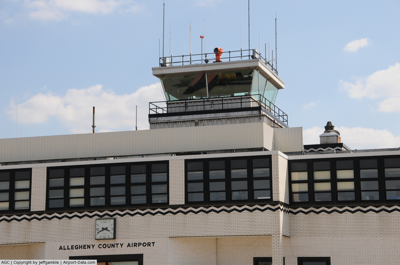
| Control Tower: | Yes |
| Lighting Schedule: | DUSK-DAWN |
| Beacon Color: | Clear-Green (lighted land airport) |
| Landing fee charge: | Yes
LNDG FEE FOR ACFT 5000 LBS & ABOVE. |
| Sectional chart: | Detroit |
| Region: | AEA - Eastern |
| Boundary ARTCC: | ZOB - Cleveland |
| Tie-in FSS: | AOO - Altoona |
| FSS Toll Free: | 1-800-WX-BRIEF |
| NOTAMs Facility: | AGC (NOTAM-d service avaliable) |
| Federal Agreements: | NGY |
Airport Communications
Airport Services
| Fuel available: | 100LLA |
| Airframe Repair: | MAJOR |
| Power Plant Repair: | MAJOR |
| Bottled Oxygen: | HIGH/LOW |
| Bulk Oxygen: | HIGH/LOW |
Runway Information
Runway 10/28
| Dimension: | 6501 x 150 ft / 1981.5 x 45.7 m |
| Surface: | CONC, Good Condition |
| Surface Treatment: | Saw-cut or plastic Grooved |
| Weight Limit: | Single wheel: 90000 lbs.
Dual wheel: 120000 lbs.
Dual tandem wheel: 210000 lbs. |
| Edge Lights: | High |
| |
Runway 10 |
Runway 28 |
| Longitude: | 079-56-27.9597W | 079-55-03.9955W |
| Latitude: | 40-21-15.4244N | 40-21-15.5209N |
| Elevation: | 1250.00 ft | 1250.00 ft |
| Alignment: | 90 | 127 |
| ILS Type: | ILS
| ILS
|
| Traffic Pattern: | Left | Left |
| Markings: | Precision instrument, Good Condition | Precision instrument, Good Condition |
| Crossing Height: | 47.00 ft | 0.00 ft |
| VASI: | 4-box on left side | |
| Visual Glide Angle: | 3.00° | 0.00° |
| RVR Equipment: | | touchdown |
| Approach lights: | | MALSR |
| Runway End Identifier: | Yes | |
| Obstruction: | 7 ft trees, 312.0 ft from runway, 281 ft left of centerline, 15:1 slope to clear | 21 ft trees, 519.0 ft from runway, 525 ft left of centerline, 15:1 slope to clear |
|
Runway 13/31
| Dimension: | 3825 x 100 ft / 1165.9 x 30.5 m |
| Surface: | CONC, Good Condition |
| Surface Treatment: | Saw-cut or plastic Grooved |
| Weight Limit: | Single wheel: 20000 lbs.
Dual wheel: 22000 lbs. |
| Edge Lights: | High |
| |
Runway 13 |
Runway 31 |
| Longitude: | 079-56-03.5874W | 079-55-20.7629W |
| Latitude: | 40-21-26.2597N | 40-21-07.4085N |
| Elevation: | 1245.00 ft | 1249.00 ft |
| Alignment: | 120 | 127 |
| Traffic Pattern: | Left | Left |
| Markings: | Basic, Good Condition | Basic, Good Condition |
| Runway End Identifier: | Yes | Yes |
| Obstruction: | 9 ft pole, 203.0 ft from runway, 42 ft right of centerline
RY 13 HAS +3 FT BRUSH, 160 FT FM RY END, 50 FT RIGHT. | 29 ft trees, 326.0 ft from runway, 235 ft left of centerline, 4:1 slope to clear |
|
Helipad H1
| Dimension: | 47 x 45 ft / 14.3 x 13.7 m |
| Surface: | CONC, Good Condition |
| |
Runway H1 |
Runway |
| Traffic Pattern: | Left | Left |
| Markings: | Basic, Good Condition | , |
|
Radio Navigation Aids
| ID |
Type |
Name |
Ch |
Freq |
Var |
Dist |
| MKP | NDB | Mc Keesport | | 287.00 | 07W | 6.8 nm |
| PNU | NDB | Washington County | | 255.00 | 08W | 16.5 nm |
| VV | NDB | Camor | | 299.00 | 08W | 29.6 nm |
| BHU | NDB | Benje | | 382.00 | 07W | 30.2 nm |
| INP | NDB | Indiana | | 242.00 | 08W | 42.9 nm |
| UCP | NDB | Castle | | 272.00 | 09W | 45.9 nm |
| SYS | NDB | Stoystown | | 209.00 | 08W | 49.2 nm |
| AGC | VOR/DME | Allegheny | 037X | 110.00 | 09W | 6.8 nm |
| HLG | VOR/DME | Wheeling | 059X | 112.20 | 07W | 29.8 nm |
| AIR | VOR/DME | Bellaire | 118X | 117.10 | 07W | 45.5 nm |
| MMJ | VORTAC | Montour | 057X | 112.00 | 08W | 14.5 nm |
| EWC | VORTAC | Ellwood City | 105X | 115.80 | 08W | 31.1 nm |
| IHD | VORTAC | Indian Head | 019X | 108.20 | 06W | 34.8 nm |
| MGW | VORTAC | Morgantown | 053X | 111.60 | 05W | 48.1 nm |
Remarks
- BIRDS & DEER ON & INVOF ARPT.
- UNEVEN PAVEMENT INTERSECTION RY 10/28 & TWY G.
- IN OPERN PRIOR TO 1959.
Images and information placed above are from
http://www.airport-data.com/airport/AGC/
We thank them for the data!
| General Info
|
| Country |
United States
|
| State |
PENNSYLVANIA
|
| FAA ID |
AGC
|
| Latitude |
40-21-15.845N
|
| Longitude |
079-55-48.608W
|
| Elevation |
1252 feet
|
| Near City |
PITTSBURGH
|
We don't guarantee the information is fresh and accurate. The data may
be wrong or outdated.
For more up-to-date information please refer to other sources.
|
|