 |
|
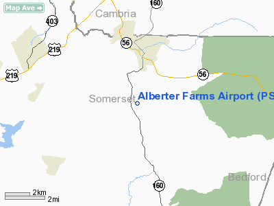
Location & QuickFacts
| FAA Information Effective: | 2008-09-25 |
| Airport Identifier: | PS52 |
| Airport Status: | Operational |
| Longitude/Latitude: | 078-49-58.0790W/40-11-42.2770N
-78.832800/40.195077 (Estimated) |
| Elevation: | 2070 ft / 630.94 m (Estimated) |
| Land: | 30 acres |
| From nearest city: | 8 nautical miles SE of Johnstown, PA |
| Location: | Somerset County, PA |
| Magnetic Variation: | 08W (1985) |
Owner & Manager
| Ownership: | Privately owned |
| Owner: | Barry M. Alberter |
| Address: | 124 Rose Lane
Windber, PA 15963 |
| Phone number: | 814-467-8765 |
| Address: |
|
Airport Operations and Facilities
| Airport Use: | Private |
| Wind indicator: | Yes |
| Segmented Circle: | No |
| Control Tower: | No |
| Landing fee charge: | No |
| Sectional chart: | Detroit |
| Region: | AEA - Eastern |
| Boundary ARTCC: | ZOB - Cleveland |
| Tie-in FSS: | AOO - Altoona |
| FSS on Airport: | No |
| FSS Toll Free: | 1-800-WX-BRIEF |
Runway Information
Runway 08/26
| Dimension: | 2600 x 100 ft / 792.5 x 30.5 m |
| Surface: | TURF, |
| |
Runway 08 |
Runway 26 |
| Traffic Pattern: | Left | Left |
| Obstruction: | | 40 ft , 400.0 ft from runway |
|
Radio Navigation Aids
| ID |
Type |
Name |
Ch |
Freq |
Var |
Dist |
| SYS | NDB | Stoystown | | 209.00 | 08W | 7.6 nm |
| BHU | NDB | Benje | | 382.00 | 07W | 22.9 nm |
| INP | NDB | Indiana | | 242.00 | 08W | 28.3 nm |
| CBE | NDB | Cumberland | | 317.00 | 07W | 33.1 nm |
| MKP | NDB | Mc Keesport | | 287.00 | 07W | 44.5 nm |
| VV | NDB | Camor | | 299.00 | 08W | 46.0 nm |
| AOO | VOR | Altoona | | 108.80 | 07W | 25.5 nm |
| REC | VOR/DME | Revloc | 043X | 110.60 | 09W | 21.5 nm |
| GRV | VOR/DME | Grantsville | 070X | 112.30 | 06W | 35.1 nm |
| JST | VORTAC | Johnstown | 077X | 113.00 | 06W | 7.3 nm |
| IHD | VORTAC | Indian Head | 019X | 108.20 | 06W | 27.6 nm |
| TON | VORTAC | Tyrone | 096X | 114.90 | 07W | 39.7 nm |
| THS | VORTAC | St Thomas | 097X | 115.00 | 07W | 43.5 nm |
Images and information placed above are from
http://www.airport-data.com/airport/PS52/
We thank them for the data!
| General Info
|
| Country |
United States
|
| State |
PENNSYLVANIA
|
| FAA ID |
PS52
|
| Latitude |
40-11-42.277N
|
| Longitude |
078-49-58.079W
|
| Elevation |
2070 feet
|
| Near City |
JOHNSTOWN
|
We don't guarantee the information is fresh and accurate. The data may
be wrong or outdated.
For more up-to-date information please refer to other sources.
|
|


