 |
|
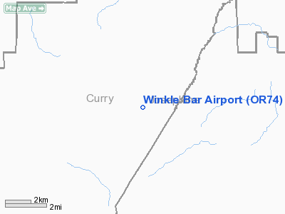
Location & QuickFacts
| FAA Information Effective: | 2008-09-25 |
| Airport Identifier: | OR74 |
| Airport Status: | Operational |
| Longitude/Latitude: | 123-48-18.2910W/42-42-05.4030N
-123.805081/42.701501 (Estimated) |
| Elevation: | 450 ft / 137.16 m (Estimated) |
| Land: | 0 acres |
| From nearest city: | 26 nautical miles NW of Grants Pass, OR |
| Location: | Curry County, OR |
| Magnetic Variation: | 18E (1985) |
Owner & Manager
| Ownership: | Privately owned |
| Owner: | Walter A Haas Jr |
| Address: |
|
| Manager: | Pacific Flights Inc |
| Address: | 3650 Biddle Rd
Medford, OR 97504 |
| Phone number: | 503-779-5445 |
Airport Operations and Facilities
| Airport Use: | Private |
| Wind indicator: | No |
| Segmented Circle: | No |
| Control Tower: | No |
| Landing fee charge: | No |
| Sectional chart: | Klamath Falls |
| Region: | ANM - Northwest Mountain |
| Boundary ARTCC: | ZSE - Seattle |
| Tie-in FSS: | MMV - Mc Minnville |
| FSS on Airport: | No |
| FSS Toll Free: | 1-800-WX-BRIEF |
Airport Services
| Airframe Repair: | NONE |
| Power Plant Repair: | NONE |
Runway Information
Runway NE/SW
| Dimension: | 900 x 30 ft / 274.3 x 9.1 m |
| Surface: | TURF, |
| |
Runway NE |
Runway SW |
| Traffic Pattern: | Left | Right |
|
Radio Navigation Aids
| ID |
Type |
Name |
Ch |
Freq |
Var |
Dist |
| RBG | NDB | Roseburg | | 400.00 | 20E | 37.6 nm |
| MEF | NDB | Medford | | 356.00 | 19E | 45.0 nm |
| RBG | VOR/DME | Roseburg | 019X | 108.20 | 20E | 35.1 nm |
| OED | VORTAC | Rogue Valley | 083X | 113.60 | 19E | 41.7 nm |
| OTH | VORTAC | North Bend | 058X | 112.10 | 18E | 45.8 nm |
| MFR | VOT | Medford-jackson County | | 117.20 | | 46.4 nm |
Remarks
- LOW APCH AROUND BENDS IN RIVER.
- PVT ARPT UNSAFE FOR GENERAL USE DUE TO TYPE OF TERRAIN & AIR CURRENTS.
- CAUTION--ARPT HAZARDOUS
- NO OBJECTION PRVDD OPNS ARE RESTRD TO PVT USE OF OWNER & OTHERS AUZD BY OWNER INCLUDING USFS & BLM.
Images and information placed above are from
http://www.airport-data.com/airport/OR74/
We thank them for the data!
| General Info
|
| Country |
United States
|
| State |
OREGON
|
| FAA ID |
OR74
|
| Latitude |
42-42-05.403N
|
| Longitude |
123-48-18.291W
|
| Elevation |
450 feet
|
| Near City |
GRANTS PASS
|
We don't guarantee the information is fresh and accurate. The data may
be wrong or outdated.
For more up-to-date information please refer to other sources.
|
|


