 |
|
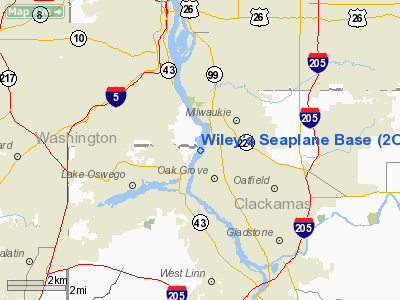
Wiley's Seaplane Base Airport |
Location & QuickFacts
| FAA Information Effective: | 2008-09-25 |
| Airport Identifier: | 2OG3 |
| Airport Status: | Operational |
| Longitude/Latitude: | 122-38-58.3360W/45-25-51.4290N
-122.649538/45.430953 (Estimated) |
| Elevation: | 12 ft / 3.66 m (Estimated) |
| Land: | 0 acres |
| From nearest city: | 1 nautical miles NE of Lake Oswego, OR |
| Location: | Clackamas County, OR |
| Magnetic Variation: | 19E (1985) |
Owner & Manager
| Ownership: | Privately owned |
| Owner: | David H Wiley-joanne B Wiley |
| Address: | 13060 Sw Fielding Rd
Lake Oswego, OR 97034 |
| Phone number: | 503-234-5361 |
| Manager: | David H Wiley-joanne B Wiley |
| Address: | 13060 Sw Fielding Rd
Lake Oswego, OR 97034 |
| Phone number: | 503-636-4930 |
Airport Operations and Facilities
| Airport Use: | Private |
| Wind indicator: | Yes |
| Segmented Circle: | No |
| Control Tower: | No |
| Landing fee charge: | No |
| Sectional chart: | Seattle |
| Region: | ANM - Northwest Mountain |
| Boundary ARTCC: | ZSE - Seattle |
| Tie-in FSS: | MMV - Mc Minnville |
| FSS on Airport: | No |
| FSS Toll Free: | 1-800-WX-BRIEF |
Airport Services
Runway Information
Runway N/S
| Dimension: | 3000 x 300 ft / 914.4 x 91.4 m |
| Surface: | WATER, |
| |
Runway N |
Runway S |
| Traffic Pattern: | Left | Left |
| Obstruction: | 136 ft bridge, 500.0 ft from runway, 3:1 slope to clear | , 50:1 slope to clear |
|
Radio Navigation Aids
| ID |
Type |
Name |
Ch |
Freq |
Var |
Dist |
| LBH | NDB | Laker | | 332.00 | 20E | 10.3 nm |
| PND | NDB | Banks | | 356.00 | 21E | 20.5 nm |
| LSO | NDB | Kelso | | 256.00 | 21E | 44.9 nm |
| CBU | TACAN | Columbia | 029X | | 20E | 9.6 nm |
| PDX | VOR/DME | Portland | 055X | 111.80 | 20E | 10.0 nm |
| UBG | VOR/DME | Newberg | 121X | 117.40 | 21E | 14.6 nm |
| BTG | VORTAC | Battle Ground | 113X | 116.60 | 21E | 19.2 nm |
| PDX | VOT | Portland Intl | | 111.00 | | 10.3 nm |
| HIO | VOT | Portland-hillsboro | | 115.20 | | 14.2 nm |
Remarks
- SELF SERVICE TIE-DOWN & DOCK SPACE.
- MINOR REPAIRES AVBL.
- FILED FOR RECORD PURPOSES ONLY.
Images and information placed above are from
http://www.airport-data.com/airport/2OG3/
We thank them for the data!
| General Info
|
| Country |
United States
|
| State |
OREGON
|
| FAA ID |
2OG3
|
| Latitude |
45-25-51.429N
|
| Longitude |
122-38-58.336W
|
| Elevation |
12 feet
|
| Near City |
LAKE OSWEGO
|
We don't guarantee the information is fresh and accurate. The data may
be wrong or outdated.
For more up-to-date information please refer to other sources.
|
|


