 |
|
Location & QuickFacts
| FAA Information Effective: | 2008-09-25 |
| Airport Identifier: | OG53 |
| Airport Status: | Operational |
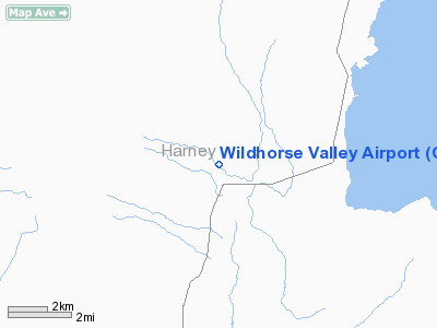
| Longitude/Latitude: | 118-36-30.0800W/42-29-16.5900N
-118.608356/42.487942 (Estimated) |
| Elevation: | 4225 ft / 1287.78 m (Estimated) |
| Land: | 318 acres |
| From nearest city: | 2 nautical miles N of Andrews, OR |
| Location: | Harney County, OR |
| Magnetic Variation: | () |
Owner & Manager
| Ownership: | Privately owned |
| Owner: | Phil Olson |
| Address: | 23725 Old Bethel Road
Amity, OR 97101 |
| Phone number: | 503-835-0504 |
| Manager: | Phil Olson |
| Address: | 23725 Old Bethel Road
Amity, OR 97101 |
| Phone number: | 503-835-0504 |
Airport Operations and Facilities
| Airport Use: | Private |
| Wind indicator: | Yes |
| Control Tower: | No |
| Sectional chart: | Klamath Falls |
| Region: | ANM - Northwest Mountain |
| Boundary ARTCC: | ZLC - Salt Lake City |
| Tie-in FSS: | MMV - Mc Minnville |
| FSS Toll Free: | 1-800-WX-BRIEF |
Runway Information
Runway 16/34
| Dimension: | 3000 x 50 ft / 914.4 x 15.2 m |
| Surface: | DIRT, |
| |
Runway 16 |
Runway 34 |
| Traffic Pattern: | Left | Left |
|
Radio Navigation Aids
| ID |
Type |
Name |
Ch |
Freq |
Var |
Dist |
| RMD | NDB | Mc Dermitt State | | 204.00 | 17E | 48.8 nm |
| REO | VORTAC | Rome | 072X | 112.50 | 19E | 33.4 nm |
Remarks
- OWNER DESIRES AIRPORT NOT BE CHARTED.
Images and information placed above are from
http://www.airport-data.com/airport/OG53/
We thank them for the data!
|
|


