 |
|
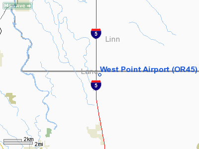
Location & QuickFacts
| FAA Information Effective: | 2008-09-25 |
| Airport Identifier: | OR45 |
| Airport Status: | Operational |
| Longitude/Latitude: | 123-03-21.3140W/44-11-49.4470N
-123.055921/44.197069 (Estimated) |
| Elevation: | 378 ft / 115.21 m (Estimated) |
| Land: | 0 acres |
| From nearest city: | 3 nautical miles N of Coburg, OR |
| Location: | Lane County, OR |
| Magnetic Variation: | 19E (1985) |
Owner & Manager
| Ownership: | Privately owned |
| Owner: | Mark Christensen |
| Address: | 33132 Coleman Rd
Eugene, OR 97401 |
| Manager: | Paul Christensen |
| Address: | 33132 Coleman Rd
Eugene, OR 97401 |
| Phone number: | 503-344-5951 |
Airport Operations and Facilities
| Airport Use: | Private |
| Wind indicator: | Yes |
| Segmented Circle: | No |
| Control Tower: | No |
| Landing fee charge: | No |
| Sectional chart: | Seattle |
| Region: | ANM - Northwest Mountain |
| Boundary ARTCC: | ZSE - Seattle |
| Tie-in FSS: | MMV - Mc Minnville |
| FSS on Airport: | No |
| FSS Toll Free: | 1-800-WX-BRIEF |
Runway Information
Runway N/S
| Dimension: | 1100 x 60 ft / 335.3 x 18.3 m |
| Surface: | GRAVEL, |
| |
Runway N |
Runway S |
| Traffic Pattern: | Left | Left |
|
Radio Navigation Aids
| ID |
Type |
Name |
Ch |
Freq |
Var |
Dist |
| EU | NDB | Frakk | | 260.00 | 19E | 7.2 nm |
| LWG | NDB | Lewisburg | | 225.00 | 18E | 26.7 nm |
| CVO | VOR/DME | Corvallis | 101X | 115.40 | 18E | 20.9 nm |
| EUG | VORTAC | Eugene | 076X | 112.90 | 20E | 8.5 nm |
| ONP | VORTAC | Newport | 118X | 117.10 | 19E | 48.8 nm |
Images and information placed above are from
http://www.airport-data.com/airport/OR45/
We thank them for the data!
| General Info
|
| Country |
United States
|
| State |
OREGON
|
| FAA ID |
OR45
|
| Latitude |
44-11-49.447N
|
| Longitude |
123-03-21.314W
|
| Elevation |
378 feet
|
| Near City |
COBURG
|
We don't guarantee the information is fresh and accurate. The data may
be wrong or outdated.
For more up-to-date information please refer to other sources.
|
|


