 |
|
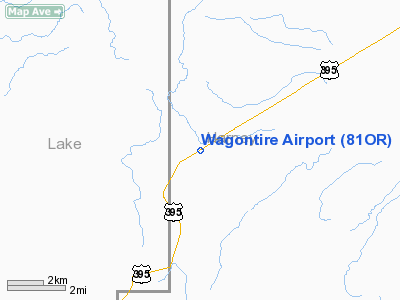
Location & QuickFacts
| FAA Information Effective: | 2008-09-25 |
| Airport Identifier: | 81OR |
| Airport Status: | Operational |
| Longitude/Latitude: | 119-52-30.8630W/43-14-59.5370N
-119.875240/43.249871 (Estimated) |
| Elevation: | 4725 ft / 1440.18 m (Estimated) |
| Land: | 5 acres |
| From nearest city: | 56 nautical miles SW of Burns, OR |
| Location: | Harney County, OR |
| Magnetic Variation: | 18E (1985) |
Owner & Manager
| Ownership: | Privately owned |
| Owner: | William E. Warner |
| Address: | Hc 74, Box 500
Riley, OR 97758 |
| Phone number: | 503-493-2317 |
| Manager: | William E. Warner |
| Address: | Hc 74, Box 500
Riley, OR 97758 |
| Phone number: | 503-493-2317 |
Airport Operations and Facilities
| Airport Use: | Private |
| Wind indicator: | Yes |
| Segmented Circle: | No |
| Control Tower: | No |
| Landing fee charge: | No |
| Sectional chart: | Seattle |
| Region: | ANM - Northwest Mountain |
| Boundary ARTCC: | ZSE - Seattle |
| Tie-in FSS: | MMV - Mc Minnville |
| FSS Toll Free: | 1-800-WX-BRIEF |
Airport Services
Runway Information
Runway 04/22
| Dimension: | 2000 x 80 ft / 609.6 x 24.4 m |
| Surface: | TURF-DIRT, |
| |
Runway 04 |
Runway 22 |
| Traffic Pattern: | Left | Left |
| Obstruction: | 4 ft fence | 4 ft fence, 0.0 ft from runway |
|
Radio Navigation Aids
| ID |
Type |
Name |
Ch |
Freq |
Var |
Dist |
| ILR | VOR/DME | Wildhorse | 085X | 113.80 | 18E | 45.2 nm |
Images and information placed above are from
http://www.airport-data.com/airport/81OR/
We thank them for the data!
| General Info
|
| Country |
United States
|
| State |
OREGON
|
| FAA ID |
81OR
|
| Latitude |
43-14-59.537N
|
| Longitude |
119-52-30.863W
|
| Elevation |
4725 feet
|
| Near City |
BURNS
|
We don't guarantee the information is fresh and accurate. The data may
be wrong or outdated.
For more up-to-date information please refer to other sources.
|
|


