 |
|
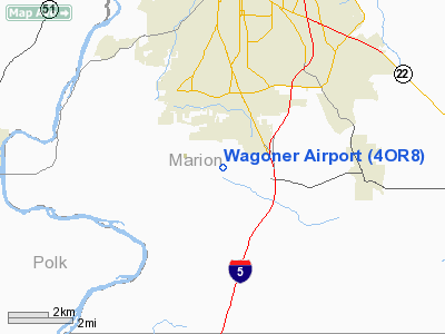
Location & QuickFacts
| FAA Information Effective: | 2008-09-25 |
| Airport Identifier: | 4OR8 |
| Airport Status: | Operational |
| Longitude/Latitude: | 123-02-29.3430W/44-50-54.4330N
-123.041484/44.848454 (Estimated) |
| Elevation: | 700 ft / 213.36 m (Estimated) |
| Land: | 0 acres |
| From nearest city: | 6 nautical miles N of Salem, OR |
| Location: | Marion County, OR |
| Magnetic Variation: | 19E (1985) |
Owner & Manager
| Ownership: | Privately owned |
| Owner: | D.t. Nelson |
| Address: | 761 Hylo Rd, Se
Salem, OR 97306 |
| Phone number: | 503-399-0647 |
| Address: |
|
Airport Operations and Facilities
| Airport Use: | Private |
| Wind indicator: | No |
| Segmented Circle: | No |
| Control Tower: | No |
| Landing fee charge: | No |
| Sectional chart: | Seattle |
| Region: | ANM - Northwest Mountain |
| Boundary ARTCC: | ZSE - Seattle |
| Tie-in FSS: | MMV - Mc Minnville |
| FSS on Airport: | No |
| FSS Toll Free: | 1-800-WX-BRIEF |
Airport Services
| Airframe Repair: | NONE |
| Power Plant Repair: | NONE |
Runway Information
Runway E/W
| Dimension: | 1050 x 75 ft / 320.0 x 22.9 m |
| Surface: | TURF-GRVL, |
| |
Runway E |
Runway W |
| Traffic Pattern: | Right | Left |
|
Radio Navigation Aids
| ID |
Type |
Name |
Ch |
Freq |
Var |
Dist |
| LWG | NDB | Lewisburg | | 225.00 | 18E | 17.2 nm |
| EU | NDB | Frakk | | 260.00 | 19E | 39.0 nm |
| PND | NDB | Banks | | 356.00 | 21E | 47.0 nm |
| LBH | NDB | Laker | | 332.00 | 20E | 48.3 nm |
| CBU | TACAN | Columbia | 029X | | 20E | 48.1 nm |
| CVO | VOR/DME | Corvallis | 101X | 115.40 | 18E | 23.6 nm |
| UBG | VOR/DME | Newberg | 121X | 117.40 | 21E | 30.5 nm |
| PDX | VOR/DME | Portland | 055X | 111.80 | 20E | 48.4 nm |
| EUG | VORTAC | Eugene | 076X | 112.90 | 20E | 44.4 nm |
| ONP | VORTAC | Newport | 118X | 117.10 | 19E | 46.5 nm |
| HIO | VOT | Portland-hillsboro | | 115.20 | | 41.8 nm |
| PDX | VOT | Portland Intl | | 111.00 | | 48.8 nm |
Remarks
- PSNL USE OF OWNER. PATTERN S OF ARPT. VFR DALGT OPNS ONLY.
Images and information placed above are from
http://www.airport-data.com/airport/4OR8/
We thank them for the data!
| General Info
|
| Country |
United States
|
| State |
OREGON
|
| FAA ID |
4OR8
|
| Latitude |
44-50-54.433N
|
| Longitude |
123-02-29.343W
|
| Elevation |
700 feet
|
| Near City |
SALEM
|
We don't guarantee the information is fresh and accurate. The data may
be wrong or outdated.
For more up-to-date information please refer to other sources.
|
|


