 |
|
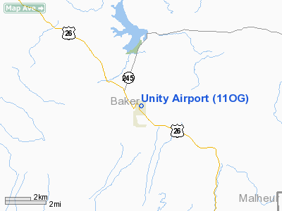
Location & QuickFacts
| FAA Information Effective: | 2008-09-25 |
| Airport Identifier: | 11OG |
| Airport Status: | Closed Indefinitely |
| Longitude/Latitude: | 118-11-11.7660W/44-27-04.5800N
-118.186602/44.451272 (Estimated) |
| Elevation: | 3975 ft / 1211.58 m (Estimated) |
| Land: | 6 acres |
| From nearest city: | 1 nautical miles N of Unity, OR |
| Location: | Baker County, OR |
| Magnetic Variation: | 18E (1985) |
Owner & Manager
| Ownership: | Privately owned |
| Owner: | John Hayes |
| Address: | Rouse Brothers Rch;po Box 10
Unity, OR 97884 |
| Address: |
|
Airport Operations and Facilities
| Airport Use: | Private |
| Wind indicator: | Yes |
| Segmented Circle: | No |
| Control Tower: | No |
| Landing fee charge: | No |
| Sectional chart: | Klamath Falls |
| Region: | ANM - Northwest Mountain |
| Boundary ARTCC: | ZLC - Salt Lake City |
| Tie-in FSS: | MMV - Mc Minnville |
| FSS on Airport: | No |
| FSS Toll Free: | 1-800-WX-BRIEF |
Airport Services
| Airframe Repair: | NONE |
| Power Plant Repair: | NONE |
| Bottled Oxygen: | NONE |
| Bulk Oxygen: | NONE |
Runway Information
Runway 10/28
| Dimension: | 2400 x 60 ft / 731.5 x 18.3 m |
| Surface: | DIRT, Fair Condition |
| |
Runway 10 |
Runway 28 |
| Traffic Pattern: | Left | Left |
| Markings: | None, | None, |
| Runway End Identifier: | No | No |
| Centerline Lights: | No | No |
| Touchdown Lights: | No | No |
| Obstruction: | 175 ft ground, 4000.0 ft from runway, 23:1 slope to clear
10/28 SAGE TO +4' ARND ALL EDGES OF RWY IN PRIM SFC. WEEDS ON RWY. | 4 ft fence, 0.0 ft from runway |
|
Radio Navigation Aids
| ID |
Type |
Name |
Ch |
Freq |
Var |
Dist |
| BKE | VOR/DME | Baker City | 100X | 115.30 | 20E | 28.5 nm |
Remarks
- NO WINTER MAINT.
- SFC SLICK WHEN WET.
- (ARPT STATUS) ARPT CLSD INDEFLY.
- NON-COMPLIANCE WITH FAR 157.
Images and information placed above are from
http://www.airport-data.com/airport/11OG/
We thank them for the data!
| General Info
|
| Country |
United States
|
| State |
OREGON
|
| FAA ID |
11OG
|
| Latitude |
44-27-04.580N
|
| Longitude |
118-11-11.766W
|
| Elevation |
3975 feet
|
| Near City |
UNITY
|
We don't guarantee the information is fresh and accurate. The data may
be wrong or outdated.
For more up-to-date information please refer to other sources.
|
|


