 |
|
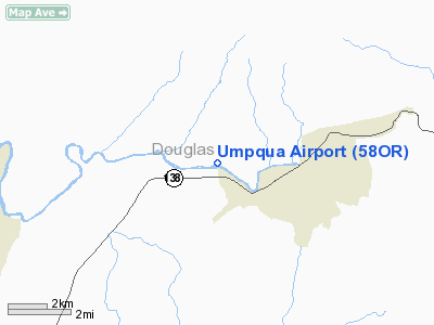
Location & QuickFacts
| FAA Information Effective: | 2008-09-25 |
| Airport Identifier: | 58OR |
| Airport Status: | Operational |
| Longitude/Latitude: | 123-07-37.0000W/43-18-35.0000N
-123.126944/43.309722 (Estimated) |
| Elevation: | 700 ft / 213.36 m (Estimated) |
| Land: | 5 acres |
| From nearest city: | 11 nautical miles NE of Roseburg, OR |
| Location: | Douglas County, OR |
| Magnetic Variation: | 18E (1995) |
Owner & Manager
| Ownership: | Privately owned |
| Owner: | Umpqua Skypark Inc |
| Address: | P O Box 731
Glide, OR 97443 |
| Phone number: | 503-496-0212 |
| Manager: | Steve Truesdell |
| Address: | 17354 N Bank Road
Roseburg, OR 97470 |
| Phone number: | 503-496-0026 |
Airport Operations and Facilities
| Airport Use: | Private |
| Wind indicator: | Yes |
| Segmented Circle: | No |
| Control Tower: | No |
| Sectional chart: | Klamath Falls |
| Region: | ANM - Northwest Mountain |
| Boundary ARTCC: | ZSE - Seattle |
| Tie-in FSS: | MMV - Mc Minnville |
| FSS on Airport: | No |
| FSS Toll Free: | 1-800-WX-BRIEF |
Runway Information
Runway 07/25
| Dimension: | 1900 x 50 ft / 579.1 x 15.2 m |
| Surface: | TURF, |
| |
Runway 07 |
Runway 25 |
| Traffic Pattern: | Left | Left |
| Obstruction: | 5 ft road | 200 ft hill, 500.0 ft from runway |
|
Radio Navigation Aids
| ID |
Type |
Name |
Ch |
Freq |
Var |
Dist |
| RBG | NDB | Roseburg | | 400.00 | 20E | 11.1 nm |
| RBG | VOR/DME | Roseburg | 019X | 108.20 | 20E | 12.5 nm |
| OTH | VORTAC | North Bend | 058X | 112.10 | 18E | 46.0 nm |
| EUG | VORTAC | Eugene | 076X | 112.90 | 20E | 48.9 nm |
Images and information placed above are from
http://www.airport-data.com/airport/58OR/
We thank them for the data!
| General Info
|
| Country |
United States
|
| State |
OREGON
|
| FAA ID |
58OR
|
| Latitude |
43-18-35.000N
|
| Longitude |
123-07-37.000W
|
| Elevation |
700 feet
|
| Near City |
ROSEBURG
|
We don't guarantee the information is fresh and accurate. The data may
be wrong or outdated.
For more up-to-date information please refer to other sources.
|
|


