 |
|
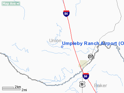
Location & QuickFacts
| FAA Information Effective: | 2008-09-25 |
| Airport Identifier: | OR16 |
| Airport Status: | Operational |
| Longitude/Latitude: | 117-58-03.7800W/45-03-26.4990N
-117.967717/45.057361 (Estimated) |
| Elevation: | 3412 ft / 1039.98 m (Estimated) |
| Land: | 0 acres |
| From nearest city: | 3 nautical miles NW of North Powder, OR |
| Location: | Union County, OR |
| Magnetic Variation: | 18E (1985) |
Owner & Manager
| Ownership: | Privately owned |
| Owner: | Lyle L. Umpleby |
| Address: | 65581 Wolf Creek Lane
North Powder, OR 97867 |
| Phone number: | 503-898-2349 |
| Manager: | Lyle L Umpleby |
| Address: | 65581 Wolf Creek Lane
North Powder, OR 97867 |
| Phone number: | 503-898-2349 |
Airport Operations and Facilities
| Airport Use: | Private |
| Wind indicator: | Yes |
| Segmented Circle: | No |
| Control Tower: | No |
| Landing fee charge: | No |
| Sectional chart: | Seattle |
| Region: | ANM - Northwest Mountain |
| Boundary ARTCC: | ZLC - Salt Lake City |
| Tie-in FSS: | MMV - Mc Minnville |
| FSS on Airport: | No |
| FSS Toll Free: | 1-800-WX-BRIEF |
Airport Services
| Airframe Repair: | NONE |
| Power Plant Repair: | NONE |
Runway Information
Runway 08/26
| Dimension: | 2640 x 50 ft / 804.7 x 15.2 m |
| Surface: | TURF, |
| |
Runway 08 |
Runway 26 |
| Traffic Pattern: | Left | Left |
|
Radio Navigation Aids
| ID |
Type |
Name |
Ch |
Freq |
Var |
Dist |
| LGD | NDB | La Grande | | 296.00 | 17E | 17.1 nm |
| BKE | VOR/DME | Baker City | 100X | 115.30 | 20E | 14.7 nm |
Images and information placed above are from
http://www.airport-data.com/airport/OR16/
We thank them for the data!
| General Info
|
| Country |
United States
|
| State |
OREGON
|
| FAA ID |
OR16
|
| Latitude |
45-03-26.499N
|
| Longitude |
117-58-03.780W
|
| Elevation |
3412 feet
|
| Near City |
NORTH POWDER
|
We don't guarantee the information is fresh and accurate. The data may
be wrong or outdated.
For more up-to-date information please refer to other sources.
|
|


