 |
|
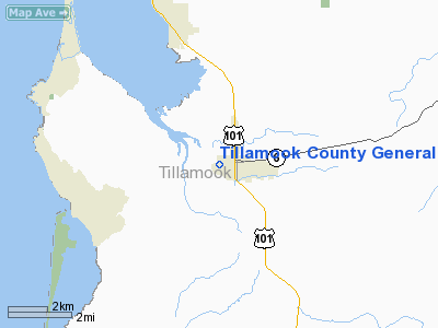
Tillamook County General Hospital Heliport |
Location & QuickFacts
| FAA Information Effective: | 2008-09-25 |
| Airport Identifier: | 6OR3 |
| Airport Status: | Operational |
| Longitude/Latitude: | 123-51-14.4510W/45-27-19.3760N
-123.854014/45.455382 (Estimated) |
| Elevation: | 3 ft / 0.91 m (Surveyed) |
| Land: | 0 acres |
| From nearest city: | 1 nautical miles W of Tillamook, OR |
| Location: | Tillamook County, OR |
| Magnetic Variation: | 20E (1985) |
Owner & Manager
| Ownership: | Publicly owned |
| Owner: | Tillamook County |
| Address: | 1000 3rd Street
Tillamook, OR 97141 |
| Phone number: | 503-842-4444 |
| Manager: | C. Wendell Hesseltine |
| Address: | 1000 3rd Street
Tillamook, OR 97141 |
| Phone number: | 503-842-4444 |
Airport Operations and Facilities
| Airport Use: | Private
MEDICAL USE. |
| Wind indicator: | Yes |
| Segmented Circle: | No |
| Control Tower: | No |
| Landing fee charge: | No |
| Sectional chart: | Seattle |
| Region: | ANM - Northwest Mountain |
| Boundary ARTCC: | ZSE - Seattle |
| Tie-in FSS: | MMV - Mc Minnville |
| FSS on Airport: | No |
| FSS Toll Free: | 1-800-WX-BRIEF |
Airport Services
| Airframe Repair: | NONE |
| Power Plant Repair: | NONE |
Runway Information
Helipad H1
| Dimension: | 80 x 80 ft / 24.4 x 24.4 m
TOUCHDOWN AREA WITHIN 100' X 100' LNDG/TKOF AREA. |
| Surface: | ASPH, |
| |
Runway H1 |
Runway |
| Traffic Pattern: | Right | Left |
|
Radio Navigation Aids
| ID |
Type |
Name |
Ch |
Freq |
Var |
Dist |
| AST | FAN MARKER | Fort Stevens | | | 22E | 45.5 nm |
| PND | NDB | Banks | | 356.00 | 21E | 35.6 nm |
| PEN | NDB | Karpen | | 201.00 | 20E | 42.6 nm |
| UBG | VOR/DME | Newberg | 121X | 117.40 | 21E | 37.5 nm |
| AST | VOR/DME | Astoria | 087X | 114.00 | 19E | 42.5 nm |
| HIO | VOT | Portland-hillsboro | | 115.20 | | 38.5 nm |
Remarks
- HELIPORT FOR MEDICAL/RESCUE PURPOSES ONLY.
Images and information placed above are from
http://www.airport-data.com/airport/6OR3/
We thank them for the data!
| General Info
|
| Country |
United States
|
| State |
OREGON
|
| FAA ID |
6OR3
|
| Latitude |
45-27-19.376N
|
| Longitude |
123-51-14.451W
|
| Elevation |
3 feet
|
| Near City |
TILLAMOOK
|
We don't guarantee the information is fresh and accurate. The data may
be wrong or outdated.
For more up-to-date information please refer to other sources.
|
|


