 |
|
| Sunriver Airport |
| IATA: SUO – ICAO: none – FAA LID: S21 |
| Summary |
| Airport type |
Public |
| Operator |
Sunriver Resort, L.P. |
| Location |
Sunriver, Oregon |
| Elevation AMSL |
4164 ft / 1269 m |
| Coordinates |
43°52′34.8000″N 121°27′11.0000″W / 43.876333°N 121.45306°W / 43.876333; -121.45306Coordinates: 43°52′34.8000″N 121°27′11.0000″W / 43.876333°N 121.45306°W / 43.876333; -121.45306 |
| Website |
http://www.sunriver-resort.com |
| Runways |
| Direction |
Length |
Surface |
| ft |
m |
| 18/36 |
5455 |
1663 |
Asphalt |
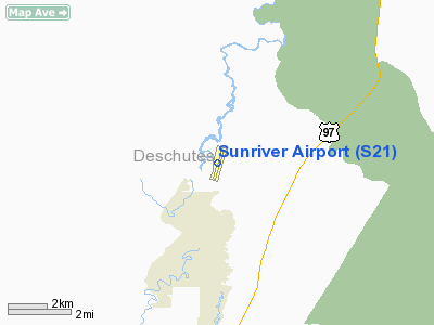
Sunriver Airport (FAA LID: S21), is a public airport located one mile (1.6 km) west of Sunriver in Deschutes County, Oregon, USA. It is used by travellers/private jets, glider tours around the area, and other uses to the public. It is located near the Sunriver Lodge. It has enough parking spaces to hold 170 aircraft; 16 of the parking spaces are specifically designed for Multi-engine piston and jet aircraft. The airport is also serviced by Enterprise Rental Car.
The above content comes from Wikipedia and is published under free licenses – click here to read more.
Location & QuickFacts
| FAA Information Effective: | 2008-09-25 |
| Airport Identifier: | S21 |
| Airport Status: | Operational |
| Longitude/Latitude: | 121-27-11.0000W/43-52-34.8000N
-121.453056/43.876333 (Estimated) |
| Elevation: | 4164 ft / 1269.19 m (Surveyed) |
| Land: | 108 acres |
| From nearest city: | 1 nautical miles W of Sunriver, OR |
| Location: | Deschutes County, OR |
| Magnetic Variation: | 18E (1985) |
Owner & Manager
| Ownership: | Privately owned |
| Owner: | Sunriver Resort, L.p. |
| Address: | Po Box 3609
Sunriver, OR 97707 |
| Phone number: | 541-593-1221 |
| Manager: | Brian Lansburgh |
| Address: | P.o. Box 3609
Sunriver, OR 97707 |
| Phone number: | 541-593-4603 |
Airport Operations and Facilities
| Airport Use: | Open to public |
| Wind indicator: | Yes |
| Segmented Circle: | Yes
SEGMENTED CIRCLE MADE OF WHITE TIRES. |
| Control Tower: | No |
| Lighting Schedule: | DUSK-DAWN
ACTVT LIRL RY 18/36 & VASI RY 18 - CTAF. |
| Beacon Color: | Clear-Green (lighted land airport) |
| Landing fee charge: | No |
| Sectional chart: | Klamath Falls |
| Region: | ANM - Northwest Mountain |
| Traffic Pattern Alt: | 1000 ft |
| Boundary ARTCC: | ZSE - Seattle |
| Tie-in FSS: | MMV - Mc Minnville |
| FSS on Airport: | No |
| FSS Toll Free: | 1-800-WX-BRIEF |
| NOTAMs Facility: | MMV (NOTAM-d service avaliable) |
| Federal Agreements: | N |
Airport Communications
| CTAF: | 122.800 |
| Unicom: | 122.800 |
Airport Services
| Fuel available: | 100LLA
AFTER HOURS FUEL PHONE 541-593-1000. |
| Power Plant Repair: | NONE |
| Bottled Oxygen: | NONE |
| Bulk Oxygen: | NONE |
Runway Information
Runway 18/36
| Dimension: | 5455 x 70 ft / 1662.7 x 21.3 m |
| Surface: | ASPH, Fair Condition |
| Weight Limit: | Single wheel: 12000 lbs. |
| Edge Lights: | Low |
| |
Runway 18 |
Runway 36 |
| Longitude: | 121-27-00.7687W | 121-27-21.1789W |
| Latitude: | 43-53-00.6520N | 43-52-08.8594N |
| Elevation: | 4158.00 ft | 4164.00 ft |
| Alignment: | 127 | 16 |
| Traffic Pattern: | Right | Left |
| Markings: | Basic, Fair Condition
RY 18/36 MKGS FADED. | Basic, Fair Condition |
| Crossing Height: | 22.00 ft | 0.00 ft |
| Displaced threshold: | 988.00 ft | 0.00 ft |
| VASI: | 2-box on left side | |
| Visual Glide Angle: | 3.50° | 0.00° |
| Obstruction: | 20 ft tree, 570.0 ft from runway, 18:1 slope to clear
RWY 18 APCH RATIO 54:1 BASED ON DSPLCD THLD; +70 FT TREES 4000 FT ON CNTRLN.
+4 FT FENCE 115 FT FM RY END ON CNTRLN. | 70 ft trees, 2000.0 ft from runway, 150 ft left of centerline, 25:1 slope to clear |
|
Radio Navigation Aids
| ID |
Type |
Name |
Ch |
Freq |
Var |
Dist |
| RD | NDB | Bodey | | 411.00 | 18E | 32.0 nm |
| DSD | VORTAC | Deschutes | 123X | 117.60 | 18E | 23.5 nm |
Remarks
- FOR NOISE ABATEMENT DEPARTING ACFT ARE URGED TO CLIMB WEST OF ARPT PRIOR TO TURNING ON COURSE.
- FLOCKS OF WATERFOWL INVOF ARPT.
Images and information placed above are from
http://www.airport-data.com/airport/S21/
We thank them for the data!
| General Info
|
| Country |
United States
|
| State |
OREGON
|
| FAA ID |
S21
|
| Latitude |
43-52-34.800N
|
| Longitude |
121-27-11.000W
|
| Elevation |
4164 feet
|
| Near City |
SUNRIVER
|
We don't guarantee the information is fresh and accurate. The data may
be wrong or outdated.
For more up-to-date information please refer to other sources.
|
|


