 |
|
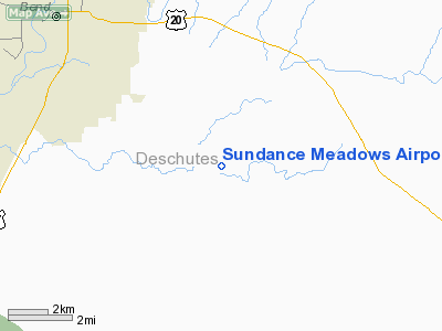
Location & QuickFacts
| FAA Information Effective: | 2008-09-25 |
| Airport Identifier: | OG05 |
| Airport Status: | Operational |
| Longitude/Latitude: | 121-12-22.0000W/43-59-24.0000N
-121.206111/43.990000 (Estimated) |
| Elevation: | 3850 ft / 1173.48 m (Estimated) |
| Land: | 0 acres |
| From nearest city: | 7 nautical miles SE of Bend, OR |
| Location: | Deschutes County, OR |
| Magnetic Variation: | 18E (1995) |
Owner & Manager
| Ownership: | Privately owned |
| Owner: | Sundance Meadows Property |
| Address: | 60335 Arnorld Market Road
Bend, OR 97702 |
| Phone number: | 503-399-9874 |
| Manager: | Joe Durst |
| Address: | 1475 Corina Drive Se
Salem, OR 97706 |
| Phone number: | 503-389-7003 |
Airport Operations and Facilities
| Airport Use: | Private |
| Wind indicator: | Yes |
| Segmented Circle: | No |
| Control Tower: | No |
| Landing fee charge: | No |
| Sectional chart: | Klamath Falls |
| Region: | ANM - Northwest Mountain |
| Boundary ARTCC: | ZSE - Seattle |
| Tie-in FSS: | MMV - Mc Minnville |
| FSS on Airport: | No |
| FSS Toll Free: | 1-800-WX-BRIEF |
Runway Information
Runway 12/30
| Dimension: | 3450 x 130 ft / 1051.6 x 39.6 m |
| Surface: | TURF-GRVL,
FIRST 200 FT EACH END RY ROUGH. |
| |
Runway 12 |
Runway 30 |
| Traffic Pattern: | Left | Left |
| Obstruction: | 40 ft trees, 450.0 ft from runway | 40 ft trees, 800.0 ft from runway |
|
Radio Navigation Aids
| ID |
Type |
Name |
Ch |
Freq |
Var |
Dist |
| RD | NDB | Bodey | | 411.00 | 18E | 20.7 nm |
| DSD | VORTAC | Deschutes | 123X | 117.60 | 18E | 16.3 nm |
Images and information placed above are from
http://www.airport-data.com/airport/OG05/
We thank them for the data!
| General Info
|
| Country |
United States
|
| State |
OREGON
|
| FAA ID |
OG05
|
| Latitude |
43-59-24.000N
|
| Longitude |
121-12-22.000W
|
| Elevation |
3850 feet
|
| Near City |
BEND
|
We don't guarantee the information is fresh and accurate. The data may
be wrong or outdated.
For more up-to-date information please refer to other sources.
|
|


