 |
|
Location & QuickFacts
| FAA Information Effective: | 2008-09-25 |
| Airport Identifier: | OG56 |
| Airport Status: | Operational |
| Longitude/Latitude: | 123-47-38.2500W/46-09-06.6900N
-123.793958/46.151858 (Estimated) |
| Elevation: | 42 ft / 12.80 m (Estimated) |
| Land: | 0 acres |
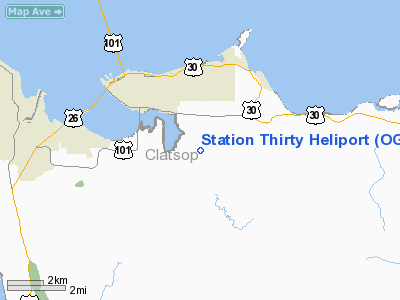
| From nearest city: | 4 nautical miles NW of Astoria, OR |
| Location: | Clatsop County, OR |
| Magnetic Variation: | () |
Owner & Manager
| Ownership: | Privately owned |
| Owner: | Oregon Dept Of Forestry |
| Address: | 92219 Hwy 202
Astoria, OR 97103 |
| Phone number: | 503-325-5451 |
| Manager: | Neal Laugle |
| Address: | 92219 Hwy 202
Astoria, OR 97103 |
| Phone number: | 503-325-5451 |
Airport Operations and Facilities
| Airport Use: | Private |
| Wind indicator: | Yes |
| Control Tower: | No |
| Sectional chart: | Seattle |
| Region: | ANM - Northwest Mountain |
| Boundary ARTCC: | ZSE - Seattle |
| Tie-in FSS: | MMV - Mc Minnville |
| FSS Toll Free: | 1-800-WX-BRIEF |
Runway Information
Helipad H1
| Dimension: | 63 x 63 ft / 19.2 x 19.2 m |
| Surface: | TURF, |
| |
Runway H1 |
Runway |
| Traffic Pattern: | Left | Left |
|
Radio Navigation Aids
| ID |
Type |
Name |
Ch |
Freq |
Var |
Dist |
| AST | FAN MARKER | Fort Stevens | | | 22E | 7.9 nm |
| PEN | NDB | Karpen | | 201.00 | 20E | 8.6 nm |
| LSO | NDB | Kelso | | 256.00 | 21E | 36.7 nm |
| PND | NDB | Banks | | 356.00 | 21E | 44.3 nm |
| TDO | NDB | Toledo | | 219.00 | 20E | 45.0 nm |
| AST | VOR/DME | Astoria | 087X | 114.00 | 19E | 3.6 nm |
Remarks
- ALL HELOS ANNOUCE INTENTIONS ON AST 122.8 ESPECIALLY DURG LOWER CEILINGS TO AVOID CONFLICT WITH ACFT ON ILS APCH TO RY 26.
Images and information placed above are from
http://www.airport-data.com/airport/OG56/
We thank them for the data!
|
|


