 |
|
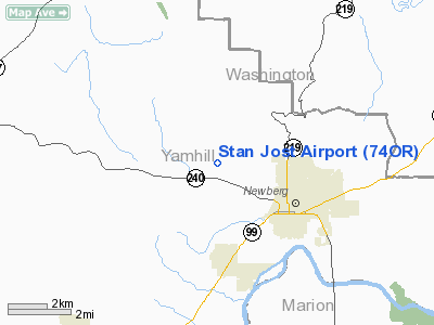
Location & QuickFacts
| FAA Information Effective: | 2008-09-25 |
| Airport Identifier: | 74OR |
| Airport Status: | Operational |
| Longitude/Latitude: | 123-01-08.3700W/45-19-25.4220N
-123.018992/45.323728 (Estimated) |
| Elevation: | 180 ft / 54.86 m (Estimated) |
| Land: | 12 acres |
| From nearest city: | 3 nautical miles NW of Newberg, OR |
| Location: | Yamhill County, OR |
| Magnetic Variation: | 20E (1980) |
Owner & Manager
| Ownership: | Privately owned |
| Owner: | Stan Jost |
| Address: | 15125 Ne Flying Featherlane
Newberg, OR 97132 |
| Phone number: | 503-554-9112 |
| Manager: | Stan Jost |
| Address: | 15125 Ne Flying Featherlane
Newberg, OR 97132 |
| Phone number: | 503-554-9112 |
Airport Operations and Facilities
| Airport Use: | Private |
| Wind indicator: | Yes
2 WIND INDICATORS. |
| Segmented Circle: | No |
| Control Tower: | No |
| Sectional chart: | Seattle |
| Region: | ANM - Northwest Mountain |
| Boundary ARTCC: | ZSE - Seattle |
| Tie-in FSS: | MMV - Mc Minnville |
| FSS Toll Free: | 1-800-WX-BRIEF |
Runway Information
Runway 15/33
| Dimension: | 1300 x 80 ft / 396.2 x 24.4 m |
| Surface: | TURF, |
| |
Runway 15 |
Runway 33 |
| Traffic Pattern: | Left | Left |
| Obstruction: | 15 ft trees, 50.0 ft from runway | |
|
Radio Navigation Aids
| ID |
Type |
Name |
Ch |
Freq |
Var |
Dist |
| PND | NDB | Banks | | 356.00 | 21E | 18.5 nm |
| LBH | NDB | Laker | | 332.00 | 20E | 26.9 nm |
| LWG | NDB | Lewisburg | | 225.00 | 18E | 44.0 nm |
| CBU | TACAN | Columbia | 029X | | 20E | 23.4 nm |
| UBG | VOR/DME | Newberg | 121X | 117.40 | 21E | 2.5 nm |
| PDX | VOR/DME | Portland | 055X | 111.80 | 20E | 23.8 nm |
| BTG | VORTAC | Battle Ground | 113X | 116.60 | 21E | 31.2 nm |
| HIO | VOT | Portland-hillsboro | | 115.20 | | 13.4 nm |
| PDX | VOT | Portland Intl | | 111.00 | | 24.1 nm |
Remarks
- PROVIDED TFC PATTERNS ARE ESTABLISHED TO AVOID CHELALEM ARPT.
Images and information placed above are from
http://www.airport-data.com/airport/74OR/
We thank them for the data!
| General Info
|
| Country |
United States
|
| State |
OREGON
|
| FAA ID |
74OR
|
| Latitude |
45-19-25.422N
|
| Longitude |
123-01-08.370W
|
| Elevation |
180 feet
|
| Near City |
NEWBERG
|
We don't guarantee the information is fresh and accurate. The data may
be wrong or outdated.
For more up-to-date information please refer to other sources.
|
|


