 |
|
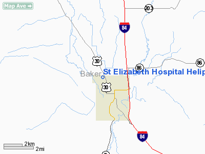
St Elizabeth Hospital Heliport |
Location & QuickFacts
| FAA Information Effective: | 2008-09-25 |
| Airport Identifier: | 93OR |
| Airport Status: | Operational |
| Longitude/Latitude: | 117-50-45.7850W/44-47-39.5450N
-117.846051/44.794318 (Estimated) |
| Elevation: | 3410 ft / 1039.37 m (Estimated) |
| Land: | 0 acres |
| From nearest city: | 1 nautical miles N of Baker, OR |
| Location: | Baker County, OR |
| Magnetic Variation: | 18E (1985) |
Owner & Manager
| Ownership: | Privately owned |
| Owner: | St Elizabeth Hospital |
| Address: | 3325 Pocahontas Road
Baker, OR 97814 |
| Phone number: | 503-523-6461 |
| Manager: | Rod Barton |
| Address: | 3325 Pocahontas Road
Baker, OR 97814 |
| Phone number: | 503-523-6461 |
Airport Operations and Facilities
| Airport Use: | Private
MEDICAL USE. |
| Wind indicator: | Yes |
| Segmented Circle: | No |
| Control Tower: | No |
| Sectional chart: | Klamath Falls |
| Region: | ANM - Northwest Mountain |
| Boundary ARTCC: | ZLC - Salt Lake City |
| Tie-in FSS: | MMV - Mc Minnville |
| FSS Toll Free: | 1-800-WX-BRIEF |
Runway Information
Helipad H1
| Dimension: | 42 x 42 ft / 12.8 x 12.8 m |
| Surface: | ASPH, |
| |
Runway H1 |
Runway |
| Traffic Pattern: | Left | Left |
|
Radio Navigation Aids
| ID |
Type |
Name |
Ch |
Freq |
Var |
Dist |
| LGD | NDB | La Grande | | 296.00 | 17E | 33.3 nm |
| BKE | VOR/DME | Baker City | 100X | 115.30 | 20E | 3.2 nm |
Images and information placed above are from
http://www.airport-data.com/airport/93OR/
We thank them for the data!
| General Info
|
| Country |
United States
|
| State |
OREGON
|
| FAA ID |
93OR
|
| Latitude |
44-47-39.545N
|
| Longitude |
117-50-45.785W
|
| Elevation |
3410 feet
|
| Near City |
BAKER
|
We don't guarantee the information is fresh and accurate. The data may
be wrong or outdated.
For more up-to-date information please refer to other sources.
|
|


