 |
|
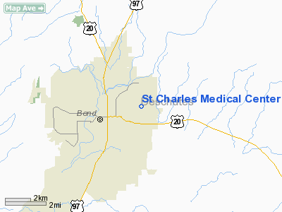
St Charles Medical Center Heliport |
Location & QuickFacts
| FAA Information Effective: | 2008-09-25 |
| Airport Identifier: | 54OR |
| Airport Status: | Operational |
| Longitude/Latitude: | 121-16-08.1110W/44-04-01.4230N
-121.268920/44.067062 (Estimated) |
| Elevation: | 3590 ft / 1094.23 m (Estimated) |
| Land: | 0 acres |
| From nearest city: | 2 nautical miles NE of Bend, OR |
| Location: | Deschutes County, OR |
| Magnetic Variation: | 18E (1985) |
Owner & Manager
| Ownership: | Privately owned |
| Owner: | St.charles Med.center |
| Address: | 2500 Ne Neff Rd.
Bend, OR 97701 |
| Phone number: | 503-382-4321 |
| Manager: | Vern Bartley, Mgr. |
| Address: | 2500 Ne Neff Rd
Bend, OR 97701 |
| Phone number: | 503-382-4321 |
Airport Operations and Facilities
| Airport Use: | Private
MEDICAL USE. |
| Wind indicator: | Yes |
| Segmented Circle: | No |
| Control Tower: | No |
| Landing fee charge: | No |
| Sectional chart: | Klamath Falls |
| Region: | ANM - Northwest Mountain |
| Boundary ARTCC: | ZSE - Seattle |
| Tie-in FSS: | MMV - Mc Minnville |
| FSS on Airport: | No |
| FSS Toll Free: | 1-800-WX-BRIEF |
Airport Services
Runway Information
Helipad H1
| Dimension: | 60 x 60 ft / 18.3 x 18.3 m |
| Surface: | ASPH-CONC, Good Condition |
| |
Runway H1 |
Runway |
| Traffic Pattern: | Left | Left |
|
Radio Navigation Aids
| ID |
Type |
Name |
Ch |
Freq |
Var |
Dist |
| RD | NDB | Bodey | | 411.00 | 18E | 18.0 nm |
| DSD | VORTAC | Deschutes | 123X | 117.60 | 18E | 11.3 nm |
Remarks
- PRIVATE EMERGENCY USE ONLY.
Images and information placed above are from
http://www.airport-data.com/airport/54OR/
We thank them for the data!
| General Info
|
| Country |
United States
|
| State |
OREGON
|
| FAA ID |
54OR
|
| Latitude |
44-04-01.423N
|
| Longitude |
121-16-08.111W
|
| Elevation |
3590 feet
|
| Near City |
BEND
|
We don't guarantee the information is fresh and accurate. The data may
be wrong or outdated.
For more up-to-date information please refer to other sources.
|
|


