 |
|
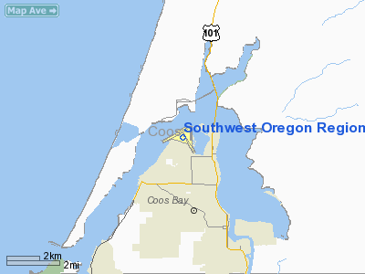
Southwest Oregon Rgnl Airport |
Southwest Oregon Regional Airport
North Bend Municipal Airport |
| IATA: OTH – ICAO: KOTH – FAA LID: OTH |
| Summary |
| Airport type |
Public |
| Operator |
Coos County Airport District |
| Location |
North Bend, Oregon |
| Elevation AMSL |
17 ft / 5 m |
| Coordinates |
43°25′02″N 124°15′46″W / 43.41722°N 124.26278°W / 43.41722; -124.26278Coordinates: 43°25′02″N 124°15′46″W / 43.41722°N 124.26278°W / 43.41722; -124.26278 |
| Website |
http://www.flyoth.com/ |
| Runways |
| Direction |
Length |
Surface |
| ft |
m |
| 4/22 |
5,321 |
1,622 |
Asphalt |
| 13/31 |
4,471 |
1,363 |
Asphalt |
Southwest Oregon Regional Airport (IATA: OTH, ICAO: KOTH, FAA LID: OTH), formerly known as North Bend Municipal Airport, is a public airport located in the city of North Bend, in Coos County, Oregon, USA. It is operated by the Coos County Airport District and serves the entire county.
The airport changed its name in April 2006 to avoid confusion with Bend, a city in central Oregon. According to an airport press release, the name "will be more descriptive of the region" and "will cure many of the problems experienced by travelers to the South Coast area who have been inadvertently sent to central Oregon's Bend/Redmond area by mistake."
It is the only commercial airport on the Oregon Coast and is served by United Airlines (Skywest). United Express offers service to San Francisco International Airport (since July 2008) and Portland International Airport (since October 2008). The airport was previously served by Horizon Air, which had linked North Bend to Portland International Airport since 1982. Horizon Air service ended on October 11, 2008.
The airport has recently been flooded by private jets filled with golfers on their way to Bandon Dunes Golf Resort, a 20 minute drive from the airport. The airport opened a new terminal in July 2008. In February 2009 a brand new Air Traffic Control Tower was commissioned for the airport. Airline
| Airlines |
Destinations |
| United Express operated by SkyWest Airlines |
Portland (OR), San Francisco |
The above content comes from Wikipedia and is published under free licenses – click here to read more.
Location & QuickFacts
| FAA Information Effective: | 2008-09-25 |
| Airport Identifier: | OTH |
| Airport Status: | Operational |
| Longitude/Latitude: | 124-14-45.6700W/43-25-01.5700N
-124.246019/43.417103 (Estimated) |
| Elevation: | 17 ft / 5.18 m (Surveyed) |
| Land: | 619 acres |
| From nearest city: | 1 nautical miles NW of North Bend, OR |
| Location: | Coos County, OR |
| Magnetic Variation: | 18E (1995) |
Owner & Manager
| Ownership: | Publicly owned |
| Owner: | Coos County Airport District |
| Address: | 2348 Colorado Ave, Box B, City Hall
North Bend, OR 97459-2079 |
| Phone number: | 541-756-8500 |
| Manager: | Gary Letellier |
| Address: | 2348 Colorado Avenue, Box F
North Bend, OR 97459-2079 |
| Phone number: | 541-756-8531
OR 541-756-7272 WX. |
Airport Operations and Facilities
| Airport Use: | Open to public |
| Wind indicator: | Yes |
| Segmented Circle: | Yes |
| Control Tower: | No |
| Lighting Schedule: | DUSK-DAWN
FOR HIRL RY 04/22 & MIRL RY 13/31 CTC - UNICOM. |
| Beacon Color: | Clear-Green (lighted land airport) |
| Landing fee charge: | Yes |
| Sectional chart: | Klamath Falls |
| Region: | ANM - Northwest Mountain |
| Boundary ARTCC: | ZSE - Seattle |
| Tie-in FSS: | MMV - Mc Minnville |
| FSS on Airport: | No |
| FSS Toll Free: | 1-800-WX-BRIEF |
| NOTAMs Facility: | OTH (NOTAM-d service avaliable) |
| Certification type/date: | I A S 05/1973 |
| Federal Agreements: | NGRY3 |
Airport Communications
| CTAF: | 122.700 |
| Unicom: | 122.700 |
Airport Services
| Fuel available: | 100LLA |
| Airframe Repair: | MAJOR |
| Power Plant Repair: | MAJOR |
| Bottled Oxygen: | NONE |
| Bulk Oxygen: | NONE |
Runway Information
Runway 04/22
| Dimension: | 5321 x 150 ft / 1621.8 x 45.7 m |
| Surface: | ASPH, Good Condition
SURFACE HAS MODERATE RAVELING. |
| Surface Treatment: | Saw-cut or plastic Grooved |
| Weight Limit: | Single wheel: 106000 lbs.
Dual wheel: 113000 lbs.
Dual tandem wheel: 190000 lbs. |
| Edge Lights: | High |
| |
Runway 04 |
Runway 22 |
| Longitude: | 124-15-38.2594W | 124-14-35.4113W |
| Latitude: | 43-24-53.0038N | 43-25-18.7427N |
| Elevation: | 16.00 ft | 13.00 ft |
| Alignment: | 61 | 127 |
| ILS Type: | ILS
| MLS |
| Traffic Pattern: | Left | Left |
| Markings: | Precision instrument, Good Condition | Precision instrument, Good Condition |
| Crossing Height: | 38.00 ft | 0.00 ft |
| VASI: | 4-box on right side | |
| Visual Glide Angle: | 3.00° | 0.00° |
| Approach lights: | MALSR
ACTIVATE MALSR RY 04 - 122.7. | |
| Obstruction: | 140 ft boat, 3700.0 ft from runway, 25:1 slope to clear | 140 ft ship, 1320.0 ft from runway, 550 ft right of centerline, 8:1 slope to clear |
| Decleard distances: | Take off run available 5321.00 ft
Take off distance available 5321.00 ft
Actual stop distance available 5321.00 ft
Landing distance available 5321.00 ft
| Take off run available 6000.00 ft
Take off distance available 6000.00 ft
Actual stop distance available 6000.00 ft
Landing distance available 5321.00 ft
|
|
Runway 13/31
| Dimension: | 4471 x 150 ft / 1362.8 x 45.7 m |
| Surface: | ASPH, Good Condition
SURFACE HAS MODERATE RAVELING. |
| Surface Treatment: | Saw-cut or plastic Grooved |
| Weight Limit: | Single wheel: 90000 lbs.
Dual wheel: 100000 lbs.
Dual tandem wheel: 100000 lbs. |
| Edge Lights: | Medium |
| |
Runway 13 |
Runway 31 |
| Longitude: | 124-14-46.5700W | 124-14-15.9400W |
| Latitude: | 43-25-11.4100N | 43-24-33.3100N |
| Elevation: | 13.00 ft | 17.00 ft |
| Alignment: | 127 | 127 |
| Traffic Pattern: | Left | Right |
| Markings: | Basic, Good Condition | Basic, Good Condition |
| Crossing Height: | 0.00 ft | 50.00 ft |
| VASI: | | 4-light PAPI on left side |
| Visual Glide Angle: | 0.00° | 4.00° |
| Runway End Identifier: | Yes | Yes |
| Obstruction: | 140 ft ship, 1740.0 ft from runway, 11:1 slope to clear | 13 ft road, 200.0 ft from runway, 250 ft right of centerline |
|
Runway 16/34
| Dimension: | 2320 x 150 ft / 707.1 x 45.7 m |
| Surface: | ASPH, Poor Condition
SURFACE HAS MODERATE RAVELING. |
| Weight Limit: | Single wheel: 45000 lbs.
Dual wheel: 60000 lbs.
Dual tandem wheel: 100000 lbs. |
| |
Runway 16 |
Runway 34 |
| Longitude: | 124-14-25.1047W | 124-14-24.7227W |
| Latitude: | 43-25-20.9160N | 43-24-58.0006N |
| Elevation: | 13.00 ft | 12.00 ft |
| Alignment: | 127 | 127 |
| Traffic Pattern: | Left | Right |
| Markings: | Basic, Poor Condition
RUNWAY 16/34 CENTERLINE FADED. | Basic, Poor Condition |
| Obstruction: | 140 ft ship, 1040.0 ft from runway, 6:1 slope to clear | 64 ft tree, 3150.0 ft from runway, 375 ft right of centerline, 46:1 slope to clear |
|
Radio Navigation Aids
| ID |
Type |
Name |
Ch |
Freq |
Var |
Dist |
| RBG | NDB | Roseburg | | 400.00 | 20E | 40.3 nm |
| RBG | VOR/DME | Roseburg | 019X | 108.20 | 20E | 41.6 nm |
| OTH | VORTAC | North Bend | 058X | 112.10 | 18E | 3.4 nm |
Remarks
- SHIP CHNL CROSSES RY 04 APRX 2/3 MI FM THR; CROSSES RY 13; 22 & 16 APRX 1000' TO 1700' FM THR; MAST HGTS TO 140'.
- MIGRATORY FLOCKS OF WATERFOWL ON & INVOF ARPT.
- NON-COMMERCIAL LANDING FEE FOR ALL AIRCRAFT OVER 12,500 LBS.
- PAEW INVOF RYS AND TYS 2330-0730 MON-FRI FOR MOWING.
Images and information placed above are from
http://www.airport-data.com/airport/OTH/
We thank them for the data!
| General Info
|
| Country |
United States
|
| State |
OREGON
|
| FAA ID |
OTH
|
| Latitude |
43-25-01.700N
|
| Longitude |
124-14-45.700W
|
| Elevation |
17 feet
|
| Near City |
NORTH BEND
|
We don't guarantee the information is fresh and accurate. The data may
be wrong or outdated.
For more up-to-date information please refer to other sources.
|
|


