 |
|
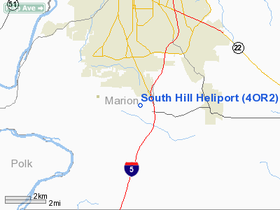
Location & QuickFacts
| FAA Information Effective: | 2008-09-25 |
| Airport Identifier: | 4OR2 |
| Airport Status: | Operational |
| Longitude/Latitude: | 123-01-22.3410W/44-50-51.4340N
-123.022873/44.847621 (Estimated) |
| Elevation: | 680 ft / 207.26 m (Estimated) |
| Land: | 0 acres |
| From nearest city: | 5 nautical miles S of Salem, OR |
| Location: | Marion County, OR |
| Magnetic Variation: | 18E (1990) |
Owner & Manager
| Ownership: | Privately owned |
| Owner: | R. F. Wilson |
| Address: | P O Box 99
Lyons, OR 97358 |
| Phone number: | 503-859-2134 |
| Manager: | R. F. Wilson |
| Address: | P O Box 99
Lyons, OR 97358 |
| Phone number: | 503-859-2134 |
Airport Operations and Facilities
| Airport Use: | Private |
| Wind indicator: | Yes |
| Segmented Circle: | No |
| Control Tower: | No |
| Sectional chart: | Seattle |
| Region: | ANM - Northwest Mountain |
| Boundary ARTCC: | ZSE - Seattle |
| Tie-in FSS: | MMV - Mc Minnville |
| FSS Toll Free: | 1-800-WX-BRIEF |
Runway Information
Helipad H1
| Dimension: | 60 x 50 ft / 18.3 x 15.2 m |
| Surface: | ASPH, |
| |
Runway H1 |
Runway |
| Traffic Pattern: | Left | Left |
|
Radio Navigation Aids
| ID |
Type |
Name |
Ch |
Freq |
Var |
Dist |
| LWG | NDB | Lewisburg | | 225.00 | 18E | 17.6 nm |
| EU | NDB | Frakk | | 260.00 | 19E | 39.1 nm |
| PND | NDB | Banks | | 356.00 | 21E | 47.1 nm |
| LBH | NDB | Laker | | 332.00 | 20E | 48.0 nm |
| CBU | TACAN | Columbia | 029X | | 20E | 47.8 nm |
| CVO | VOR/DME | Corvallis | 101X | 115.40 | 18E | 23.9 nm |
| UBG | VOR/DME | Newberg | 121X | 117.40 | 21E | 30.5 nm |
| PDX | VOR/DME | Portland | 055X | 111.80 | 20E | 48.2 nm |
| EUG | VORTAC | Eugene | 076X | 112.90 | 20E | 44.5 nm |
| ONP | VORTAC | Newport | 118X | 117.10 | 19E | 47.3 nm |
| HIO | VOT | Portland-hillsboro | | 115.20 | | 41.8 nm |
| PDX | VOT | Portland Intl | | 111.00 | | 48.5 nm |
Remarks
- NOISE SENSITIVE NEIGHBORHOOD IN CLOSE PROXIMITY TO HELIPORT.
Images and information placed above are from
http://www.airport-data.com/airport/4OR2/
We thank them for the data!
| General Info
|
| Country |
United States
|
| State |
OREGON
|
| FAA ID |
4OR2
|
| Latitude |
44-50-51.434N
|
| Longitude |
123-01-22.341W
|
| Elevation |
680 feet
|
| Near City |
SALEM
|
We don't guarantee the information is fresh and accurate. The data may
be wrong or outdated.
For more up-to-date information please refer to other sources.
|
|


