 |
|
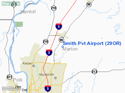
Location & QuickFacts
| FAA Information Effective: | 2008-09-25 |
| Airport Identifier: | 29OR |
| Airport Status: | Operational |
| Longitude/Latitude: | 122-57-25.3420W/45-01-54.4300N
-122.957039/45.031786 (Estimated) |
| Elevation: | 180 ft / 54.86 m (Estimated) |
| Land: | 5 acres |
| From nearest city: | 1 nautical miles SE of Brooks, OR |
| Location: | Marion County, OR |
| Magnetic Variation: | 19E (1985) |
Owner & Manager
| Ownership: | Privately owned |
| Owner: | Northwest Shade Trees |
| Address: | 12973 Se 352nd Avenue
Boring, OR 97009 |
| Phone number: | 503-663-3520 |
| Manager: | Mac Mc Carter |
| Address: | 3958 Hertel Drive South
Salem, OR 97302 |
| Phone number: | 503-391-1712 |
Airport Operations and Facilities
| Airport Use: | Private |
| Wind indicator: | Yes |
| Segmented Circle: | No |
| Control Tower: | No |
| Landing fee charge: | No |
| Sectional chart: | Seattle |
| Region: | ANM - Northwest Mountain |
| Boundary ARTCC: | ZSE - Seattle |
| Tie-in FSS: | MMV - Mc Minnville |
| FSS on Airport: | No |
| FSS Toll Free: | 1-800-WX-BRIEF |
Airport Communications
Runway Information
Runway 16/34
| Dimension: | 2500 x 70 ft / 762.0 x 21.3 m |
| Surface: | TURF, |
| |
Runway 16 |
Runway 34 |
| Traffic Pattern: | Left | Left |
| Displaced threshold: | 300.00 ft | 0.00 ft |
|
Radio Navigation Aids
| ID |
Type |
Name |
Ch |
Freq |
Var |
Dist |
| LWG | NDB | Lewisburg | | 225.00 | 18E | 28.5 nm |
| PND | NDB | Banks | | 356.00 | 21E | 36.2 nm |
| LBH | NDB | Laker | | 332.00 | 20E | 37.1 nm |
| CBU | TACAN | Columbia | 029X | | 20E | 36.5 nm |
| UBG | VOR/DME | Newberg | 121X | 117.40 | 21E | 19.3 nm |
| CVO | VOR/DME | Corvallis | 101X | 115.40 | 18E | 35.1 nm |
| PDX | VOR/DME | Portland | 055X | 111.80 | 20E | 36.9 nm |
| BTG | VORTAC | Battle Ground | 113X | 116.60 | 21E | 45.7 nm |
| HIO | VOT | Portland-hillsboro | | 115.20 | | 30.6 nm |
| PDX | VOT | Portland Intl | | 111.00 | | 37.2 nm |
Remarks
- NO LANDING WITH TWIN ENGINE AIRCRAFT.
- SEASONAL USE ASSOCIATED WITH HEAVY RAIN.
- CAUTION: IRRIGATION PIPE USED TO WATER RUNWAY.
Images and information placed above are from
http://www.airport-data.com/airport/29OR/
We thank them for the data!
| General Info
|
| Country |
United States
|
| State |
OREGON
|
| FAA ID |
29OR
|
| Latitude |
45-01-54.430N
|
| Longitude |
122-57-25.342W
|
| Elevation |
180 feet
|
| Near City |
BROOKS
|
We don't guarantee the information is fresh and accurate. The data may
be wrong or outdated.
For more up-to-date information please refer to other sources.
|
|


