 |
|
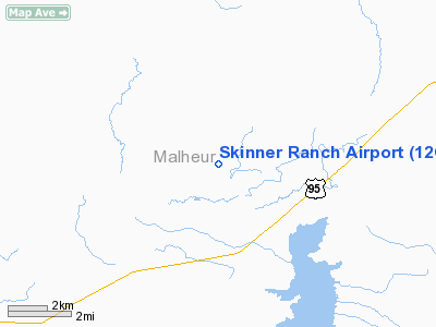
Location & QuickFacts
| FAA Information Effective: | 2008-09-25 |
| Airport Identifier: | 12OR |
| Airport Status: | Operational |
| Longitude/Latitude: | 117-16-55.5280W/42-57-04.5560N
-117.282091/42.951266 (Estimated) |
| Elevation: | 4273 ft / 1302.41 m (Surveyed) |
| Land: | 0 acres |
| From nearest city: | 10 nautical miles SW of Jordan Valley, OR |
| Location: | Malheur County, OR |
| Magnetic Variation: | 17E (1985) |
Owner & Manager
| Ownership: | Privately owned |
| Owner: | Skinner Ranches Inc |
| Address: | Box 216
Jordan Valley, OR 97910 |
| Phone number: | 503-586-2282 |
| Manager: | Robert M. Skinner |
| Address: | Box 216
Jordan Valley, OR 97910 |
| Phone number: | 503-586-2282 |
Airport Operations and Facilities
| Airport Use: | Private |
| Wind indicator: | Yes |
| Segmented Circle: | No |
| Control Tower: | No |
| Landing fee charge: | No |
| Sectional chart: | Klamath Falls |
| Region: | ANM - Northwest Mountain |
| Boundary ARTCC: | ZLC - Salt Lake City |
| Tie-in FSS: | MMV - Mc Minnville |
| FSS on Airport: | No |
| FSS Toll Free: | 1-800-WX-BRIEF |
Runway Information
Runway 06/24
| Dimension: | 2200 x 75 ft / 670.6 x 22.9 m |
| Surface: | DIRT, |
| |
Runway 06 |
Runway 24 |
| Traffic Pattern: | Left | Left |
|
Radio Navigation Aids
| ID |
Type |
Name |
Ch |
Freq |
Var |
Dist |
| REO | VORTAC | Rome | 072X | 112.50 | 19E | 33.7 nm |
Images and information placed above are from
http://www.airport-data.com/airport/12OR/
We thank them for the data!
| General Info
|
| Country |
United States
|
| State |
OREGON
|
| FAA ID |
12OR
|
| Latitude |
42-57-04.556N
|
| Longitude |
117-16-55.528W
|
| Elevation |
4273 feet
|
| Near City |
JORDAN VALLEY
|
We don't guarantee the information is fresh and accurate. The data may
be wrong or outdated.
For more up-to-date information please refer to other sources.
|
|


