|
|
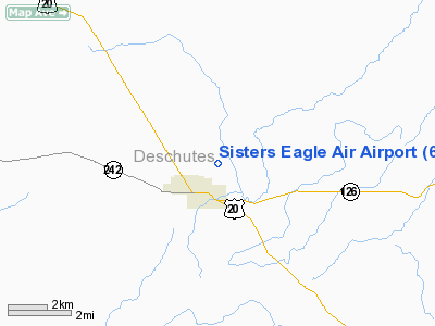
Sisters Eagle Air Airport |
| Sisters Eagle Air Airport |
 |
| IATA: none – ICAO: FAA: 6K5 |
| Summary |
| Airport type |
Public |
| Operator |
Sisters Eagle Air, Inc. |
| Location |
Sisters, Oregon |
| Elevation AMSL |
3168 ft / 966 m |
| Coordinates |
44°18′16.4160″N 121°32′21.1640″W / 44.30456°N 121.53921222°W / 44.30456; -121.53921222Coordinates: 44°18′16.4160″N 121°32′21.1640″W / 44.30456°N 121.53921222°W / 44.30456; -121.53921222 |
| Runways |
| Direction |
Length |
Surface |
| ft |
m |
| 2/20 |
3550 |
1082 |
Asphalt |
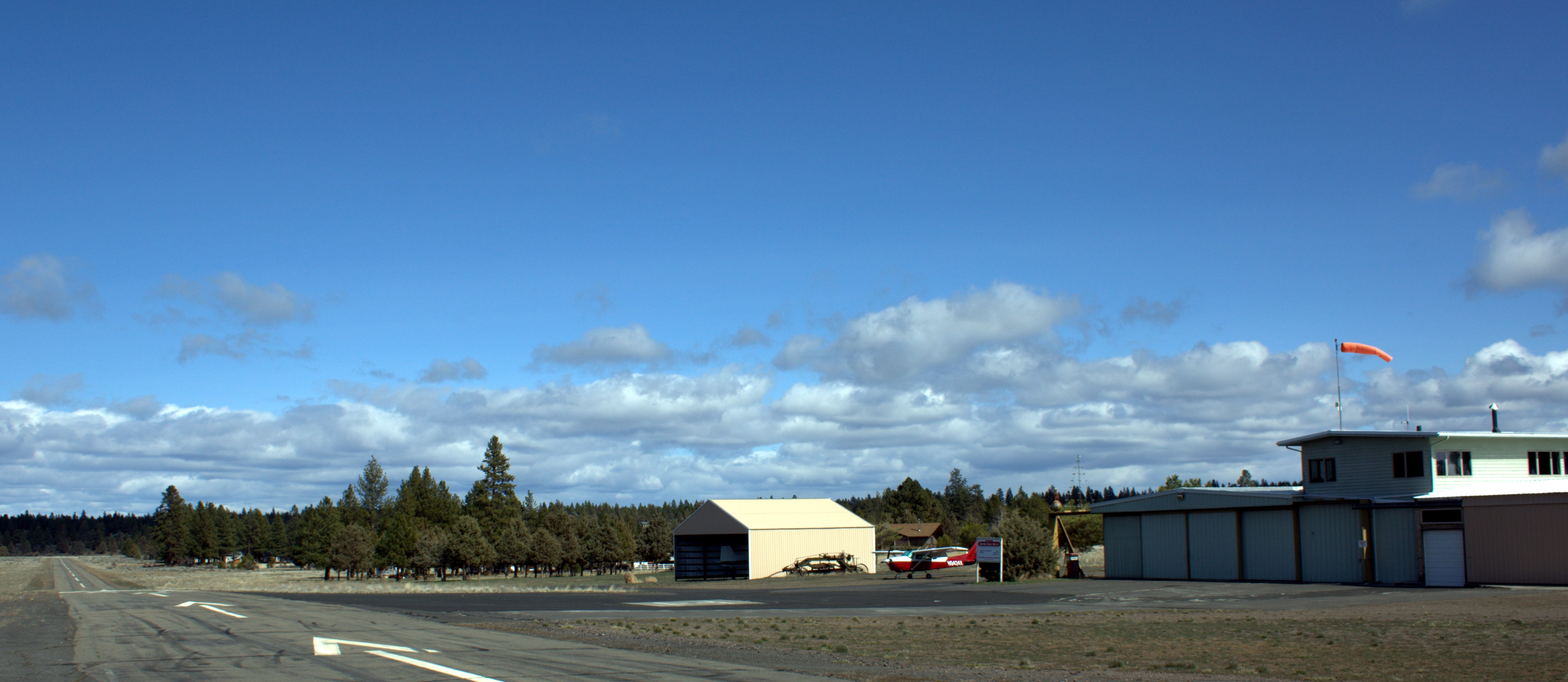
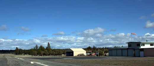
Sisters Eagle Air Airport (FAA LID: 6K5) is a public airport located one mile (1.6 km) north of Sisters in Deschutes County, Oregon, USA. There are some subdivisions with access to the airport. It is also used for wildfire aircraft support.
The above content comes from Wikipedia and is published under free licenses – click here to read more.
Location & QuickFacts
| FAA Information Effective: | 2008-09-25 |
| Airport Identifier: | 6K5 |
| Airport Status: | Operational |
| Longitude/Latitude: | 121-32-21.1640W/44-18-16.4160N
-121.539212/44.304560 (Estimated) |
| Elevation: | 3168 ft / 965.61 m (Estimated) |
| Land: | 20 acres |
| From nearest city: | 1 nautical miles N of Sisters, OR |
| Location: | Deschutes County, OR |
| Magnetic Variation: | 19E (1985) |
Owner & Manager
| Ownership: | Privately owned |
| Owner: | Sisters Eagle Air, Inc. |
| Address: | Po Box 507
Sisters, OR 97759 |
| Phone number: | 541-549-6011 |
| Manager: | David Clemens |
| Address: | Po Box 507
Sisters, OR 97759 |
| Phone number: | 541-549-6011 |
Airport Operations and Facilities
| Airport Use: | Open to public |
| Wind indicator: | Yes |
| Segmented Circle: | No |
| Control Tower: | No |
| Landing fee charge: | Yes |
| Sectional chart: | Klamath Falls |
| Region: | ANM - Northwest Mountain |
| Traffic Pattern Alt: | 1000 ft |
| Boundary ARTCC: | ZSE - Seattle |
| Tie-in FSS: | MMV - Mc Minnville |
| FSS on Airport: | No |
| FSS Toll Free: | 1-800-WX-BRIEF |
| NOTAMs Facility: | MMV (NOTAM-d service avaliable) |
Airport Communications
Airport Services
| Airframe Repair: | NONE |
| Power Plant Repair: | NONE |
| Bottled Oxygen: | NONE |
| Bulk Oxygen: | NONE |
Runway Information
Runway 02/20
| Dimension: | 3550 x 30 ft / 1082.0 x 9.1 m |
| Surface: | ASPH, Good Condition |
| Weight Limit: | Single wheel: 4000 lbs. |
| |
Runway 02 |
Runway 20 |
| Longitude: | 121-32-36.9000W | 121-32-04.6000W |
| Latitude: | 44-18-02.9000N | 44-18-29.2000N |
| Traffic Pattern: | Left | Left |
| Markings: | Nonstandard, Good Condition
02/20 NRS & CNTRLN SMALLER THAN STD. | Nonstandard, Good Condition
RWY 02 /20 NRS & CNTRLN SMALLER THAN STD. |
| Displaced threshold: | 340.00 ft | 0.00 ft |
| Obstruction: | 38 ft tree, 978.0 ft from runway, 50 ft right of centerline, 20:1 slope to clear
RWY 02 33:1 CLEARANCE TO DISPLACED THRESHOLD
+15 FT ROAD 50 FT FM RY END 25 FT L. | 80 ft trees, 630.0 ft from runway, 75 ft left of centerline, 5:1 slope to clear |
|
Radio Navigation Aids
| ID |
Type |
Name |
Ch |
Freq |
Var |
Dist |
| RD | NDB | Bodey | | 411.00 | 18E | 22.4 nm |
| DSD | VORTAC | Deschutes | 123X | 117.60 | 18E | 10.6 nm |
Remarks
- RISING TERRAIN OFF DEP END OF RY 02. CHECK DENSITY ALT/ACFT PERFORMANCE PRIOR TO TKOF. AVOID OVERFLIGHTS OF HOMES TO NE.
- DEER ON & INVOF ARPT.
- ESTABD PRIOR TO 1959.
Images and information placed above are from
http://www.airport-data.com/airport/6K5/
We thank them for the data!
| General Info
|
| Country |
United States
|
| State |
OREGON
|
| FAA ID |
6K5
|
| Latitude |
44-18-16.416N
|
| Longitude |
121-32-21.164W
|
| Elevation |
3168 feet
|
| Near City |
SISTERS
|
We don't guarantee the information is fresh and accurate. The data may
be wrong or outdated.
For more up-to-date information please refer to other sources.
|
|