 |
|
Silver Lake F S Strip Airport |
| Silver Lake Forest Service Strip |
| IATA: none – ICAO: none – FAA LID: 45S |
| Summary |
| Airport type |
Public |
| Operator |
US Forest Service |
| Location |
Silver Lake, Oregon |
| Elevation AMSL |
4492 ft / 1369 m |
| Coordinates |
43°06′39.5010″N 121°05′39.0000″W / 43.1109725°N 121.09417°W / 43.1109725; -121.09417Coordinates: 43°06′39.5010″N 121°05′39.0000″W / 43.1109725°N 121.09417°W / 43.1109725; -121.09417 |
| Runways |
| Direction |
Length |
Surface |
| ft |
m |
| 3/21 |
3000 |
914 |
Gravel/Dirt |
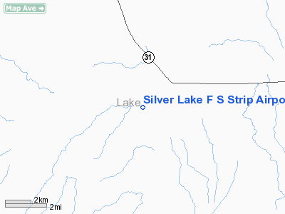
Silver Lake Forest Service Strip (FAA LID: 45S) is a public airport located three miles (4.8 km) southwest of Silver Lake in Lake County, Oregon, USA.
The above content comes from Wikipedia and is published under free licenses – click here to read more.
Location & QuickFacts
| FAA Information Effective: | 2008-09-25 |
| Airport Identifier: | 45S |
| Airport Status: | Operational |
| Longitude/Latitude: | 121-05-39.0000W/43-06-39.5010N
-121.094167/43.110972 (Estimated) |
| Elevation: | 4492 ft / 1369.16 m (Estimated) |
| Land: | 10 acres |
| From nearest city: | 3 nautical miles SW of Silver Lake, OR |
| Location: | Lake County, OR |
| Magnetic Variation: | 18E (1985) |
Owner & Manager
| Ownership: | Publicly owned |
| Owner: | U.s. Forest Service |
| Address: | Po Box 129
Silver Lake, OR 97638 |
| Phone number: | 541-576-2107 |
| Manager: | Mike Haddock |
| Address: | Us Forest Serv/po Box 129
Silver Lake, OR 97638 |
| Phone number: | 541-576-7520 |
Airport Operations and Facilities
| Airport Use: | Open to public |
| Wind indicator: | No |
| Segmented Circle: | Yes
MARKED WITH WHITE TIRES. |
| Control Tower: | No |
| Landing fee charge: | No |
| Sectional chart: | Klamath Falls |
| Region: | ANM - Northwest Mountain |
| Boundary ARTCC: | ZSE - Seattle |
| Tie-in FSS: | MMV - Mc Minnville |
| FSS on Airport: | No |
| FSS Toll Free: | 1-800-WX-BRIEF |
| NOTAMs Facility: | MMV (NOTAM-d service avaliable) |
Airport Communications
Airport Services
| Airframe Repair: | NONE |
| Power Plant Repair: | NONE |
| Bottled Oxygen: | NONE |
| Bulk Oxygen: | NONE |
Runway Information
Runway 03/21
| Dimension: | 3000 x 55 ft / 914.4 x 16.8 m |
| Surface: | GRVL-DIRT, Fair Condition
RY 03/21 WEED GROWTH & SAGE THROUGHOUT PRIMARY SFC. |
| |
Runway 03 |
Runway 21 |
| Elevation: | 4492.00 ft | 0.00 ft |
| Traffic Pattern: | Left | Left |
| Obstruction: | 4 ft fence, 100.0 ft from runway, 25:1 slope to clear | 4 ft fence, 120.0 ft from runway, 30:1 slope to clear |
|
Radio Navigation Aids
| ID |
Type |
Name |
Ch |
Freq |
Var |
Dist |
| LKV | VORTAC | Lakeview | 57X | 112.00 | 19E | 45.3 nm |
Remarks
- RY SOFT WHEN WET, CALL 541-576-7520 FOR CURRENT CONDITION.
- ESTBD PRIOR TO 15 MAY 1959.
Images and information placed above are from
http://www.airport-data.com/airport/45S/
We thank them for the data!
| General Info
|
| Country |
United States
|
| State |
OREGON
|
| FAA ID |
45S
|
| Latitude |
43-06-39.501N
|
| Longitude |
121-05-39.000W
|
| Elevation |
4492 feet
|
| Near City |
SILVER LAKE
|
We don't guarantee the information is fresh and accurate. The data may
be wrong or outdated.
For more up-to-date information please refer to other sources.
|
|


