 |
|
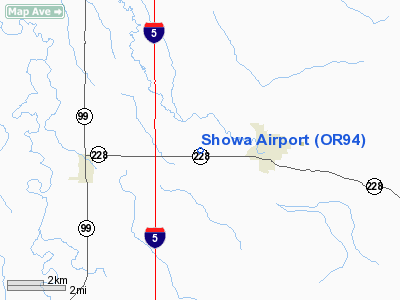
Location & QuickFacts
| FAA Information Effective: | 2008-09-25 |
| Airport Identifier: | OR94 |
| Airport Status: | Operational |
| Longitude/Latitude: | 123-01-46.3220W/44-23-30.0000N
-123.029534/44.391667 (Estimated) |
| Elevation: | 298 ft / 90.83 m (Estimated) |
| Land: | 0 acres |
| From nearest city: | 2 nautical miles W of Brownsville, OR |
| Location: | Linn County, OR |
| Magnetic Variation: | 18E (1990) |
Owner & Manager
| Ownership: | Privately owned |
| Owner: | Glen A Showalter |
| Address: | 33779 Hwy 228
Halsey, OR 97348 |
| Phone number: | 503-466-5911 |
| Address: |
|
Airport Operations and Facilities
| Airport Use: | Private |
| Segmented Circle: | No |
| Control Tower: | No |
| Sectional chart: | Seattle |
| Region: | ANM - Northwest Mountain |
| Boundary ARTCC: | ZSE - Seattle |
| Tie-in FSS: | MMV - Mc Minnville |
| FSS on Airport: | No |
| FSS Toll Free: | 1-800-WX-BRIEF |
Runway Information
Runway 01/19
| Dimension: | 2050 x 35 ft / 624.8 x 10.7 m |
| Surface: | TURF, |
| |
Runway 01 |
Runway 19 |
| Traffic Pattern: | Left | Left |
| Obstruction: | 40 ft pline, 100.0 ft from runway | 75 ft trees, 100.0 ft from runway |
|
Radio Navigation Aids
| ID |
Type |
Name |
Ch |
Freq |
Var |
Dist |
| EU | NDB | Frakk | | 260.00 | 19E | 13.5 nm |
| LWG | NDB | Lewisburg | | 225.00 | 18E | 16.9 nm |
| CVO | VOR/DME | Corvallis | 101X | 115.40 | 18E | 13.1 nm |
| EUG | VORTAC | Eugene | 076X | 112.90 | 20E | 18.3 nm |
| ONP | VORTAC | Newport | 118X | 117.10 | 19E | 45.6 nm |
Images and information placed above are from
http://www.airport-data.com/airport/OR94/
We thank them for the data!
| General Info
|
| Country |
United States
|
| State |
OREGON
|
| FAA ID |
OR94
|
| Latitude |
44-23-30.000N
|
| Longitude |
123-01-46.322W
|
| Elevation |
298 feet
|
| Near City |
BROWNSVILLE
|
We don't guarantee the information is fresh and accurate. The data may
be wrong or outdated.
For more up-to-date information please refer to other sources.
|
|


