 |
|
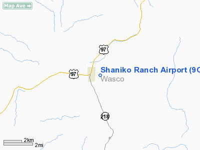
Location & QuickFacts
| FAA Information Effective: | 2008-09-25 |
| Airport Identifier: | 9OR1 |
| Airport Status: | Operational |
| Longitude/Latitude: | 120-44-23.1570W/45-00-10.4510N
-120.739766/45.002903 (Estimated) |
| Elevation: | 3300 ft / 1005.84 m (Estimated) |
| Land: | 10 acres |
| From nearest city: | 0 nautical miles N of Shaniko, OR |
| Location: | Wasco County, OR |
| Magnetic Variation: | 18E (1990) |
Owner & Manager
| Ownership: | Privately owned |
| Owner: | Don Whitaker |
| Address: | P.o. Box 40
Roseburg, OR 97470 |
| Phone number: | 503-459-4602 |
| Manager: | Don Whitaker |
| Address: | P.o. Box 40
Roseburg, OR 97470 |
| Phone number: | 503-673-0419 |
Airport Operations and Facilities
| Airport Use: | Private |
| Wind indicator: | Yes |
| Segmented Circle: | No |
| Control Tower: | No |
| Sectional chart: | Seattle |
| Region: | ANM - Northwest Mountain |
| Boundary ARTCC: | ZSE - Seattle |
| Tie-in FSS: | MMV - Mc Minnville |
| FSS on Airport: | No |
| FSS Toll Free: | 1-800-WX-BRIEF |
Runway Information
Runway 11/29
| Dimension: | 3100 x 80 ft / 944.9 x 24.4 m |
| Surface: | TURF, |
| |
Runway 11 |
Runway 29 |
| Traffic Pattern: | Left | Left |
|
Radio Navigation Aids
| ID |
Type |
Name |
Ch |
Freq |
Var |
Dist |
| RD | NDB | Bodey | | 411.00 | 18E | 43.4 nm |
| LTJ | VOR/DME | Klickitat | 070X | 112.30 | 21E | 45.4 nm |
| IMB | VORTAC | Kimberly | 103X | 115.60 | 20E | 48.7 nm |
Images and information placed above are from
http://www.airport-data.com/airport/9OR1/
We thank them for the data!
| General Info
|
| Country |
United States
|
| State |
OREGON
|
| FAA ID |
9OR1
|
| Latitude |
45-00-10.451N
|
| Longitude |
120-44-23.157W
|
| Elevation |
3300 feet
|
| Near City |
SHANIKO
|
We don't guarantee the information is fresh and accurate. The data may
be wrong or outdated.
For more up-to-date information please refer to other sources.
|
|


