 |
|
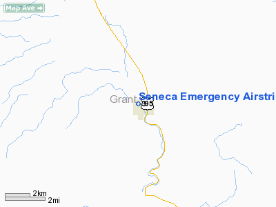
Seneca Emergency Airstrip Airport |
Location & QuickFacts
| FAA Information Effective: | 2008-09-25 |
| Airport Identifier: | OR98 |
| Airport Status: | Operational |
| Longitude/Latitude: | 118-58-53.8120W/44-08-17.5520N
-118.981614/44.138209 (Estimated) |
| Elevation: | 4666 ft / 1422.20 m (Estimated) |
| Land: | 0 acres |
| From nearest city: | 1 nautical miles W of Seneca, OR |
| Location: | Grant County, OR |
| Magnetic Variation: | 18E (1985) |
Owner & Manager
| Ownership: | Privately owned |
| Owner: | City Of Seneca |
| Address: | P.o. Box 208
Seneca, OR 97873 |
| Phone number: | 503-542-2161 |
| Manager: | Reba Duncan |
| Address: | Shirttail Creek Road
Seneca, OR 97873 |
| Phone number: | 503-542-2001 |
Airport Operations and Facilities
| Airport Use: | Private |
| Wind indicator: | Yes |
| Segmented Circle: | No |
| Control Tower: | No |
| Sectional chart: | Klamath Falls |
| Region: | ANM - Northwest Mountain |
| Boundary ARTCC: | ZSE - Seattle |
| Tie-in FSS: | MMV - Mc Minnville |
| FSS Toll Free: | 1-800-WX-BRIEF |
Runway Information
Runway 12/30
| Dimension: | 2250 x 50 ft / 685.8 x 15.2 m |
| Surface: | GRAVEL, |
| |
Runway 12 |
Runway 30 |
| Traffic Pattern: | Left | Left |
| Obstruction: | | 50 ft pline, 1000.0 ft from runway |
|
Radio Navigation Aids
| ID |
Type |
Name |
Ch |
Freq |
Var |
Dist |
| ILR | VOR/DME | Wildhorse | 085X | 113.80 | 18E | 32.8 nm |
| IMB | VORTAC | Kimberly | 103X | 115.60 | 20E | 43.9 nm |
Images and information placed above are from
http://www.airport-data.com/airport/OR98/
We thank them for the data!
| General Info
|
| Country |
United States
|
| State |
OREGON
|
| FAA ID |
OR98
|
| Latitude |
44-08-17.552N
|
| Longitude |
118-58-53.812W
|
| Elevation |
4666 feet
|
| Near City |
SENECA
|
We don't guarantee the information is fresh and accurate. The data may
be wrong or outdated.
For more up-to-date information please refer to other sources.
|
|


