 |
|
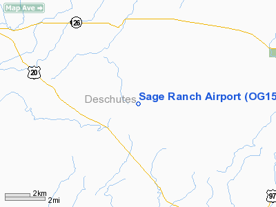
Location & QuickFacts
| FAA Information Effective: | 2008-09-25 |
| Airport Identifier: | OG15 |
| Airport Status: | Operational |
| Longitude/Latitude: | 121-23-28.1000W/44-13-59.4000N
-121.391139/44.233167 (Estimated) |
| Elevation: | 3170 ft / 966.22 m (Estimated) |
| Land: | 120 acres |
| From nearest city: | 7 nautical miles SE of Sisters, OR |
| Location: | Deschutes County, OR |
| Magnetic Variation: | 18E (1995) |
Owner & Manager
| Ownership: | Privately owned |
| Owner: | Rm & M Graves |
| Address: | 67200 Sage Ranch Road
Bend, OR 97701 |
| Phone number: | 503-383-0421 |
| Manager: | Rm Graves |
| Address: | 67200 Sage Ranch Road
Bend, OR 97701 |
| Phone number: | 502-383-0421 |
Airport Operations and Facilities
| Airport Use: | Private |
| Wind indicator: | Yes |
| Segmented Circle: | No |
| Control Tower: | No |
| Sectional chart: | Klamath Falls |
| Region: | ANM - Northwest Mountain |
| Boundary ARTCC: | ZSE - Seattle |
| Tie-in FSS: | MMV - Mc Minnville |
| FSS on Airport: | No |
| FSS Toll Free: | 1-800-WX-BRIEF |
Runway Information
Runway 14/32
| Dimension: | 2400 x 70 ft / 731.5 x 21.3 m |
| Surface: | DIRT, |
| |
Runway 14 |
Runway 32 |
| Traffic Pattern: | Left | Left |
| Obstruction: | 85 ft trees, 1600.0 ft from runway | 70 ft trees, 1300.0 ft from runway |
|
Radio Navigation Aids
| ID |
Type |
Name |
Ch |
Freq |
Var |
Dist |
| RD | NDB | Bodey | | 411.00 | 18E | 16.6 nm |
| DSD | VORTAC | Deschutes | 123X | 117.60 | 18E | 4.0 nm |
Images and information placed above are from
http://www.airport-data.com/airport/OG15/
We thank them for the data!
| General Info
|
| Country |
United States
|
| State |
OREGON
|
| FAA ID |
OG15
|
| Latitude |
44-13-59.400N
|
| Longitude |
121-23-28.100W
|
| Elevation |
3170 feet
|
| Near City |
SISTERS
|
We don't guarantee the information is fresh and accurate. The data may
be wrong or outdated.
For more up-to-date information please refer to other sources.
|
|


