 |
|
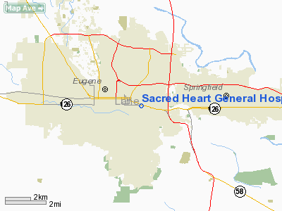
Sacred Heart General Hospital Heliport |
Location & QuickFacts
| FAA Information Effective: | 2008-09-25 |
| Airport Identifier: | OR69 |
| Airport Status: | Operational |
| Longitude/Latitude: | 123-04-34.3110W/44-02-49.4490N
-123.076197/44.047069 (Estimated) |
| Elevation: | 498 ft / 151.79 m (Estimated) |
| Land: | 0 acres |
| From nearest city: | 9 nautical miles NW of Eugene, OR |
| Location: | Lane County, OR |
| Magnetic Variation: | 19E (1985) |
Owner & Manager
| Ownership: | Privately owned |
| Owner: | Sacred Heart General Hospital |
| Address: | P.o. Box 10905
Eugene, OR 97440 |
| Phone number: | 503-686-6865 |
| Manager: | Paul Reed |
| Address: | P.o. Box 10905
Eugene, OR 97440 |
| Phone number: | 503-686-6865 |
Airport Operations and Facilities
| Airport Use: | Private
MEDICAL USE. |
| Wind indicator: | Yes |
| Segmented Circle: | No |
| Control Tower: | No |
| Landing fee charge: | No |
| Sectional chart: | Klamath Falls |
| Region: | ANM - Northwest Mountain |
| Boundary ARTCC: | ZSE - Seattle |
| Tie-in FSS: | MMV - Mc Minnville |
| FSS on Airport: | No |
| FSS Toll Free: | 1-800-WX-BRIEF |
Airport Services
| Airframe Repair: | NONE |
| Power Plant Repair: | NONE |
Runway Information
Helipad H1
| Dimension: | 53 x 53 ft / 16.2 x 16.2 m |
| Surface: | CONC,
ROOFTOP, LOAD LIMIT: 12000 LBS STATIC, 18000 LBS IMPACT. |
| |
Runway H1 |
Runway |
| Elevation: | 462.00 ft | 0.00 ft |
| Traffic Pattern: | Left | Left |
|
Radio Navigation Aids
| ID |
Type |
Name |
Ch |
Freq |
Var |
Dist |
| EU | NDB | Frakk | | 260.00 | 19E | 11.7 nm |
| LWG | NDB | Lewisburg | | 225.00 | 18E | 35.1 nm |
| CVO | VOR/DME | Corvallis | 101X | 115.40 | 18E | 28.8 nm |
| EUG | VORTAC | Eugene | 076X | 112.90 | 20E | 7.7 nm |
Remarks
- RWY H1 26' BLDG NEAR LDG PAD
Images and information placed above are from
http://www.airport-data.com/airport/OR69/
We thank them for the data!
| General Info
|
| Country |
United States
|
| State |
OREGON
|
| FAA ID |
OR69
|
| Latitude |
44-02-49.449N
|
| Longitude |
123-04-34.311W
|
| Elevation |
498 feet
|
| Near City |
EUGENE
|
We don't guarantee the information is fresh and accurate. The data may
be wrong or outdated.
For more up-to-date information please refer to other sources.
|
|


