 |
|
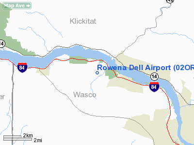
Location & QuickFacts
| FAA Information Effective: | 2008-09-25 |
| Airport Identifier: | 02OR |
| Airport Status: | Operational |
| Longitude/Latitude: | 121-18-59.2610W/45-40-53.4320N
-121.316461/45.681509 (Estimated) |
| Elevation: | 705 ft / 214.88 m (Estimated) |
| Land: | 0 acres |
| From nearest city: | 10 nautical miles W of The Dalles, OR |
| Location: | Wasco County, OR |
| Magnetic Variation: | 19E (1985) |
Owner & Manager
| Ownership: | Privately owned |
| Owner: | Rowena Dell Joint Venture |
| Address: | 1096 Canyon Way W.
The Dalles, OR 97058 |
| Manager: | Karl A. Johnson |
| Address: | 1096 Canyon Way W.
The Dalles, OR 97058 |
| Phone number: | 503-478-3526 |
Airport Operations and Facilities
| Airport Use: | Private |
| Wind indicator: | No |
| Segmented Circle: | No |
| Control Tower: | No |
| Landing fee charge: | No |
| Sectional chart: | Seattle |
| Region: | ANM - Northwest Mountain |
| Boundary ARTCC: | ZSE - Seattle |
| Tie-in FSS: | MMV - Mc Minnville |
| FSS on Airport: | No |
| FSS Toll Free: | 1-800-WX-BRIEF |
Runway Information
Runway E/W
| Dimension: | 2000 x 30 ft / 609.6 x 9.1 m |
| Surface: | TURF, |
| |
Runway E |
Runway W |
| Traffic Pattern: | Left | Left |
|
Radio Navigation Aids
| ID |
Type |
Name |
Ch |
Freq |
Var |
Dist |
| LBH | NDB | Laker | | 332.00 | 20E | 48.9 nm |
| LTJ | VOR/DME | Klickitat | 070X | 112.30 | 21E | 9.3 nm |
Images and information placed above are from
http://www.airport-data.com/airport/02OR/
We thank them for the data!
| General Info
|
| Country |
United States
|
| State |
OREGON
|
| FAA ID |
02OR
|
| Latitude |
45-40-53.432N
|
| Longitude |
121-18-59.261W
|
| Elevation |
705 feet
|
| Near City |
THE DALLES
|
We don't guarantee the information is fresh and accurate. The data may
be wrong or outdated.
For more up-to-date information please refer to other sources.
|
|


