 |
|
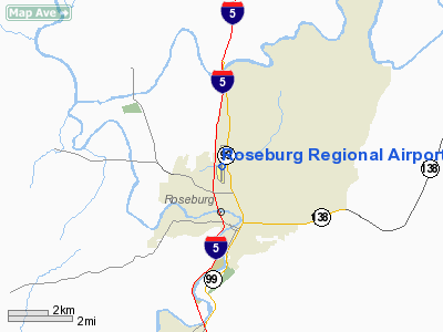
Roseburg Regional Airport
Marion E. Carl Memorial Field |
| IATA: RBG – ICAO: KRBG – FAA LID: RBG |
| Summary |
| Airport type |
Public |
| Owner |
City of Roseburg |
| Serves |
Roseburg, Oregon |
| Elevation AMSL |
529 ft / 161 m |
| Coordinates |
43°14′20″N 123°21′21″W / 43.23889°N 123.35583°W / 43.23889; -123.35583 |
| Website |
cityofroseburg.org/... |
| Runways |
| Direction |
Length |
Surface |
| ft |
m |
| 16/34 |
4,602 |
1,403 |
Asphalt |
| Statistics (2008) |
| Aircraft operations |
31,750 |
| Based aircraft |
94 |
| Sources: Airport website and FAA |
Roseburg Regional Airport (IATA: RBG, ICAO: KRBG, FAA LID: RBG) is a city-owned, public-use airport located one nautical mile (1.85 km) northwest of the central business district of Roseburg, a city in Douglas County, Oregon, United States. It is also known as Major General Marion E. Carl Memorial Field, named after Marion Eugene Carl (1915–1998).
Facilities and aircraft
Roseburg Regional Airport covers an area of 196 acres (79 ha) at an elevation of 529 feet (161 m) above mean sea level. It has one runway designated 16/34 with an asphalt surface measuring 4,602 by 100 feet (1,403 x 30 m).
For the 12-month period ending August 26, 2008, the airport had 31,750 aircraft operations, an average of 86 per day: 92% general aviation, 8% air taxi, and <1% military. At that time there were 94 aircraft based at this airport: 84% single-engine, 11% multi-engine, 2% jet and 3% helicopter.
The above content comes from Wikipedia and is published under free licenses – click here to read more.
Location & QuickFacts
| FAA Information Effective: | 2008-09-25 |
| Airport Identifier: | RBG |
| Airport Status: | Operational |
| Longitude/Latitude: | 123-21-21.1000W/43-14-19.6000N
-123.355861/43.238778 (Estimated) |
| Elevation: | 529 ft / 161.24 m (Surveyed) |
| Land: | 196 acres |
| From nearest city: | 1 nautical miles NW of Roseburg, OR |
| Location: | Douglas County, OR |
| Magnetic Variation: | 18E (1985) |
Owner & Manager
| Ownership: | Publicly owned |
| Owner: | City Of Roseburg |
| Address: | City Hall
Roseburg, OR 97470 |
| Phone number: | 541-672-7701 |
| Manager: | Clay Baumgartner |
| Address: | 900 Se Douglas
Roseburg, OR 97470 |
| Phone number: | 541-672-7701 |
Airport Operations and Facilities
| Airport Use: | Open to public |
| Wind indicator: | Yes |
| Segmented Circle: | Yes |
| Control Tower: | No |
| Lighting Schedule: | DUSK-DAWN
ACTVT REIL RY 16 & RY 34 - CTAF. |
| Beacon Color: | Clear-Green (lighted land airport) |
| Landing fee charge: | No |
| Sectional chart: | Klamath Falls |
| Region: | ANM - Northwest Mountain |
| Boundary ARTCC: | ZSE - Seattle |
| Tie-in FSS: | MMV - Mc Minnville |
| FSS on Airport: | No |
| FSS Toll Free: | 1-800-WX-BRIEF |
| NOTAMs Facility: | RBG (NOTAM-d service avaliable) |
| Federal Agreements: | NGY |
Airport Communications
| CTAF: | 122.800 |
| Unicom: | 122.800 |
Airport Services
| Fuel available: | 100LLA |
| Airframe Repair: | MAJOR |
| Power Plant Repair: | MAJOR |
| Bulk Oxygen: | HIGH |
Runway Information
Runway 16/34
| Dimension: | 4602 x 100 ft / 1402.7 x 30.5 m |
| Surface: | ASPH, Good Condition |
| Weight Limit: | Single wheel: 42000 lbs.
Dual wheel: 54000 lbs.
Dual tandem wheel: 88000 lbs. |
| Edge Lights: | Medium |
| |
Runway 16 |
Runway 34 |
| Longitude: | 123-21-21.1010W | 123-21-21.0310W |
| Latitude: | 43-14-42.3510N | 43-13-56.9000N |
| Elevation: | 528.00 ft | 501.00 ft |
| Alignment: | 127 | 127 |
| Traffic Pattern: | Left | Left |
| Markings: | Non-precision instrument, Good Condition | Non-precision instrument, Good Condition |
| Crossing Height: | 0.00 ft | 53.00 ft |
| Displaced threshold: | 700.00 ft | 371.00 ft |
| VASI: | | 2-box on left side |
| Visual Glide Angle: | 0.00° | 3.00° |
| Runway End Identifier: | Yes | Yes
REIL RY 34 OTS INDEFLY. |
| Obstruction: | 8 ft fence, 305.0 ft from runway, 13:1 slope to clear
+374 FT LIGHTED POLE ON HILL AT 5500 FT ON CNTRLN; 14:1 BASED ON DSPLCD THLD. | 15 ft tree, 720.0 ft from runway, 110 ft right of centerline, 34:1 slope to clear
+65 FT TREE AT 1100 FT 250 FT L; 16:1 BASED ON DSPLCD THLD. |
|
Radio Navigation Aids
| ID |
Type |
Name |
Ch |
Freq |
Var |
Dist |
| RBG | NDB | Roseburg | | 400.00 | 20E | 0.2 nm |
| RBG | VOR/DME | Roseburg | 019X | 108.20 | 20E | 3.4 nm |
| OTH | VORTAC | North Bend | 058X | 112.10 | 18E | 37.1 nm |
| OED | VORTAC | Rogue Valley | 083X | 113.60 | 19E | 49.6 nm |
Remarks
- MIGRATORY FLOCKS OF WATERFOWL ON & INVOF ARPT.
- +700 TO 1200 FT TERRAIN WITHIN 2 MILES SURROUNDING ARPT.
Images and information placed above are from
http://www.airport-data.com/airport/RBG/
We thank them for the data!
| General Info
|
| Country |
United States
|
| State |
OREGON
|
| FAA ID |
RBG
|
| Latitude |
43-14-19.619N
|
| Longitude |
123-21-21.102W
|
| Elevation |
529 feet
|
| Near City |
ROSEBURG
|
We don't guarantee the information is fresh and accurate. The data may
be wrong or outdated.
For more up-to-date information please refer to other sources.
|
|


