 |
|
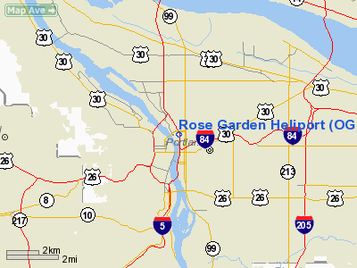
Location & QuickFacts
| FAA Information Effective: | 2008-09-25 |
| Airport Identifier: | OG11 |
| Airport Status: | Operational |
| Longitude/Latitude: | 122-39-58.0000W/45-31-58.0000N
-122.666111/45.532778 (Estimated) |
| Elevation: | 138 ft / 42.06 m (Estimated) |
| Land: | 0 acres |
| From nearest city: | 0 nautical miles NE of Portland, OR |
| Location: | Multnomah County, OR |
| Magnetic Variation: | 19E (1995) |
Owner & Manager
| Ownership: | Privately owned |
| Owner: | Oregon Arena Corp |
| Address: | 1 Center Court Suite 200
Portland, OR 97204 |
| Phone number: | 503-234-9291 |
| Manager: | Dave Hathaway-or Arena Corp |
| Address: | 1 Center Court Suire 200
Portland, OR 97204 |
| Phone number: | 503-234-9291 |
Airport Operations and Facilities
| Airport Use: | Private |
| Wind indicator: | Yes |
| Segmented Circle: | No |
| Control Tower: | No |
| Landing fee charge: | No |
| Sectional chart: | Seattle |
| Region: | ANM - Northwest Mountain |
| Boundary ARTCC: | ZSE - Seattle |
| Tie-in FSS: | MMV - Mc Minnville |
| FSS on Airport: | No |
| FSS Toll Free: | 1-800-WX-BRIEF |
Airport Communications
Runway Information
Helipad H1
| Dimension: | 40 x 40 ft / 12.2 x 12.2 m |
| Surface: | CONC, |
| |
Runway H1 |
Runway |
| Traffic Pattern: | Left | Left |
|
Radio Navigation Aids
| ID |
Type |
Name |
Ch |
Freq |
Var |
Dist |
| LBH | NDB | Laker | | 332.00 | 20E | 8.6 nm |
| PND | NDB | Banks | | 356.00 | 21E | 17.0 nm |
| LSO | NDB | Kelso | | 256.00 | 21E | 38.8 nm |
| CBU | TACAN | Columbia | 029X | | 20E | 4.1 nm |
| PDX | VOR/DME | Portland | 055X | 111.80 | 20E | 4.4 nm |
| UBG | VOR/DME | Newberg | 121X | 117.40 | 21E | 17.0 nm |
| BTG | VORTAC | Battle Ground | 113X | 116.60 | 21E | 13.3 nm |
| PDX | VOT | Portland Intl | | 111.00 | | 4.8 nm |
| HIO | VOT | Portland-hillsboro | | 115.20 | | 11.9 nm |
Remarks
- OBSTRUCTION LIGHTS ARE ON OBSTRUCTIONS AROUND LANDING AREA.
- PRVDD PORTLAND ATCT CONTACTED FOR OPNS INVOF PORTLAND.
Images and information placed above are from
http://www.airport-data.com/airport/OG11/
We thank them for the data!
| General Info
|
| Country |
United States
|
| State |
OREGON
|
| FAA ID |
OG11
|
| Latitude |
45-31-58.000N
|
| Longitude |
122-39-58.000W
|
| Elevation |
138 feet
|
| Near City |
PORTLAND
|
We don't guarantee the information is fresh and accurate. The data may
be wrong or outdated.
For more up-to-date information please refer to other sources.
|
|


