 |
|
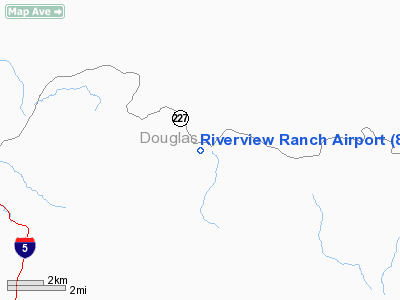
Location & QuickFacts
| FAA Information Effective: | 2008-09-25 |
| Airport Identifier: | 8OR3 |
| Airport Status: | Operational |
| Longitude/Latitude: | 123-07-17.2130W/42-56-01.4300N
-123.121448/42.933731 (Estimated) |
| Elevation: | 840 ft / 256.03 m (Estimated) |
| Land: | 0 acres |
| From nearest city: | 3 nautical miles SE of Days Creek, OR |
| Location: | Douglas County, OR |
| Magnetic Variation: | 18E (1985) |
Owner & Manager
| Ownership: | Privately owned |
| Owner: | A C Miller |
| Address: | 16035 Tiller Trail Hwy
Days Creek, OR 97429 |
| Phone number: | 503-825-3448 |
| Address: |
|
Airport Operations and Facilities
| Airport Use: | Private |
| Wind indicator: | Yes |
| Segmented Circle: | No |
| Control Tower: | No |
| Landing fee charge: | No |
| Sectional chart: | Klamath Falls |
| Region: | ANM - Northwest Mountain |
| Boundary ARTCC: | ZSE - Seattle |
| Tie-in FSS: | MMV - Mc Minnville |
| FSS on Airport: | No |
| FSS Toll Free: | 1-800-WX-BRIEF |
Runway Information
Runway 09/27
| Dimension: | 1800 x 60 ft / 548.6 x 18.3 m |
| Surface: | TURF, |
| |
Runway 09 |
Runway 27 |
| Traffic Pattern: | Left | Left |
|
Radio Navigation Aids
| ID |
Type |
Name |
Ch |
Freq |
Var |
Dist |
| RBG | NDB | Roseburg | | 400.00 | 20E | 20.9 nm |
| MEF | NDB | Medford | | 356.00 | 19E | 34.3 nm |
| RBG | VOR/DME | Roseburg | 019X | 108.20 | 20E | 18.1 nm |
| OED | VORTAC | Rogue Valley | 083X | 113.60 | 19E | 28.8 nm |
| MFR | VOT | Medford-jackson County | | 117.20 | | 36.4 nm |
Remarks
- FILED FOR RECORD PURPOSES.
Images and information placed above are from
http://www.airport-data.com/airport/8OR3/
We thank them for the data!
| General Info
|
| Country |
United States
|
| State |
OREGON
|
| FAA ID |
8OR3
|
| Latitude |
42-56-01.430N
|
| Longitude |
123-07-17.213W
|
| Elevation |
840 feet
|
| Near City |
DAYS CREEK
|
We don't guarantee the information is fresh and accurate. The data may
be wrong or outdated.
For more up-to-date information please refer to other sources.
|
|


