 |
|
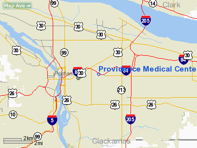
Providence Medical Center Heliport |
Location & QuickFacts
| FAA Information Effective: | 2008-09-25 |
| Airport Identifier: | 34OR |
| Airport Status: | Operational |
| Longitude/Latitude: | 122-36-43.5300W/45-31-40.8500N
-122.612092/45.528014 (Estimated) |
| Elevation: | 234 ft / 71.32 m (Estimated) |
| Land: | 0 acres |
| From nearest city: | 4 nautical miles E of Portland, OR |
| Location: | Multnomah County, OR |
| Magnetic Variation: | 19E (1985) |
Owner & Manager
| Ownership: | Privately owned |
| Owner: | Providence Medical Center |
| Address: | 4805 N E Glisan
Portland, OR 97213 |
| Phone number: | 503-230-6548 |
| Manager: | Harry B. Daniels |
| Address: | 4805 N E Glisan
Portland, OR 97213 |
| Phone number: | 503-230-6106 |
Airport Operations and Facilities
| Airport Use: | Private
MEDICAL USE. |
| Wind indicator: | Yes |
| Segmented Circle: | Yes |
| Control Tower: | No |
| Lighting Schedule: | PHONE REQ
FOR PERIMETER LGTS PHONE 503-230-6548 |
| Landing fee charge: | No |
| Sectional chart: | Seattle |
| Region: | ANM - Northwest Mountain |
| Boundary ARTCC: | ZSE - Seattle |
| Tie-in FSS: | MMV - Mc Minnville |
| FSS Toll Free: | 1-800-WX-BRIEF |
Runway Information
Helipad H1
| Dimension: | 106 x 106 ft / 32.3 x 32.3 m |
| Surface: | CONC, |
| |
Runway H1 |
Runway |
| Traffic Pattern: | Left | Left |
|
Radio Navigation Aids
| ID |
Type |
Name |
Ch |
Freq |
Var |
Dist |
| LBH | NDB | Laker | | 332.00 | 20E | 6.4 nm |
| PND | NDB | Banks | | 356.00 | 21E | 19.3 nm |
| LSO | NDB | Kelso | | 256.00 | 21E | 39.8 nm |
| CBU | TACAN | Columbia | 029X | | 20E | 3.6 nm |
| PDX | VOR/DME | Portland | 055X | 111.80 | 20E | 4.0 nm |
| UBG | VOR/DME | Newberg | 121X | 117.40 | 21E | 18.7 nm |
| BTG | VORTAC | Battle Ground | 113X | 116.60 | 21E | 13.2 nm |
| PDX | VOT | Portland Intl | | 111.00 | | 4.2 nm |
| HIO | VOT | Portland-hillsboro | | 115.20 | | 14.2 nm |
Images and information placed above are from
http://www.airport-data.com/airport/34OR/
We thank them for the data!
| General Info
|
| Country |
United States
|
| State |
OREGON
|
| FAA ID |
34OR
|
| Latitude |
45-31-41.427N
|
| Longitude |
122-36-43.338W
|
| Elevation |
170 feet
|
| Near City |
PORTLAND
|
We don't guarantee the information is fresh and accurate. The data may
be wrong or outdated.
For more up-to-date information please refer to other sources.
|
|


