 |
|
| Powers Airport |
| IATA: none – ICAO: none – FAA LID: 6S6 |
| Summary |
| Airport type |
Public |
| Operator |
Port of Coquille River |
| Location |
Powers, Oregon |
| Elevation AMSL |
326 ft / 18 m |
| Coordinates |
42°52′10.3960″N 124°03′33.3450″W / 42.86955444°N 124.0592625°W / 42.86955444; -124.0592625Coordinates: 42°52′10.3960″N 124°03′33.3450″W / 42.86955444°N 124.0592625°W / 42.86955444; -124.0592625 |
| Runways |
| Direction |
Length |
Surface |
| ft |
m |
| 13/31 |
2500 |
762 |
Turf |
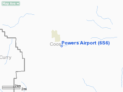
Powers Airport (FAA LID: 6S6), is a public airport located 1 mile (1.6 km) southwest of Powers, in Coos County, Oregon, USA.
The above content comes from Wikipedia and is published under free licenses – click here to read more.
Location & QuickFacts
| FAA Information Effective: | 2008-09-25 |
| Airport Identifier: | 6S6 |
| Airport Status: | Operational |
| Longitude/Latitude: | 124-03-33.3450W/42-52-10.3960N
-124.059262/42.869554 (Estimated) |
| Elevation: | 326 ft / 99.36 m (Estimated) |
| Land: | 77 acres |
| From nearest city: | 1 nautical miles SE of Powers, OR |
| Location: | Coos County, OR |
| Magnetic Variation: | 18E (1985) |
Owner & Manager
| Ownership: | Publicly owned |
| Owner: | Port Of Coquille River |
| Address: | Po Box 640
Myrtle Point, OR 97458 |
| Manager: | Gordon Hayes |
| Address: | 45837 Hwy 242
Mrytle Point, OR 97458 |
| Phone number: | 541-572-2172 |
Airport Operations and Facilities
| Airport Use: | Open to public |
| Wind indicator: | Yes |
| Segmented Circle: | No |
| Control Tower: | No |
| Landing fee charge: | No |
| Sectional chart: | Klamath Falls |
| Region: | ANM - Northwest Mountain |
| Traffic Pattern Alt: | 1000 ft |
| Boundary ARTCC: | ZSE - Seattle |
| Tie-in FSS: | MMV - Mc Minnville |
| FSS on Airport: | No |
| FSS Toll Free: | 1-800-WX-BRIEF |
| NOTAMs Facility: | MMV (NOTAM-d service avaliable) |
| Federal Agreements: | GY |
Airport Communications
Airport Services
| Airframe Repair: | NONE |
| Power Plant Repair: | NONE |
| Bottled Oxygen: | NONE |
| Bulk Oxygen: | NONE |
Runway Information
Runway 13/31
| Dimension: | 2500 x 60 ft / 762.0 x 18.3 m |
| Surface: | TURF, Good Condition |
| |
Runway 13 |
Runway 31 |
| Traffic Pattern: | Left | Left |
| Obstruction: | 50 ft trees, 609.0 ft from runway, 11:1 slope to clear | 130 ft trees, 3000.0 ft from runway, 23:1 slope to clear |
|
Radio Navigation Aids
| ID |
Type |
Name |
Ch |
Freq |
Var |
Dist |
| RBG | NDB | Roseburg | | 400.00 | 20E | 37.8 nm |
| RBG | VOR/DME | Roseburg | 019X | 108.20 | 20E | 36.3 nm |
| OTH | VORTAC | North Bend | 058X | 112.10 | 18E | 33.2 nm |
Remarks
- ARPT IN VALLEY SURROUNDED BY HIGH TERRAIN.
- LIVESTOCK AND WILDLIFE ON & INVOF OF ARPT.
Images and information placed above are from
http://www.airport-data.com/airport/6S6/
We thank them for the data!
| General Info
|
| Country |
United States
|
| State |
OREGON
|
| FAA ID |
6S6
|
| Latitude |
42-52-10.396N
|
| Longitude |
124-03-33.345W
|
| Elevation |
326 feet
|
| Near City |
POWERS
|
We don't guarantee the information is fresh and accurate. The data may
be wrong or outdated.
For more up-to-date information please refer to other sources.
|
|


