|
|
Portland-troutdale Airport |
| Portland-Troutdale Airport |
 |
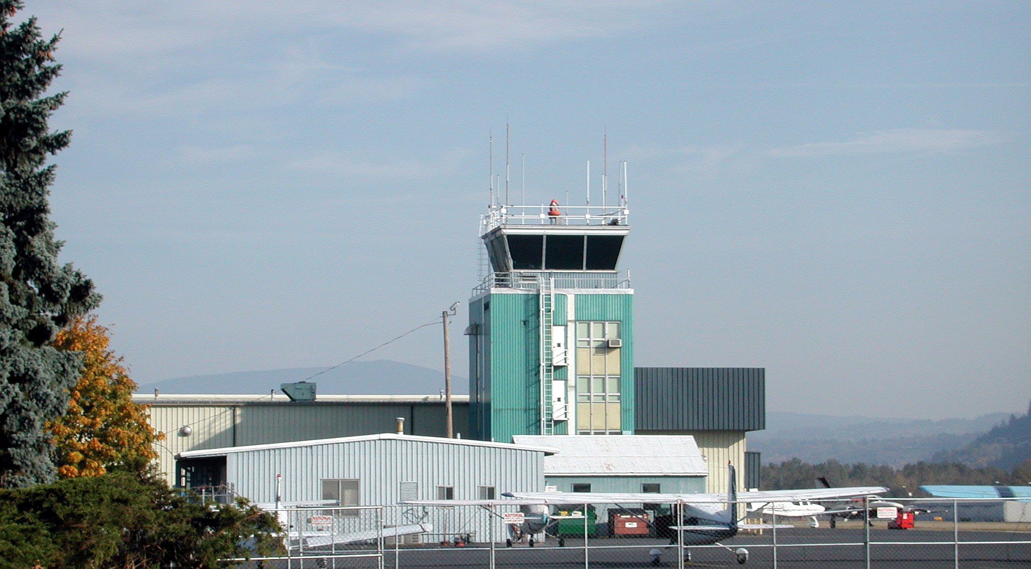
| Control tower |
| IATA: TTD – ICAO: KTTD – FAA LID: TTD |
| Summary |
| Airport type |
Public |
| Owner |
Port of Portland |
| Serves |
Portland, Oregon |
| Location |
Troutdale, Oregon |
| Elevation AMSL |
39 ft / 12 m |
| Coordinates |
45°32′58″N 122°24′04″W / 45.54944°N 122.40111°W / 45.54944; -122.40111 |
| Website |
TTD Home |
| Runways |
| Direction |
Length |
Surface |
| ft |
m |
| 7/25 |
5,399 |
1,646 |
Asphalt |
| Statistics (2008) |
| Aircraft operations |
105,020 |
| Based aircraft |
154 |
| Source: Federal Aviation Administration |
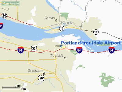
Portland-Troutdale Airport (IATA: TTD, ICAO: KTTD, FAA LID: TTD) is a public use airport located 10 nautical miles (19 km) east of the central business district of Portland, in Multnomah County, Oregon, United States. Also known as Troutdale Airport, it is located in Troutdale. It is one of four airports in the Portland metropolitan area owned and operated by the Port of Portland.
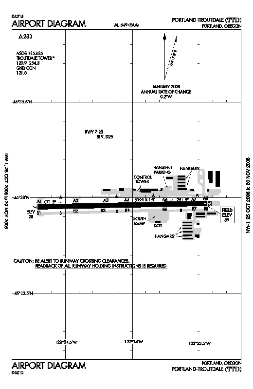 | |
FAA diagram of Troutdale Airport |
The airport was purchased by the Port of Portland in 1942, serving as a reliever airport for nearby Portland International Airport (PDX) until the 1950s. Troutdale Airport serves as a base for one full fixed-base operator (FBO), several limited FBOs, flight schools, and aircraft repair and maintenance facilities. It is also a popular base for scenic aerial tours of the Columbia River Gorge and recreational flying.
Operations at times may be limited or restricted as Portland International Airport take-off and approach paths cross directly above Troutdale Airport. Facilities and aircraft
Portland-Troutdale Airport covers an area of 284 acres (115 ha) at an elevation of 39 feet (12 m) above mean sea level. It has one runway designated 7/25 with an asphalt surface measuring 5,399 by 150 feet (1,646 x 46 m).
For the 12-month period ending July 1, 2008, the airport had 105,020 aircraft operations, an average of 287 per day: 95% general aviation, 4% air taxi, and 1% military. At that time there were 154 aircraft based at this airport: 84% single-engine, 9% multi-engine, 1% jet and 6% helicopter.
Services
- Aeroflight Executive Services - Scheduled cargo flights to Seattle, Tacoma, Boise, Medford, Spokane.
- Gorge Winds Aviation - FBO, flight training, pilot shop
- Hillsboro Aviation - flight training, pilot shop
- KGW and KATU operate their news helicopters out of Troutdale.
The above content comes from Wikipedia and is published under free licenses – click here to read more.
 |
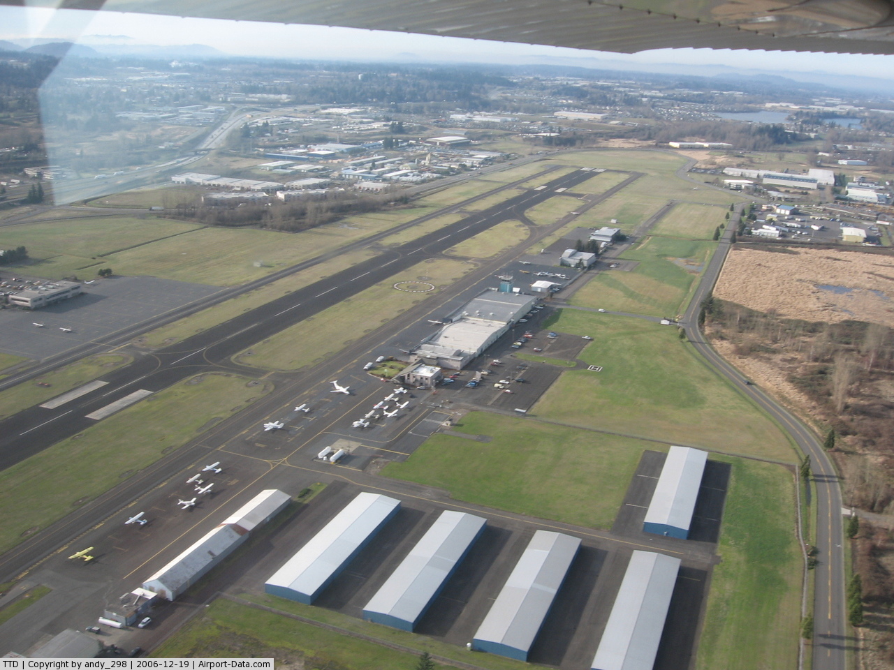
(Click on the photo to enlarge) |
Location & QuickFacts
| FAA Information Effective: | 2008-09-25 |
| Airport Identifier: | TTD |
| Airport Status: | Operational |
| Longitude/Latitude: | 122-24-04.5000W/45-32-57.7000N
-122.401250/45.549361 (Estimated) |
| Elevation: | 39 ft / 11.89 m (Surveyed) |
| Land: | 284 acres |
| From nearest city: | 10 nautical miles E of Portland, OR |
| Location: | Multnomah County, OR |
| Magnetic Variation: | 19E (1985) |
Owner & Manager
| Ownership: | Publicly owned |
| Owner: | The Port Of Portland |
| Address: | Box 3529
Portland, OR 97208 |
| Phone number: | 503-944-7000 |
| Manager: | Steve Nagy |
| Address: | Port Of Portland Box 3529
Portland, OR 97208 |
| Phone number: | 503-460-4119 |
Airport Operations and Facilities
| Airport Use: | Open to public |
| Wind indicator: | Yes |
| Segmented Circle: | Yes |
| Control Tower: | Yes |
| Lighting Schedule: | DUSK-DAWN
ACTVT MIRL RY 07/25 - CTAF. |
| Beacon Color: | Clear-Green (lighted land airport) |
| Landing fee charge: | Yes
COMMERCIAL ACFT & OPERATORS OF ACFT WITH AN FAA CERTIFIED MAX GROSS LANDING WEIGHT THAT EXCEEDS 10000 LBS ARE REQUIRED TO PAY A LANDING FEE. |
| Sectional chart: | Seattle |
| Region: | ANM - Northwest Mountain |
| Boundary ARTCC: | ZSE - Seattle |
| Tie-in FSS: | MMV - Mc Minnville |
| FSS on Airport: | No |
| FSS Toll Free: | 1-800-WX-BRIEF |
| NOTAMs Facility: | TTD (NOTAM-d service avaliable) |
| Federal Agreements: | NGY3 |
Airport Communications
| CTAF: | 120.900 |
| Unicom: | 122.950 |
Airport Services
| Fuel available: | 100LLA |
| Airframe Repair: | MAJOR |
| Power Plant Repair: | MAJOR |
| Bottled Oxygen: | NONE |
| Bulk Oxygen: | HIGH |
Runway Information
Runway 07/25
| Dimension: | 5399 x 150 ft / 1645.6 x 45.7 m |
| Surface: | ASPH, Good Condition |
| Weight Limit: | Single wheel: 19000 lbs.
Dual wheel: 25000 lbs. |
| Edge Lights: | Medium |
| |
Runway 07 |
Runway 25 |
| Longitude: | 122-24-42.4266W | 122-23-26.5865W |
| Latitude: | 45-32-57.1030N | 45-32-58.3399N |
| Elevation: | 28.00 ft | 39.00 ft |
| Alignment: | 89 | 127 |
| Traffic Pattern: | Left | Left |
| Markings: | Non-precision instrument, Good Condition | Non-precision instrument, Good Condition |
| Crossing Height: | 50.00 ft | 0.00 ft |
| VASI: | 4-box on left side | |
| Visual Glide Angle: | 3.00° | 0.00° |
| Runway End Identifier: | Yes | Yes |
| Obstruction: | 60 ft trees, 2200.0 ft from runway, 33:1 slope to clear | 35 ft trees, 1278.0 ft from runway, 30:1 slope to clear |
|
Radio Navigation Aids
| ID |
Type |
Name |
Ch |
Freq |
Var |
Dist |
| LBH | NDB | Laker | | 332.00 | 20E | 2.6 nm |
| PND | NDB | Banks | | 356.00 | 21E | 27.5 nm |
| LSO | NDB | Kelso | | 256.00 | 21E | 42.3 nm |
| CBU | TACAN | Columbia | 029X | | 20E | 9.1 nm |
| PDX | VOR/DME | Portland | 055X | 111.80 | 20E | 9.0 nm |
| UBG | VOR/DME | Newberg | 121X | 117.40 | 21E | 27.0 nm |
| BTG | VORTAC | Battle Ground | 113X | 116.60 | 21E | 14.4 nm |
| PDX | VOT | Portland Intl | | 111.00 | | 8.9 nm |
| HIO | VOT | Portland-hillsboro | | 115.20 | | 23.0 nm |
Remarks
- MIGRATORY FLOCKSOF WATERFOWL ON & INVOF ARPT.
- PORTLAND INTL ARPT RY 10L/28R EXTNDD CENTERLINE CROSSES ARPT, ATCT MAY ISSUE RESTRICCTIONS DUE TO PDX TFC.
- ESTABD PRIOR TO 1959.
Images and information placed above are from
http://www.airport-data.com/airport/TTD/
We thank them for the data!
| General Info
|
| Country |
United States
|
| State |
OREGON
|
| FAA ID |
TTD
|
| Latitude |
45-32-57.728N
|
| Longitude |
122-24-04.507W
|
| Elevation |
39 feet
|
| Near City |
PORTLAND
|
We don't guarantee the information is fresh and accurate. The data may
be wrong or outdated.
For more up-to-date information please refer to other sources.
|
|