|
|
Portland-Mulino Airport
Mulino Airport |
 |
| IATA: none – ICAO: none – FAA LID: 4S9 |
| Summary |
| Airport type |
Public |
| Owner |
Port of Portland |
| Operator |
Oregon Department of Aviation |
| Location |
Mulino, Oregon |
| Elevation AMSL |
260 ft / 79 m |
| Coordinates |
45°12′59″N 122°35′25″W / 45.21639°N 122.59028°W / 45.21639; -122.59028Coordinates: 45°12′59″N 122°35′25″W / 45.21639°N 122.59028°W / 45.21639; -122.59028 |
| Runways |
| Direction |
Length |
Surface |
| ft |
m |
| 14/32 |
3,600 |
1,097 |
Asphalt |
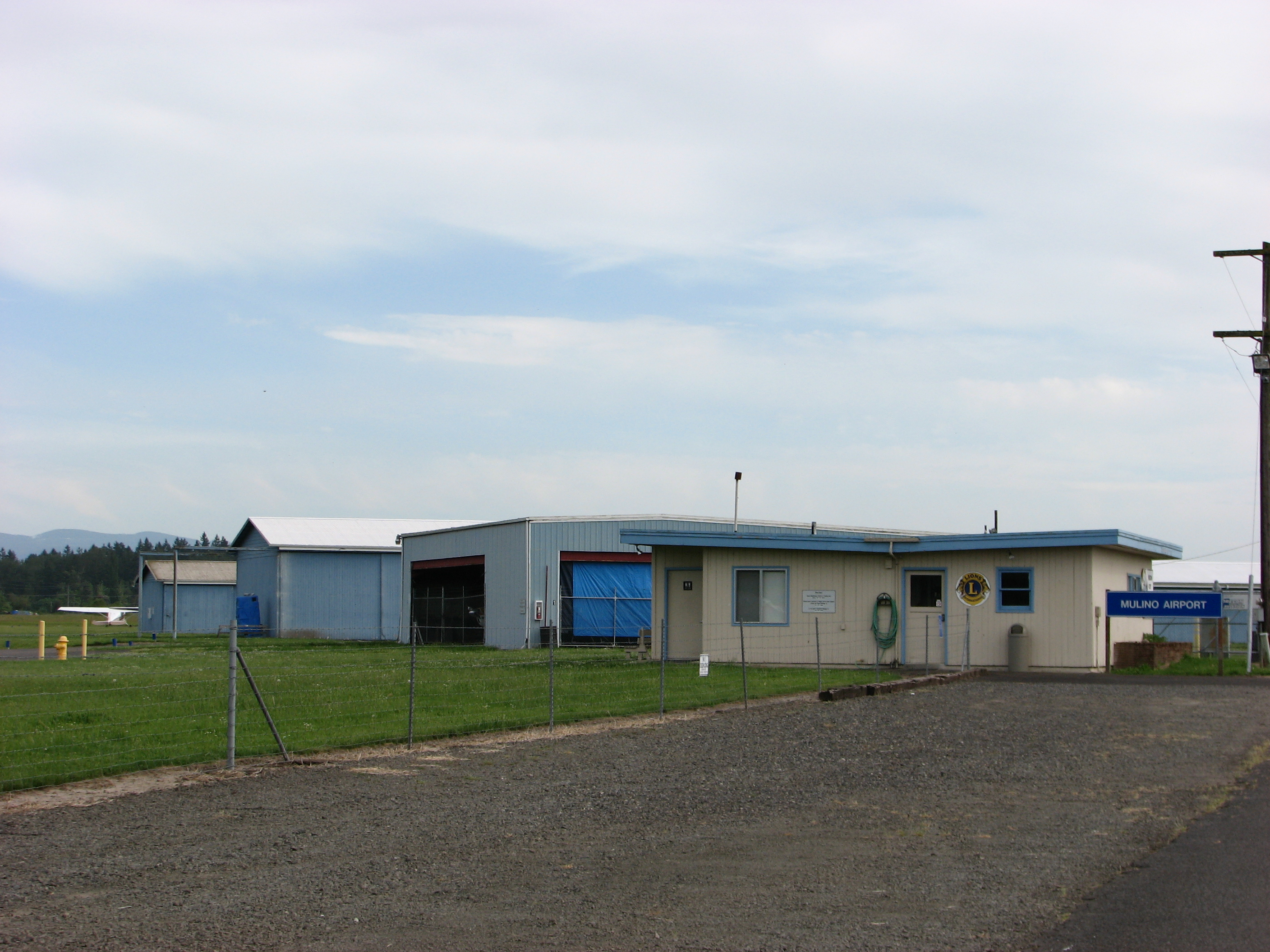
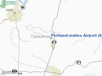
Portland-Mulino Airport (ICAO: 4S9), also known as Mulino Airport, is a public airport located at Mulino, Oregon, near the city of Molalla, about 20 miles (32 km) south of Portland with easy access from Interstate 205 via Oregon Route 213. It is owned by the Port of Portland and managed by the Oregon Department of Aviation .
The airport is home to over 40 light general aviation aircraft (including weekend glider activities) with 34 existing aircraft T-hangars and approximately 25 tie-down spots. Mulino is also home to the Mulino Chapter of the Oregon Pilot Association and its annual fly-in blueberry pancake breakfast.
Mulino Airport is located on 275 acres (111 ha) with a 3,425-foot (1,044 m) runway, and was acquired in May 1988 to enhance airspace capacity and appropriate levels of safety within the Port of Portland's system of airports.
The above content comes from Wikipedia and is published under free licenses – click here to read more.
Location & QuickFacts
| FAA Information Effective: | 2008-09-25 |
| Airport Identifier: | 4S9 |
| Airport Status: | Operational |
| Longitude/Latitude: | 122-35-24.3020W/45-12-58.7700N
-122.590084/45.216325 (Estimated) |
| Elevation: | 260 ft / 79.25 m (Surveyed) |
| Land: | 275 acres |
| From nearest city: | 20 nautical miles S of Portland-mulino, OR |
| Location: | Clackamas County, OR |
| Magnetic Variation: | 19E (1985) |
Owner & Manager
| Ownership: | Publicly owned |
| Owner: | The Port Of Portland |
| Address: | Po Box 3529
Portland, OR 97208 |
| Phone number: | 503-944-7000 |
| Manager: | Oregon Department Of Aviation |
| Address: | 3040 25th Street Se
Salem, OR 97302 |
| Phone number: | 503-378-4880 |
Airport Operations and Facilities
| Airport Use: | Open to public |
| Wind indicator: | Yes |
| Segmented Circle: | Yes |
| Control Tower: | No |
| Lighting Schedule: | DUSK-DAWN
ACTIVATE MIRL RY 14/32, TWY LGTS, & WINDCONE - CTAF. PAPI RYS 14 & 32 OPR 24 HRS. |
| Beacon Color: | Clear-Green (lighted land airport) |
| Landing fee charge: | No |
| Sectional chart: | Seattle |
| Region: | ANM - Northwest Mountain |
| Boundary ARTCC: | ZSE - Seattle |
| Tie-in FSS: | MMV - Mc Minnville |
| FSS on Airport: | No |
| FSS Toll Free: | 1-800-WX-BRIEF |
| NOTAMs Facility: | MMV (NOTAM-d service avaliable) |
| Federal Agreements: | NGY |
Airport Communications
| CTAF: | 123.050 |
| Unicom: | 123.050 |
Airport Services
| Power Plant Repair: | MINOR |
| Bottled Oxygen: | NONE |
| Bulk Oxygen: | NONE |
Runway Information
Runway 14/32
| Dimension: | 3425 x 100 ft / 1043.9 x 30.5 m |
| Surface: | ASPH, Good Condition |
| Edge Lights: | Medium |
| |
Runway 14 |
Runway 32 |
| Longitude: | 122-35-33.1090W | 122-35-16.3590W |
| Latitude: | 45-13-15.4240N | 45-12-43.7430N |
| Elevation: | 248.00 ft | 260.00 ft |
| Alignment: | 127 | 127 |
| Traffic Pattern: | Right | Left |
| Markings: | Basic, Good Condition | Basic, Good Condition |
| Crossing Height: | 43.00 ft | 33.00 ft |
| VASI: | 2-light PAPI on left side | 2-light PAPI on left side |
| Visual Glide Angle: | 3.00° | 3.00° |
| Obstruction: | 3 ft fence, 280.0 ft from runway, 26:1 slope to clear | 53 ft , 1020.0 ft from runway, 10 ft right of centerline, 15:1 slope to clear |
|
Radio Navigation Aids
| ID |
Type |
Name |
Ch |
Freq |
Var |
Dist |
| LBH | NDB | Laker | | 332.00 | 20E | 20.3 nm |
| PND | NDB | Banks | | 356.00 | 21E | 31.4 nm |
| LWG | NDB | Lewisburg | | 225.00 | 18E | 46.4 nm |
| CBU | TACAN | Columbia | 029X | | 20E | 22.4 nm |
| UBG | VOR/DME | Newberg | 121X | 117.40 | 21E | 18.4 nm |
| PDX | VOR/DME | Portland | 055X | 111.80 | 20E | 22.7 nm |
| BTG | VORTAC | Battle Ground | 113X | 116.60 | 21E | 31.9 nm |
| PDX | VOT | Portland Intl | | 111.00 | | 23.0 nm |
| HIO | VOT | Portland-hillsboro | | 115.20 | | 24.7 nm |
Remarks
- RY 14 DESIGNATED CALM WIND RY.
- BIRDS ON & INVOF OF ARPT.
- BE ALERT FOR WEEKEND GLIDER ACTIVITY.
- EXISTED PRIOR TO 1959.
Images and information placed above are from
http://www.airport-data.com/airport/4S9/
We thank them for the data!
| General Info
|
| Country |
United States
|
| State |
OREGON
|
| FAA ID |
4S9
|
| Latitude |
45-12-58.767N
|
| Longitude |
122-35-24.302W
|
| Elevation |
257 feet
|
| Near City |
PORTLAND-MULINO
|
We don't guarantee the information is fresh and accurate. The data may
be wrong or outdated.
For more up-to-date information please refer to other sources.
|
|