 |
|
Location & QuickFacts
| FAA Information Effective: | 2008-09-25 |
| Airport Identifier: | 64OR |
| Airport Status: | Operational |
| Longitude/Latitude: | 123-10-20.3630W/45-02-01.4240N
-123.172323/45.033729 (Estimated) |
| Elevation: | 230 ft / 70.10 m (Estimated) |
| Land: | 100 acres |
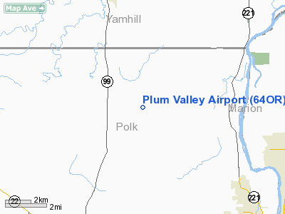
| From nearest city: | 6 nautical miles SE of Amity, OR |
| Location: | Polk County, OR |
| Magnetic Variation: | 20E (1980) |
Owner & Manager
| Ownership: | Privately owned |
| Owner: | Phil Olson |
| Address: | 23725 Old Bethel Road
Amity, OR 97101 |
| Phone number: | 503-835-0504 |
| Manager: | Phil Olson |
| Address: | 23725 Old Bethel Road
Amity, OR 97101 |
| Phone number: | 503-835-0504 |
Airport Operations and Facilities
| Airport Use: | Private |
| Wind indicator: | Yes |
| Segmented Circle: | No |
| Control Tower: | No |
| Sectional chart: | Seattle |
| Region: | ANM - Northwest Mountain |
| Boundary ARTCC: | ZSE - Seattle |
| Tie-in FSS: | MMV - Mc Minnville |
| FSS Toll Free: | 1-800-WX-BRIEF |
Runway Information
Runway 07/25
| Dimension: | 2300 x 50 ft / 701.0 x 15.2 m |
| Surface: | TURF, |
| |
Runway 07 |
Runway 25 |
| Traffic Pattern: | Left | Left |
|
Radio Navigation Aids
| ID |
Type |
Name |
Ch |
Freq |
Var |
Dist |
| LWG | NDB | Lewisburg | | 225.00 | 18E | 25.6 nm |
| PND | NDB | Banks | | 356.00 | 21E | 36.3 nm |
| LBH | NDB | Laker | | 332.00 | 20E | 42.8 nm |
| EU | NDB | Frakk | | 260.00 | 19E | 49.4 nm |
| CBU | TACAN | Columbia | 029X | | 20E | 40.9 nm |
| UBG | VOR/DME | Newberg | 121X | 117.40 | 21E | 20.9 nm |
| CVO | VOR/DME | Corvallis | 101X | 115.40 | 18E | 32.5 nm |
| PDX | VOR/DME | Portland | 055X | 111.80 | 20E | 41.3 nm |
| ONP | VORTAC | Newport | 118X | 117.10 | 19E | 46.8 nm |
| BTG | VORTAC | Battle Ground | 113X | 116.60 | 21E | 49.4 nm |
| HIO | VOT | Portland-hillsboro | | 115.20 | | 31.9 nm |
| PDX | VOT | Portland Intl | | 111.00 | | 41.7 nm |
Remarks
Images and information placed above are from
http://www.airport-data.com/airport/64OR/
We thank them for the data!
| General Info
|
| Country |
United States
|
| State |
OREGON
|
| FAA ID |
64OR
|
| Latitude |
45-02-01.424N
|
| Longitude |
123-10-20.363W
|
| Elevation |
230 feet
|
| Near City |
AMITY
|
We don't guarantee the information is fresh and accurate. The data may
be wrong or outdated.
For more up-to-date information please refer to other sources.
|
|


