 |
|
| Pinehurst State Airport |
| IATA: none – ICAO: FAA: 24S |
| Summary |
| Airport type |
Public |
| Operator |
Oregon Department of Aviation |
| Location |
Pinehurst, Oregon |
| Elevation AMSL |
3638 ft / 1109 m |
| Coordinates |
42°06′36.7200″N 122°22′59.4900″W / 42.1102°N 122.3831917°W / 42.1102; -122.3831917Coordinates: 42°06′36.7200″N 122°22′59.4900″W / 42.1102°N 122.3831917°W / 42.1102; -122.3831917 |
| Runways |
| Direction |
Length |
Surface |
| ft |
m |
| 4/22 |
2800 |
853 |
Asphalt |
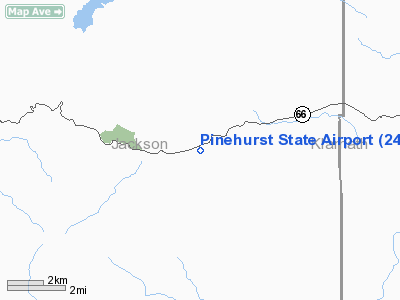
Pinehurst State Airport (FAA LID: 24S), is a public airport located 1 mile (1.6 km) southwest of Pinehurst, in Jackson County, Oregon, USA.
The above content comes from Wikipedia and is published under free licenses – click here to read more.
Location & QuickFacts
| FAA Information Effective: | 2008-09-25 |
| Airport Identifier: | 24S |
| Airport Status: | Operational |
| Longitude/Latitude: | 122-22-59.4900W/42-06-36.7200N
-122.383192/42.110200 (Estimated) |
| Elevation: | 3638 ft / 1108.86 m (Estimated) |
| Land: | 103 acres |
| From nearest city: | 1 nautical miles SW of Pinehurst, OR |
| Location: | Jackson County, OR |
| Magnetic Variation: | 18E (1985) |
Owner & Manager
| Ownership: | Publicly owned |
| Owner: | Oregon Dept. Of Aviation |
| Address: | 3040 25th St, Se
Salem, OR 97302-1125 |
| Phone number: | 503-378-4880 |
| Manager: | State Airport Mgr |
| Address: | 3040 25th St, Se
Salem, OR 97310 |
| Phone number: | 503-378-4880 |
Airport Operations and Facilities
| Airport Use: | Open to public |
| Wind indicator: | Yes |
| Segmented Circle: | Yes
TIRES PAINTED WHITE. |
| Control Tower: | No |
| Landing fee charge: | No |
| Sectional chart: | Klamath Falls |
| Region: | ANM - Northwest Mountain |
| Traffic Pattern Alt: | 1000 ft |
| Boundary ARTCC: | ZSE - Seattle |
| Tie-in FSS: | MMV - Mc Minnville |
| FSS on Airport: | No |
| FSS Toll Free: | 1-800-WX-BRIEF |
| NOTAMs Facility: | MMV (NOTAM-d service avaliable) |
Airport Communications
Airport Services
| Airframe Repair: | NONE |
| Power Plant Repair: | NONE |
| Bottled Oxygen: | NONE |
| Bulk Oxygen: | NONE |
Runway Information
Runway 04/22
| Dimension: | 2800 x 30 ft / 853.4 x 9.1 m |
| Surface: | ASPH, Fair Condition |
| |
Runway 04 |
Runway 22 |
| Traffic Pattern: | Left | Left |
| Markings: | Basic, Poor Condition
RY 04/22 MARKINGS CHIPPED, FADED AND FAINT. | Basic, Poor Condition |
| Obstruction: | 83 ft trees, 960.0 ft from runway, 9:1 slope to clear
+40 FT TREES 10 FT FROM RY END, 105 FT L. | 60 ft trees, 801.0 ft from runway, 100 ft right of centerline, 10:1 slope to clear
PILES OF ROCKS AND +10 FT TREES FM RY END TO 200 FT 65 FT R OF CNTRLN. |
|
Radio Navigation Aids
| ID |
Type |
Name |
Ch |
Freq |
Var |
Dist |
| MOG | NDB | Montague | | 404.00 | 19E | 23.4 nm |
| MEF | NDB | Medford | | 356.00 | 19E | 27.8 nm |
| LFA | NDB | Merrill | | 347.00 | 17E | 33.9 nm |
| FJS | VOR/DME | Fort Jones | 033X | 109.60 | 19E | 44.0 nm |
| LMT | VORTAC | Klamath Falls | 106X | 115.90 | 17E | 29.3 nm |
| OED | VORTAC | Rogue Valley | 083X | 113.60 | 19E | 32.4 nm |
| MFR | VOT | Medford-jackson County | | 117.20 | | 26.2 nm |
Remarks
-
- RY 04/22 70 FT TREES ALONG BOTH SIDES OF RY; 125 FT FM CNTRLN.
- OWNER ADVISES CONTACT OREGON DEPT OF AVIATION (503-378-4880) PRIOR TO USE.
- WINTER MAINTENANCE IREG MAY BE CLSD BY SNOW.
- ESTABD PRIOR TO MAY 1959.
Images and information placed above are from
http://www.airport-data.com/airport/24S/
We thank them for the data!
| General Info
|
| Country |
United States
|
| State |
OREGON
|
| FAA ID |
24S
|
| Latitude |
42-06-29.499N
|
| Longitude |
122-23-04.076W
|
| Elevation |
3650 feet
|
| Near City |
PINEHURST
|
We don't guarantee the information is fresh and accurate. The data may
be wrong or outdated.
For more up-to-date information please refer to other sources.
|
|


