 |
|
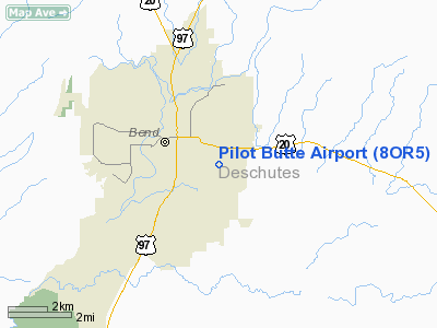
Location & QuickFacts
| FAA Information Effective: | 2008-09-25 |
| Airport Identifier: | 8OR5 |
| Airport Status: | Operational |
| Longitude/Latitude: | 121-16-32.1090W/44-02-50.4230N
-121.275586/44.047340 (Estimated) |
| Elevation: | 3675 ft / 1120.14 m (Estimated) |
| Land: | 0 acres |
| From nearest city: | 0 nautical miles SE of Bend, OR |
| Location: | Deschutes County, OR |
| Magnetic Variation: | 18E (1990) |
Owner & Manager
| Ownership: | Privately owned |
| Owner: | Pilot Butte Airport Assoc |
| Address: | 210 Se Cessna Dr.
Bend, OR 97702 |
| Phone number: | 541-389-1456 |
| Manager: | Don Wilfong |
| Address: | 210 Se Cessna Dr.
Bend, OR 97702 |
| Phone number: | 541-389-1456 |
Airport Operations and Facilities
| Airport Use: | Private |
| Segmented Circle: | No |
| Control Tower: | No |
| Sectional chart: | Klamath Falls |
| Region: | ANM - Northwest Mountain |
| Boundary ARTCC: | ZSE - Seattle |
| Tie-in FSS: | MMV - Mc Minnville |
| FSS Toll Free: | 1-800-WX-BRIEF |
Runway Information
Runway 18/36
| Dimension: | 2400 x 20 ft / 731.5 x 6.1 m |
| Surface: | ASPH, |
| |
Runway 18 |
Runway 36 |
| Traffic Pattern: | Left | Left |
| Obstruction: | 60 ft trees, 400.0 ft from runway | 45 ft trees, 425.0 ft from runway |
|
Radio Navigation Aids
| ID |
Type |
Name |
Ch |
Freq |
Var |
Dist |
| RD | NDB | Bodey | | 411.00 | 18E | 19.2 nm |
| DSD | VORTAC | Deschutes | 123X | 117.60 | 18E | 12.4 nm |
Images and information placed above are from
http://www.airport-data.com/airport/8OR5/
We thank them for the data!
| General Info
|
| Country |
United States
|
| State |
OREGON
|
| FAA ID |
8OR5
|
| Latitude |
44-02-50.423N
|
| Longitude |
121-16-32.109W
|
| Elevation |
3675 feet
|
| Near City |
BEND
|
We don't guarantee the information is fresh and accurate. The data may
be wrong or outdated.
For more up-to-date information please refer to other sources.
|
|


