 |
|
Location & QuickFacts
| FAA Information Effective: | 2008-09-25 |
| Airport Identifier: | OG57 |
| Airport Status: | Operational |
| Longitude/Latitude: | 124-05-38.6400W/43-58-29.2200N
-124.094067/43.974783 (Estimated) |
| Elevation: | 13 ft / 3.96 m (Estimated) |
| Land: | 0 acres |
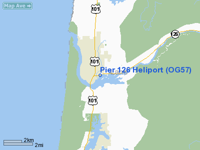
| From nearest city: | 0 nautical miles E of Florence, OR |
| Location: | Lane County, OR |
| Magnetic Variation: | () |
Owner & Manager
| Ownership: | Privately owned |
| Owner: | Donald V. & Norma L. Saxon |
| Address: | 05719 North Fork Siuslaw Rd.
Florence, OR 97439 |
| Phone number: | 541-997-2086 |
| Manager: | Donald V. & Norma L. Saxon |
| Address: | 05719 North Fork Siuslaw Rd.
Florence, OR 97439 |
| Phone number: | 541-997-2086 |
Airport Operations and Facilities
| Airport Use: | Private |
| Control Tower: | No |
| Sectional chart: | Klamath Falls |
| Region: | ANM - Northwest Mountain |
| Boundary ARTCC: | ZSE - Seattle |
| Tie-in FSS: | MMV - Mc Minnville |
| FSS Toll Free: | 1-800-WX-BRIEF |
Runway Information
Helipad H1
| Dimension: | 45 x 45 ft / 13.7 x 13.7 m |
| Surface: | TURF, |
| |
Runway H1 |
Runway |
| Traffic Pattern: | Left | Left |
|
Radio Navigation Aids
| ID |
Type |
Name |
Ch |
Freq |
Var |
Dist |
| EU | NDB | Frakk | | 260.00 | 19E | 40.3 nm |
| CVO | VOR/DME | Corvallis | 101X | 115.40 | 18E | 46.7 nm |
| OTH | VORTAC | North Bend | 058X | 112.10 | 18E | 33.8 nm |
| ONP | VORTAC | Newport | 118X | 117.10 | 19E | 36.1 nm |
| EUG | VORTAC | Eugene | 076X | 112.90 | 20E | 38.7 nm |
Images and information placed above are from
http://www.airport-data.com/airport/OG57/
We thank them for the data!
|
|


