 |
|
Location & QuickFacts
| FAA Information Effective: | 2008-09-25 |
| Airport Identifier: | 16OR |
| Airport Status: | Operational |
| Longitude/Latitude: | 123-03-36.3140W/44-08-51.4480N
-123.060087/44.147624 (Estimated) |
| Elevation: | 388 ft / 118.26 m (Estimated) |
| Land: | 0 acres |
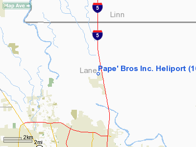
| From nearest city: | 1 nautical miles N of Coburg, OR |
| Location: | Lane County, OR |
| Magnetic Variation: | 19E (1985) |
Owner & Manager
| Ownership: | Privately owned |
| Owner: | Pape' Bros Inc. |
| Address: | P. O. Box 407
Eugene, OR 97440 |
| Phone number: | 503-342-1234 |
| Manager: | Don Schram |
| Address: | 7505 Ne Airport Way
Portland, OR 98218 |
| Phone number: | 503-281-3300 |
Airport Operations and Facilities
| Airport Use: | Private |
| Segmented Circle: | No |
| Control Tower: | No |
| Landing fee charge: | No |
| Sectional chart: | Klamath Falls |
| Region: | ANM - Northwest Mountain |
| Boundary ARTCC: | ZSE - Seattle |
| Tie-in FSS: | MMV - Mc Minnville |
| FSS Toll Free: | 1-800-WX-BRIEF |
Runway Information
Helipad H1
| Dimension: | 100 x 100 ft / 30.5 x 30.5 m |
| Surface: | TURF, |
| |
Runway H1 |
Runway |
| Traffic Pattern: | Left | Left |
|
Radio Navigation Aids
| ID |
Type |
Name |
Ch |
Freq |
Var |
Dist |
| EU | NDB | Frakk | | 260.00 | 19E | 7.9 nm |
| LWG | NDB | Lewisburg | | 225.00 | 18E | 29.4 nm |
| CVO | VOR/DME | Corvallis | 101X | 115.40 | 18E | 23.4 nm |
| EUG | VORTAC | Eugene | 076X | 112.90 | 20E | 7.2 nm |
Remarks
- PROVIDED ALL HELIPORT FLIGHT OPRNS ARE CONDUCTED TO AVOID TFC PATS IN USE AT BRIGGS AND DOWNING ARPTS.
Images and information placed above are from
http://www.airport-data.com/airport/16OR/
We thank them for the data!
| General Info
|
| Country |
United States
|
| State |
OREGON
|
| FAA ID |
16OR
|
| Latitude |
44-08-51.448N
|
| Longitude |
123-03-36.314W
|
| Elevation |
388 feet
|
| Near City |
COBURG
|
We don't guarantee the information is fresh and accurate. The data may
be wrong or outdated.
For more up-to-date information please refer to other sources.
|
|


