 |
|
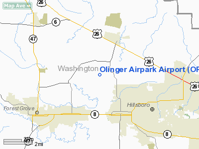
Location & QuickFacts
| FAA Information Effective: | 2008-09-25 |
| Airport Identifier: | OR81 |
| Airport Status: | Operational |
| Longitude/Latitude: | 123-01-10.3800W/45-33-35.4150N
-123.019550/45.559838 (Estimated) |
| Elevation: | 185 ft / 56.39 m (Estimated) |
| Land: | 0 acres |
| From nearest city: | 3 nautical miles W of Hillsboro, OR |
| Location: | Washington County, OR |
| Magnetic Variation: | 19E (1985) |
Owner & Manager
| Ownership: | Privately owned |
| Owner: | Olinger Airpark Association |
| Address: | 33400 Nw Bagley Road
Hillsboro, OR 97124 |
| Phone number: | 503-846-0115 |
| Manager: | Current Airpark President |
| Address: | 33380 Nw Bagley Road
Hillsboro, OR 97124 |
| Phone number: | 503-640-5186 |
Airport Operations and Facilities
| Airport Use: | Private |
| Wind indicator: | Yes |
| Segmented Circle: | No |
| Control Tower: | No |
| Lighting Schedule: | DUSK-DAWN |
| Landing fee charge: | No |
| Sectional chart: | Seattle |
| Region: | ANM - Northwest Mountain |
| Boundary ARTCC: | ZSE - Seattle |
| Tie-in FSS: | MMV - Mc Minnville |
| FSS on Airport: | No |
| FSS Toll Free: | 1-800-WX-BRIEF |
Airport Services
| Airframe Repair: | NONE |
| Power Plant Repair: | NONE |
Runway Information
Runway 07/25
| Dimension: | 2000 x 80 ft / 609.6 x 24.4 m |
| Surface: | TURF-GRVL, |
| Edge Lights: | Low |
| |
Runway 07 |
Runway 25 |
| Traffic Pattern: | Left | Left |
| Obstruction: | | 100 ft trees, 2000.0 ft from runway |
|
Radio Navigation Aids
| ID |
Type |
Name |
Ch |
Freq |
Var |
Dist |
| PND | NDB | Banks | | 356.00 | 21E | 4.4 nm |
| LBH | NDB | Laker | | 332.00 | 20E | 23.5 nm |
| LSO | NDB | Kelso | | 256.00 | 21E | 36.1 nm |
| PEN | NDB | Karpen | | 201.00 | 20E | 42.2 nm |
| CBU | TACAN | Columbia | 029X | | 20E | 17.3 nm |
| UBG | VOR/DME | Newberg | 121X | 117.40 | 21E | 12.5 nm |
| PDX | VOR/DME | Portland | 055X | 111.80 | 20E | 17.5 nm |
| BTG | VORTAC | Battle Ground | 113X | 116.60 | 21E | 21.2 nm |
| HIO | VOT | Portland-hillsboro | | 115.20 | | 3.2 nm |
| PDX | VOT | Portland Intl | | 111.00 | | 17.8 nm |
Remarks
- NONCOMPLIANCE WITH FAR 157.
Images and information placed above are from
http://www.airport-data.com/airport/OR81/
We thank them for the data!
| General Info
|
| Country |
United States
|
| State |
OREGON
|
| FAA ID |
OR81
|
| Latitude |
45-33-35.415N
|
| Longitude |
123-01-10.380W
|
| Elevation |
185 feet
|
| Near City |
HILLSBORO
|
We don't guarantee the information is fresh and accurate. The data may
be wrong or outdated.
For more up-to-date information please refer to other sources.
|
|


