 |
|
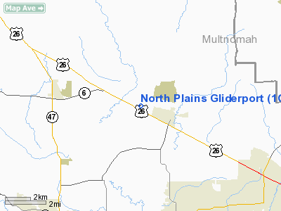
North Plains Gliderport Airport |
Location & QuickFacts
| FAA Information Effective: | 2008-09-25 |
| Airport Identifier: | 1OR4 |
| Airport Status: | Operational |
| Longitude/Latitude: | 123-01-29.3830W/45-36-14.4130N
-123.024829/45.604004 (Estimated) |
| Elevation: | 210 ft / 64.01 m (Estimated) |
| Land: | 0 acres |
| From nearest city: | 2 nautical miles W of North Plains, OR |
| Location: | Washington County, OR |
| Magnetic Variation: | 20E (1985) |
Owner & Manager
| Ownership: | Privately owned |
| Owner: | Willamette Valley Soaring Clb |
| Address: | Pmb 166, 25 Mw 23rd Pl, Ste 6
Portland, OR 97210 |
| Phone number: | 503-647-0913 |
| Manager: | George O'leary, Treasurer |
| Address: | Pmb 166, 25 Mw 23rd Pl, Ste 6
Portland, OR 97210 |
| Phone number: | 503-223-4262 |
Airport Operations and Facilities
| Airport Use: | Private |
| Wind indicator: | Yes |
| Segmented Circle: | No |
| Control Tower: | No |
| Landing fee charge: | No |
| Sectional chart: | Seattle |
| Region: | ANM - Northwest Mountain |
| Boundary ARTCC: | ZSE - Seattle |
| Tie-in FSS: | MMV - Mc Minnville |
| FSS on Airport: | No |
| FSS Toll Free: | 1-800-WX-BRIEF |
Airport Services
| Airframe Repair: | NONE |
| Power Plant Repair: | NONE |
Runway Information
Runway 09/27
| Dimension: | 2000 x 200 ft / 609.6 x 61.0 m |
| Surface: | TURF, |
| |
Runway 09 |
Runway 27 |
| Traffic Pattern: | Left | Left |
|
Radio Navigation Aids
| ID |
Type |
Name |
Ch |
Freq |
Var |
Dist |
| PND | NDB | Banks | | 356.00 | 21E | 1.8 nm |
| LBH | NDB | Laker | | 332.00 | 20E | 24.0 nm |
| LSO | NDB | Kelso | | 256.00 | 21E | 33.5 nm |
| PEN | NDB | Karpen | | 201.00 | 20E | 39.9 nm |
| CBU | TACAN | Columbia | 029X | | 20E | 17.4 nm |
| UBG | VOR/DME | Newberg | 121X | 117.40 | 21E | 15.2 nm |
| PDX | VOR/DME | Portland | 055X | 111.80 | 20E | 17.6 nm |
| AST | VOR/DME | Astoria | 087X | 114.00 | 19E | 49.0 nm |
| BTG | VORTAC | Battle Ground | 113X | 116.60 | 21E | 20.1 nm |
| HIO | VOT | Portland-hillsboro | | 115.20 | | 5.0 nm |
| PDX | VOT | Portland Intl | | 111.00 | | 17.8 nm |
Remarks
- FIELD IS USED FOR SAILPLANE OPERATIONS
- NO OBJ PROVIDED ARPT IS LIMITED TO PVT USE OF SPONSOR & THAT ALL TFC PATTERNS ARE ESTABD N OF RWY.
Images and information placed above are from
http://www.airport-data.com/airport/1OR4/
We thank them for the data!
| General Info
|
| Country |
United States
|
| State |
OREGON
|
| FAA ID |
1OR4
|
| Latitude |
45-36-14.413N
|
| Longitude |
123-01-29.383W
|
| Elevation |
210 feet
|
| Near City |
NORTH PLAINS
|
We don't guarantee the information is fresh and accurate. The data may
be wrong or outdated.
For more up-to-date information please refer to other sources.
|
|


