 |
|
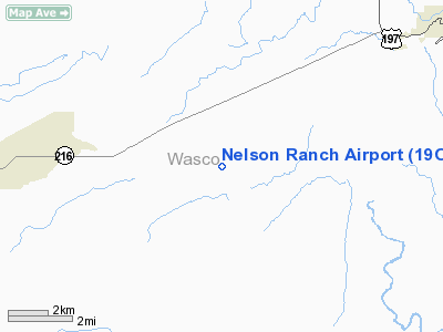
Location & QuickFacts
| FAA Information Effective: | 2008-09-25 |
| Airport Identifier: | 19OR |
| Airport Status: | Operational |
| Longitude/Latitude: | 121-13-25.2220W/45-06-34.4230N
-121.223673/45.109562 (Estimated) |
| Elevation: | 2000 ft / 609.60 m (Estimated) |
| Land: | 15 acres |
| From nearest city: | 8 nautical miles SW of Maupin, OR |
| Location: | Wasco County, OR |
| Magnetic Variation: | 19E (1985) |
Owner & Manager
| Ownership: | Privately owned |
| Owner: | Hans Nelson & Sons Nursery Inc |
| Address: | 31020 Se Waybill Road
Boring, OR 97009 |
| Phone number: | 503-663-3348 |
| Manager: | Dan L Nelson, President |
| Address: | 31020 Se Waybill Road
Boring, OR 97009 |
| Phone number: | 503-663-3348 |
Airport Operations and Facilities
| Airport Use: | Private |
| Wind indicator: | Yes |
| Segmented Circle: | No |
| Control Tower: | No |
| Sectional chart: | Seattle |
| Region: | ANM - Northwest Mountain |
| Boundary ARTCC: | ZSE - Seattle |
| Tie-in FSS: | MMV - Mc Minnville |
| FSS Toll Free: | 1-800-WX-BRIEF |
Runway Information
Runway 07/25
| Dimension: | 2500 x 40 ft / 762.0 x 12.2 m |
| Surface: | DIRT, |
| |
Runway 07 |
Runway 25 |
| Traffic Pattern: | Left | Left |
| Obstruction: | | 160 ft pline, 2640.0 ft from runway |
|
Radio Navigation Aids
| ID |
Type |
Name |
Ch |
Freq |
Var |
Dist |
| RD | NDB | Bodey | | 411.00 | 18E | 49.0 nm |
| LTJ | VOR/DME | Klickitat | 070X | 112.30 | 21E | 36.7 nm |
Images and information placed above are from
http://www.airport-data.com/airport/19OR/
We thank them for the data!
| General Info
|
| Country |
United States
|
| State |
OREGON
|
| FAA ID |
19OR
|
| Latitude |
45-06-34.423N
|
| Longitude |
121-13-25.222W
|
| Elevation |
2000 feet
|
| Near City |
MAUPIN
|
We don't guarantee the information is fresh and accurate. The data may
be wrong or outdated.
For more up-to-date information please refer to other sources.
|
|


