 |
|
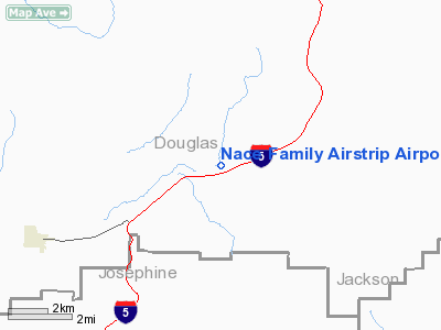
Nace Family Airstrip Airport |
Location & QuickFacts
| FAA Information Effective: | 2008-09-25 |
| Airport Identifier: | OG41 |
| Airport Status: | Operational |
| Longitude/Latitude: | 123-18-52.2300W/42-46-16.4300N
-123.314508/42.771231 (Estimated) |
| Elevation: | 1550 ft / 472.44 m (Estimated) |
| Land: | 36 acres |
| From nearest city: | 5 nautical miles NE of Glendale, OR |
| Location: | Douglas County, OR |
| Magnetic Variation: | () |
Owner & Manager
| Ownership: | Privately owned |
| Owner: | Stan & Kris Nace |
| Address: | 4847 Azaleaglen Rd.
Glendale, OR 97442 |
| Phone number: | 541-832-2258 |
| Manager: | Stan & Kris Nace |
| Address: | 4847 Azaleaglen Rd.
Glendale, OR 97442 |
| Phone number: | 541-832-2258 |
Airport Operations and Facilities
| Airport Use: | Private |
| Wind indicator: | Yes |
| Segmented Circle: | No |
| Control Tower: | No |
| Sectional chart: | Klamath Falls |
| Region: | ANM - Northwest Mountain |
| Boundary ARTCC: | ZSE - Seattle |
| Tie-in FSS: | MMV - Mc Minnville |
| FSS Toll Free: | 1-800-WX-BRIEF |
Runway Information
Runway 04/22
| Dimension: | 1300 x 30 ft / 396.2 x 9.1 m |
| Surface: | TURF-DIRT, |
| |
Runway 04 |
Runway 22 |
| Traffic Pattern: | Left | Left |
| Displaced threshold: | 250.00 ft | 0.00 ft |
| Obstruction: | 40 ft pline, 50.0 ft from runway | |
|
Radio Navigation Aids
| ID |
Type |
Name |
Ch |
Freq |
Var |
Dist |
| RBG | NDB | Roseburg | | 400.00 | 20E | 28.0 nm |
| MEF | NDB | Medford | | 356.00 | 19E | 29.9 nm |
| RBG | VOR/DME | Roseburg | 019X | 108.20 | 20E | 24.8 nm |
| OED | VORTAC | Rogue Valley | 083X | 113.60 | 19E | 25.0 nm |
| MFR | VOT | Medford-jackson County | | 117.20 | | 31.8 nm |
Images and information placed above are from
http://www.airport-data.com/airport/OG41/
We thank them for the data!
|
|


