 |
|
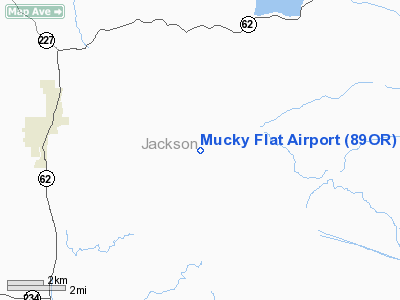
Location & QuickFacts
| FAA Information Effective: | 2008-09-25 |
| Airport Identifier: | 89OR |
| Airport Status: | Operational |
| Longitude/Latitude: | 122-42-45.1420W/42-35-52.4540N
-122.712539/42.597904 (Estimated) |
| Elevation: | 2000 ft / 609.60 m (Estimated) |
| Land: | 0 acres |
| From nearest city: | 18 nautical miles N of Eagle Point, OR |
| Location: | Jackson County, OR |
| Magnetic Variation: | 18E (1985) |
Owner & Manager
| Ownership: | Privately owned |
| Owner: | Bob Walch |
| Address: | 1875 Crowfoot Road
Eagle Point, OR 97524 |
| Phone number: | 503-826-3110 |
| Address: |
|
Airport Operations and Facilities
| Airport Use: | Private |
| Segmented Circle: | No |
| Control Tower: | No |
| Landing fee charge: | No |
| Sectional chart: | Klamath Falls |
| Region: | ANM - Northwest Mountain |
| Boundary ARTCC: | ZSE - Seattle |
| Tie-in FSS: | MMV - Mc Minnville |
| FSS on Airport: | No |
| FSS Toll Free: | 1-800-WX-BRIEF |
Runway Information
Runway 02/20
| Dimension: | 1250 x 40 ft / 381.0 x 12.2 m |
| Surface: | GRVL, |
| |
Runway 02 |
Runway 20 |
| Traffic Pattern: | Left | Left |
|
Radio Navigation Aids
| ID |
Type |
Name |
Ch |
Freq |
Var |
Dist |
| MEF | NDB | Medford | | 356.00 | 19E | 14.4 nm |
| RBG | NDB | Roseburg | | 400.00 | 20E | 47.7 nm |
| RBG | VOR/DME | Roseburg | 019X | 108.20 | 20E | 45.0 nm |
| OED | VORTAC | Rogue Valley | 083X | 113.60 | 19E | 11.4 nm |
| MFR | VOT | Medford-jackson County | | 117.20 | | 15.9 nm |
Images and information placed above are from
http://www.airport-data.com/airport/89OR/
We thank them for the data!
| General Info
|
| Country |
United States
|
| State |
OREGON
|
| FAA ID |
89OR
|
| Latitude |
42-35-52.454N
|
| Longitude |
122-42-45.142W
|
| Elevation |
2000 feet
|
| Near City |
EAGLE POINT
|
We don't guarantee the information is fresh and accurate. The data may
be wrong or outdated.
For more up-to-date information please refer to other sources.
|
|


