 |
|
Location & QuickFacts
| FAA Information Effective: | 2008-09-25 |
| Airport Identifier: | OG10 |
| Airport Status: | Operational |
| Longitude/Latitude: | 122-49-34.0000W/44-33-26.0000N
-122.826111/44.557222 (Estimated) |
| Elevation: | 400 ft / 121.92 m (Estimated) |
| Land: | 0 acres |
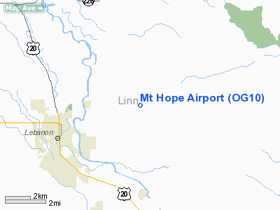
| From nearest city: | 5 nautical miles NE of Lebanon, OR |
| Location: | Linn County, OR |
| Magnetic Variation: | 18E (1995) |
Owner & Manager
| Ownership: | Privately owned |
| Owner: | Bill & Bob Lund |
| Address: | 39662 Mt Hope Dr
Lebanon, OR 97355 |
| Phone number: | 541-926-3800 |
| Manager: | Bill & Bob Lund |
| Address: | 240 2nd Ave Sw
Lebanon, OR 97321 |
| Phone number: | 541-926-3800 |
Airport Operations and Facilities
| Airport Use: | Private |
| Segmented Circle: | No |
| Control Tower: | No |
| Landing fee charge: | No |
| Sectional chart: | Seattle |
| Region: | ANM - Northwest Mountain |
| Boundary ARTCC: | ZSE - Seattle |
| Tie-in FSS: | MMV - Mc Minnville |
| FSS on Airport: | No |
| FSS Toll Free: | 1-800-WX-BRIEF |
Runway Information
Runway 13/31
| Dimension: | 1750 x 50 ft / 533.4 x 15.2 m |
| Surface: | TURF, |
| |
Runway 13 |
Runway 31 |
| Traffic Pattern: | Left | Left |
| Obstruction: | 30 ft pline, 1500.0 ft from runway | 100 ft hill, 3000.0 ft from runway |
|
Radio Navigation Aids
| ID |
Type |
Name |
Ch |
Freq |
Var |
Dist |
| LWG | NDB | Lewisburg | | 225.00 | 18E | 19.3 nm |
| EU | NDB | Frakk | | 260.00 | 19E | 26.7 nm |
| CVO | VOR/DME | Corvallis | 101X | 115.40 | 18E | 20.3 nm |
| UBG | VOR/DME | Newberg | 121X | 117.40 | 21E | 48.3 nm |
| EUG | VORTAC | Eugene | 076X | 112.90 | 20E | 31.3 nm |
Remarks
- OWNER DESIRES ARPT NOT TO BE CHARTED.
Images and information placed above are from
http://www.airport-data.com/airport/OG10/
We thank them for the data!
| General Info
|
| Country |
United States
|
| State |
OREGON
|
| FAA ID |
OG10
|
| Latitude |
44-33-26.000N
|
| Longitude |
122-49-34.000W
|
| Elevation |
400 feet
|
| Near City |
LEBANON
|
We don't guarantee the information is fresh and accurate. The data may
be wrong or outdated.
For more up-to-date information please refer to other sources.
|
|


